
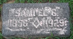
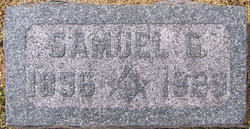
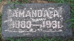
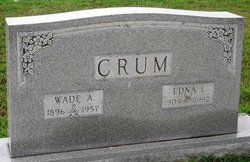
Samuel Green Crum
| Birth | : | 13 May 1857 Moniteau County, Missouri, USA |
| Death | : | 24 Nov 1929 Miller County, Missouri, USA |
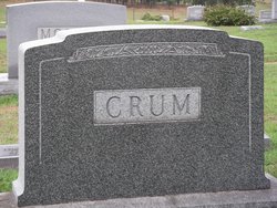
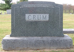
| Burial | : | Cross Cut Cemetery, Cross Cut, Brown County, USA |
| Coordinate | : | 32.0228004, -99.1314011 |
| Description | : | son of William and Matilda (Harber) Crum Unknown Newspaper, November 1929 Judge Samuel Green Crum, one of Miller County's most prominent and widely-known citizens, died at his home east of Olean November24th after an illness of three years. His decease marks the passing of a pioneer farmer, one who was not only well-versed in his occupation or profession as you might call it, but at the same time a man who took a keen and active interest in political, church, school and other public matters. He was born May 13, 1857, in Moniteau County. His parents came to Missouri... Read More |
frequently asked questions (FAQ):
-
Where is Samuel Green Crum's memorial?
Samuel Green Crum's memorial is located at: Cross Cut Cemetery, Cross Cut, Brown County, USA.
-
When did Samuel Green Crum death?
Samuel Green Crum death on 24 Nov 1929 in Miller County, Missouri, USA
-
Where are the coordinates of the Samuel Green Crum's memorial?
Latitude: 32.0228004
Longitude: -99.1314011
Family Members:
Spouse
Children
Flowers:


Nearby Cemetories:
1. Cross Cut Cemetery
Cross Cut, Brown County, USA
Coordinate: 32.0228004, -99.1314011
2. Mann Cemetery
Brown County, USA
Coordinate: 31.9889280, -99.0806620
3. Smith Cemetery
Brown County, USA
Coordinate: 31.9675007, -99.1564026
4. Henderson Family Cemetery
Burkett, Coleman County, USA
Coordinate: 32.0077850, -99.2133670
5. Blake Cemetery
Williams, Brown County, USA
Coordinate: 32.0292350, -99.0369860
6. Burkett Cemetery
Burkett, Coleman County, USA
Coordinate: 31.9958300, -99.2252800
7. Pioneer Cemetery
Pioneer, Eastland County, USA
Coordinate: 32.0993996, -99.0836029
8. Triplitt Cemetery
Cross Cut, Brown County, USA
Coordinate: 31.9387050, -99.0653030
9. Adams Cemetery
Coleman County, USA
Coordinate: 32.0106010, -99.2500000
10. Cross Plains Memorial Park
Cross Plains, Callahan County, USA
Coordinate: 32.1245850, -99.1706400
11. Dressy Cemetery
Cross Plains, Callahan County, USA
Coordinate: 32.1060982, -99.2311020
12. Lost Creek Cemetery
May, Brown County, USA
Coordinate: 31.9637000, -99.0097000
13. Windham Cemetery
Lake Brownwood, Brown County, USA
Coordinate: 31.9138160, -99.0411910
14. Lewis Family Cemetery
Grosvenor, Brown County, USA
Coordinate: 31.8892790, -99.1373460
15. Liberty Cemetery
Eastland County, USA
Coordinate: 32.1514015, -99.0883026
16. Fairview Cemetery
Grosvenor, Brown County, USA
Coordinate: 31.8738995, -99.1769028
17. Salt Tank Cemetery
Rising Star, Eastland County, USA
Coordinate: 32.1569800, -99.0298600
18. Wolf Valley Cemetery
May, Brown County, USA
Coordinate: 32.0267470, -98.9345300
19. Breeze Dibrell Cow Grave
Burkett, Coleman County, USA
Coordinate: 31.8930810, -99.2589960
20. Rising Star Cemetery
Rising Star, Eastland County, USA
Coordinate: 32.1000850, -98.9538170
21. Caddo Peak Cemetery
Callahan County, USA
Coordinate: 32.1671982, -99.2363968
22. Oglesby Cemetery
Callahan County, USA
Coordinate: 32.1781006, -99.2249985
23. Camp Colorado Cemetery
Coleman County, USA
Coordinate: 31.8847120, -99.2583310
24. Nations Cemetery
Echo, Coleman County, USA
Coordinate: 31.9234910, -99.3078020