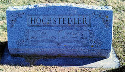
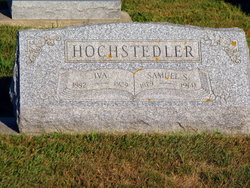
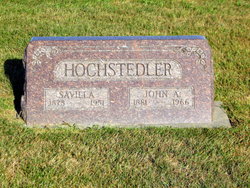
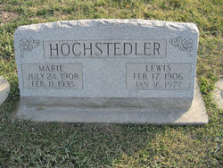
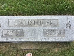
Samuel S. “Sam” Hochstedler
| Birth | : | 31 Aug 1879 Johnson County, Iowa, USA |
| Death | : | 27 Dec 1960 West Liberty, Muscatine County, Iowa, USA |
| Burial | : | Saint Andrews Church Cemetery, LeRoy, Dodge County, USA |
| Coordinate | : | 43.5732994, -88.5500336 |
| Plot | : | 739 |
| Description | : | Gospel Herald Vol. 54, No. 3, 1/17/1961, p. 70-71 Samuel S. Hochstedler 1879-1960 Hochstedler, Samuel S., son of Samuel and Ann (Miller) Hochstedler, was born in Johnson Co., Iowa, Aug. 31, 1879; died Dec. 27, 1960, at West Liberty, Iowa; aged 81 y. 3 m. 26 d. On Dec. 31, 1901, he was married to Iva Miller who died in 1929. To this union were born 5 sons (Omar, Cedar Rapids; Lewis and Raymond, Kalona; Monroe, Wellman; and Robert, Hills, Iowa. In February, 1934, he was married to Anna Gingerich, who survives. Besides his wife and 5 sons, there are also 20 grandchildren, 27 great-grandchildren and one... Read More |
frequently asked questions (FAQ):
-
Where is Samuel S. “Sam” Hochstedler's memorial?
Samuel S. “Sam” Hochstedler's memorial is located at: Saint Andrews Church Cemetery, LeRoy, Dodge County, USA.
-
When did Samuel S. “Sam” Hochstedler death?
Samuel S. “Sam” Hochstedler death on 27 Dec 1960 in West Liberty, Muscatine County, Iowa, USA
-
Where are the coordinates of the Samuel S. “Sam” Hochstedler's memorial?
Latitude: 43.5732994
Longitude: -88.5500336
Family Members:
Parent
Spouse
Siblings
Children
Flowers:
Nearby Cemetories:
1. Saint Andrews Church Cemetery
LeRoy, Dodge County, USA
Coordinate: 43.5732994, -88.5500336
2. Tidyman Cemetery
LeRoy, Dodge County, USA
Coordinate: 43.5482370, -88.5810470
3. Saint Luke Evangelical Lutheran Church Cemetery
Knowles, Dodge County, USA
Coordinate: 43.5718720, -88.5016540
4. Saint Paul Cemetery
Kekoskee, Dodge County, USA
Coordinate: 43.5455310, -88.5809180
5. Emanuel Cemetery
Knowles, Dodge County, USA
Coordinate: 43.5877991, -88.4997025
6. Brownsville Community Cemetery
Brownsville, Dodge County, USA
Coordinate: 43.5995380, -88.5053440
7. Mount Pleasant Cemetery
LeRoy, Dodge County, USA
Coordinate: 43.6167800, -88.5263000
8. Kekoskee Cemetery
Kekoskee, Dodge County, USA
Coordinate: 43.5263390, -88.5612850
9. Miles Farm Cemetery
LeRoy, Dodge County, USA
Coordinate: 43.6251880, -88.5917650
10. Saint Pauls Evangelical Lutheran Cemetery
Brownsville, Dodge County, USA
Coordinate: 43.6167200, -88.4889100
11. Saint Peters Cemetery
Theresa, Dodge County, USA
Coordinate: 43.5367012, -88.4794006
12. Mount Pleasant Cemetery
Oakfield, Fond du Lac County, USA
Coordinate: 43.6391983, -88.5460968
13. Saint Marys Cemetery
Lomira, Dodge County, USA
Coordinate: 43.5903015, -88.4518967
14. Saint Johns Lutheran Cemetery
Lomira, Dodge County, USA
Coordinate: 43.5877266, -88.4469833
15. Salem Cemetery
Lomira, Dodge County, USA
Coordinate: 43.5872530, -88.4463790
16. Saint Gobki Cemetery
Theresa, Dodge County, USA
Coordinate: 43.5144005, -88.4803009
17. Old Saint Marys Catholic Cemetery
Mayville, Dodge County, USA
Coordinate: 43.4935200, -88.5394100
18. Saint Pauls Evangelical Lutheran Cemetery
Lomira, Dodge County, USA
Coordinate: 43.5510050, -88.4430740
19. Old Community Cemetery
Lomira, Dodge County, USA
Coordinate: 43.6086590, -88.4499060
20. Oak Center Cemetery
Oak Center, Fond du Lac County, USA
Coordinate: 43.6466600, -88.6009400
21. Graceland Cemetery
Mayville, Dodge County, USA
Coordinate: 43.4900818, -88.5464325
22. Saint Pauls Cemetery
Theresa, Dodge County, USA
Coordinate: 43.4935989, -88.5141983
23. Saint Johns Cemetery
Mayville, Dodge County, USA
Coordinate: 43.4880500, -88.5473200
24. Union Cemetery
Theresa, Dodge County, USA
Coordinate: 43.5261002, -88.4514008

