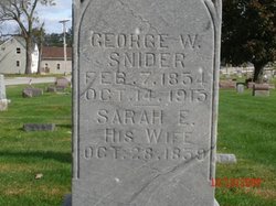
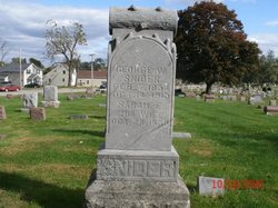
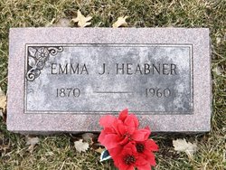
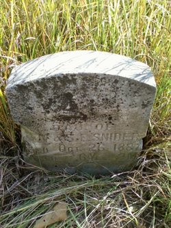
Sarah Elizabeth Baker Hain
| Birth | : | 8 Oct 1859 Cedar County, Iowa, USA |
| Death | : | 29 Dec 1951 Muscatine, Muscatine County, Iowa, USA |
| Burial | : | St James Churchyard, Ab Kettleby, Melton Borough, England |
| Coordinate | : | 52.7985680, -0.9273270 |
| Plot | : | Fletcher 4 block 20 lot 1 |
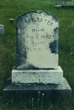
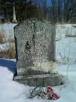
| Description | : | She was the daughter of John & Sarah Baker. She married George Walter Snider on Nov. 08, 1875. They had 6 children. Charles E. (Nellie M. Halterman), Albert Henry (Myrtle), Sarah B., Joseph L., Frank & George Walter Snider, Jr.. She was the daughter-in-law of Henry Snider & Susannah Truitt Snider Pearson. |
frequently asked questions (FAQ):
-
Where is Sarah Elizabeth Baker Hain's memorial?
Sarah Elizabeth Baker Hain's memorial is located at: St James Churchyard, Ab Kettleby, Melton Borough, England.
-
When did Sarah Elizabeth Baker Hain death?
Sarah Elizabeth Baker Hain death on 29 Dec 1951 in Muscatine, Muscatine County, Iowa, USA
-
Where are the coordinates of the Sarah Elizabeth Baker Hain's memorial?
Latitude: 52.7985680
Longitude: -0.9273270
Family Members:
Parent
Spouse
Siblings
Children
Flowers:
Nearby Cemetories:
1. St James Churchyard
Ab Kettleby, Melton Borough, England
Coordinate: 52.7985680, -0.9273270
2. St. Michael's Churchyard
Wartnaby, Melton Borough, England
Coordinate: 52.8012220, -0.9447660
3. St. Bartolomew's Churchyard, Welby
Melton Mowbray, Melton Borough, England
Coordinate: 52.7814860, -0.9263090
4. St Peter's Churchyard
Saxelbye, Melton Borough, England
Coordinate: 52.7817900, -0.9626700
5. Scalford Melton Road Cemetery
Scalford, Melton Borough, England
Coordinate: 52.8090150, -0.8766850
6. Long Clawson Sandpit Lane Cemetery
Long Clawson, Melton Borough, England
Coordinate: 52.8338110, -0.9273370
7. Scalford Wesleyan Chapelyard
Scalford, Melton Borough, England
Coordinate: 52.8080500, -0.8702700
8. St John the Baptist Churchyard
Grimston, Melton Borough, England
Coordinate: 52.7902720, -0.9850350
9. St Egelwin Churchyard
Scalford, Melton Borough, England
Coordinate: 52.8093250, -0.8694080
10. St. Leonards Churchyard Sysonby
Melton Mowbray, Melton Borough, England
Coordinate: 52.7633900, -0.9076000
11. Grange Lane Churchyard Extension, Sysonby
Melton Mowbray, Melton Borough, England
Coordinate: 52.7627410, -0.9077140
12. All Saints Churchyard
Asfordby, Melton Borough, England
Coordinate: 52.7635100, -0.9523300
13. St. Remigius Churchyard
Long Clawson, Melton Borough, England
Coordinate: 52.8373290, -0.9294660
14. St Mary the Virgin Churchyard
Nether Broughton, Melton Borough, England
Coordinate: 52.8289780, -0.9687040
15. Asfordby Loughborough Road Cemetery
Asfordby, Melton Borough, England
Coordinate: 52.7654300, -0.9626900
16. Melton Mowbray Old Cemetery
Melton Mowbray, Melton Borough, England
Coordinate: 52.7662520, -0.8859770
17. St Peter Churchyard
Kirby Bellars, Melton Borough, England
Coordinate: 52.7569830, -0.9376920
18. St Mary Churchyard
Melton Mowbray, Melton Borough, England
Coordinate: 52.7635680, -0.8858380
19. St. John the Baptist Catholic Churchyard
Melton Mowbray, Melton Borough, England
Coordinate: 52.7648338, -0.8812819
20. Thorpe Road Cemetery
Melton Mowbray, Melton Borough, England
Coordinate: 52.7706600, -0.8708200
21. Old Dalby Main Road Cemetery
Old Dalby, Melton Borough, England
Coordinate: 52.8084650, -1.0007670
22. St John the Baptist Churchyard
Old Dalby, Melton Borough, England
Coordinate: 52.8053510, -1.0017970
23. St Luke's Churchyard
Upper Broughton, Rushcliffe Borough, England
Coordinate: 52.8293700, -0.9870900
24. St. Mary the Virgin Churchyard
Melton Mowbray, Melton Borough, England
Coordinate: 52.7729800, -0.8594080

