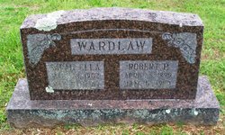
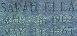
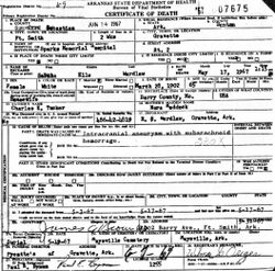
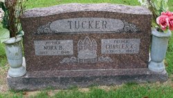
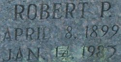
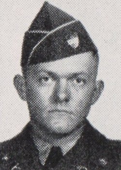
Sarah Ella Tucker Wardlaw
| Birth | : | 28 Mar 1902 Eagle Rock, Barry County, Missouri, USA |
| Death | : | 17 May 1967 Fort Smith, Sebastian County, Arkansas, USA |
| Burial | : | Rainville Memorial Cemetery, Basin, Jefferson County, USA |
| Coordinate | : | 46.2736630, -112.2514180 |
| Plot | : | South Section |
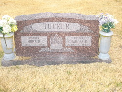
| Description | : | Daughter of Charles Kenion Tucker and Nora Bell HADDOCK Tucker Wife of Robert Pierce Wardlaw married 9 December 1925 at Pineville, McDonald County, Missouri, United States |
frequently asked questions (FAQ):
-
Where is Sarah Ella Tucker Wardlaw's memorial?
Sarah Ella Tucker Wardlaw's memorial is located at: Rainville Memorial Cemetery, Basin, Jefferson County, USA.
-
When did Sarah Ella Tucker Wardlaw death?
Sarah Ella Tucker Wardlaw death on 17 May 1967 in Fort Smith, Sebastian County, Arkansas, USA
-
Where are the coordinates of the Sarah Ella Tucker Wardlaw's memorial?
Latitude: 46.2736630
Longitude: -112.2514180
Family Members:
Parent
Spouse
Siblings
Children
Flowers:
Nearby Cemetories:
1. Rainville Memorial Cemetery
Basin, Jefferson County, USA
Coordinate: 46.2736630, -112.2514180
2. Boulder Cemetery
Boulder, Jefferson County, USA
Coordinate: 46.2393990, -112.1074982
3. Jefferson City Cemetery
Jefferson City, Jefferson County, USA
Coordinate: 46.3913000, -112.0308000
4. Elkhorn Cemetery
Elkhorn, Jefferson County, USA
Coordinate: 46.2683450, -111.9480010
5. Saint John the Evangelist Catholic Church Cemetery
Boulder, Jefferson County, USA
Coordinate: 46.1234000, -111.9505000
6. John Montgomery Gravesite
Unionville, Lewis and Clark County, USA
Coordinate: 46.5170000, -112.0845000
7. Old Elliston Cemetery
Elliston, Powell County, USA
Coordinate: 46.5610000, -112.3983000
8. Elliston Cemetery
Elliston, Powell County, USA
Coordinate: 46.5693090, -112.4406270
9. Potters Field
Butte, Silver Bow County, USA
Coordinate: 45.9894470, -112.4773280
10. Saint Johns Columbarium
Butte, Silver Bow County, USA
Coordinate: 45.9923000, -112.5178000
11. Old Catholic Cemetery
Helena, Lewis and Clark County, USA
Coordinate: 46.5779120, -112.0183220
12. Plymouth Congregational Church Columbarium
Helena, Lewis and Clark County, USA
Coordinate: 46.5804000, -112.0109000
13. Calvary Cemetery
Lewis and Clark County, USA
Coordinate: 46.5997009, -112.0714035
14. City Cemetery (Defunct)
Helena, Lewis and Clark County, USA
Coordinate: 46.5896660, -112.0360010
15. Mount Moriah Cemetery
Butte, Silver Bow County, USA
Coordinate: 45.9885500, -112.5423400
16. BNai Israel Cemetery
Butte, Silver Bow County, USA
Coordinate: 45.9865700, -112.5409000
17. Cathedral of the Sacred Hearts of Jesus and Mary
Helena, Lewis and Clark County, USA
Coordinate: 46.5902550, -112.0339480
18. Saint Peters Episcopal Cathedral Columbarium
Helena, Lewis and Clark County, USA
Coordinate: 46.5925598, -112.0400925
19. Saint Patrick's Cemetery
Butte, Silver Bow County, USA
Coordinate: 45.9844017, -112.5406036
20. Montana State Veterans Cemetery
Helena, Lewis and Clark County, USA
Coordinate: 46.6151886, -112.0993042
21. Mountain View Cemetery
Butte, Silver Bow County, USA
Coordinate: 45.9622720, -112.5077200
22. Benton Avenue Cemetery
Helena, Lewis and Clark County, USA
Coordinate: 46.6045265, -112.0415497
23. Fort William Henry Harrison Cemetery
Helena, Lewis and Clark County, USA
Coordinate: 46.6227000, -112.1103000
24. Old Saint Marys Catholic Cemetery
Helena, Lewis and Clark County, USA
Coordinate: 46.5958150, -112.0105560

