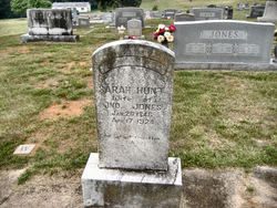
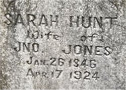
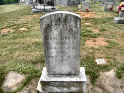
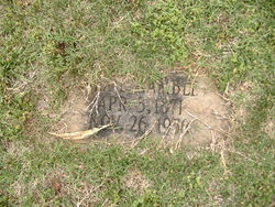
Sarah Hunt Jones
| Birth | : | 26 Jan 1846 North Carolina, USA |
| Death | : | 17 Apr 1924 Rutherford County, North Carolina, USA |
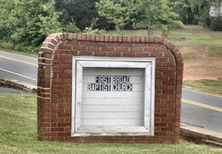
| Burial | : | First Broad Baptist Church Cemetery, Bostic, Rutherford County, USA |
| Coordinate | : | 35.5176770, -81.7543960 |
| Description | : | Name Sarah Jones Event Date 17 Apr 1924 Event Place Golden Valley, Rutherford, North Carolina Gender Female Race (Original) White Race White Age (Original) 78y 2m 21d Birth Date 26 Jun 1845 ... Read More |
frequently asked questions (FAQ):
-
Where is Sarah Hunt Jones's memorial?
Sarah Hunt Jones's memorial is located at: First Broad Baptist Church Cemetery, Bostic, Rutherford County, USA.
-
When did Sarah Hunt Jones death?
Sarah Hunt Jones death on 17 Apr 1924 in Rutherford County, North Carolina, USA
-
Where are the coordinates of the Sarah Hunt Jones's memorial?
Latitude: 35.5176770
Longitude: -81.7543960
Family Members:
Spouse
Children
Flowers:
Nearby Cemetories:
1. First Broad Baptist Church Cemetery
Bostic, Rutherford County, USA
Coordinate: 35.5176770, -81.7543960
2. Fortune Cemetery
Rutherford County, USA
Coordinate: 35.5092010, -81.7647018
3. Golden Valley Missionary Methodist Church Cemetery
Bostic, Rutherford County, USA
Coordinate: 35.4961700, -81.7678800
4. Golden Valley United Methodist Church Cemetery
Bostic, Rutherford County, USA
Coordinate: 35.5203018, -81.7900009
5. Mooney-Van Zandt Cemetery
Rutherford County, USA
Coordinate: 35.5335800, -81.7932500
6. Golden Valley Church of the Brethren Cemetery
Sunshine, Rutherford County, USA
Coordinate: 35.5368800, -81.7974200
7. Diviney Cemetery
Duncans Creek, Rutherford County, USA
Coordinate: 35.5143920, -81.7042200
8. Fairview Church Cemetery
Forest City, Rutherford County, USA
Coordinate: 35.5409640, -81.8010940
9. Duncans Creek Presbyterian Church Cemetery
Hollis, Rutherford County, USA
Coordinate: 35.4742680, -81.7276620
10. Cooper Springs Congregational Holiness Church Ceme
Rutherford County, USA
Coordinate: 35.4755700, -81.7844540
11. Weast Cemetery
Sunshine, Rutherford County, USA
Coordinate: 35.5341320, -81.8145960
12. Fellowship Baptist Church Cemetery
Bostic, Rutherford County, USA
Coordinate: 35.5650630, -81.7235360
13. Mount Pleasant Baptist Church Cemetery
Rutherford County, USA
Coordinate: 35.5509280, -81.6976340
14. Lees Chapel United Methodist Church Cemetery
Polkville, Cleveland County, USA
Coordinate: 35.4860764, -81.6936951
15. Ross Hill Baptist Church Cemetery
Bostic, Rutherford County, USA
Coordinate: 35.4575280, -81.7922220
16. Price Family Cemetery
Hollis, Rutherford County, USA
Coordinate: 35.4548240, -81.7194440
17. Mount Harmony Baptist Church Cemetery
Bostic, Rutherford County, USA
Coordinate: 35.4588380, -81.7996940
18. New Home United Methodist Church Cemetery
Casar, Cleveland County, USA
Coordinate: 35.5064300, -81.6653100
19. Silver Creek Knob
Burke County, USA
Coordinate: 35.5835000, -81.7970000
20. Calvary's Cross Baptist Cemetery
Lawndale, Cleveland County, USA
Coordinate: 35.4743690, -81.6791790
21. Sweezy-Murray Family Cemetery
Rutherford County, USA
Coordinate: 35.4432090, -81.7671363
22. Mount Zion Baptist Church Cemetery
Casar, Cleveland County, USA
Coordinate: 35.4843300, -81.6655900
23. Mount Harmony Memorial Cemetery
Polkville, Cleveland County, USA
Coordinate: 35.4598700, -81.6858000
24. Cane Creek Baptist Church Cemetery
Union Mills, Rutherford County, USA
Coordinate: 35.5222250, -81.8530630

