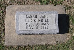
Sarah Jane Davis Luckinbill
| Birth | : | 9 Oct 1848 Madison, Dane County, Wisconsin, USA |
| Death | : | 5 Nov 1927 Simpson, Mitchell County, Kansas, USA |
| Burial | : | Taita Old Cemetery, Naenae, Lower Hutt City, New Zealand |
| Coordinate | : | -41.1945700, 174.9564000 |
| Plot | : | Block 4W, Lot 3 |
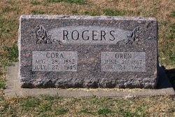
| Description | : | Sara Jane Davis Luckinbill was born in Madison, Dane County, Wisconsin on October 9, 1848. Her parents, Phanuel and Nancy McCabe Davis, moved to Guthrie County, Iowa when Sara Jane was a child. She grew up in Iowa and married Peter Luckinbill Jr. in 1864. They had three children: Willard, Clara Luckinbill Thompson Kerns, and Cora Luckinbill Rogers. She joined the Methodist Church in her early youth and lived a Christian life. In March of 1877 Sara Jane, Peter and their two small children moved to Rooks County Kansas. A few years later they moved... Read More |
frequently asked questions (FAQ):
-
Where is Sarah Jane Davis Luckinbill's memorial?
Sarah Jane Davis Luckinbill's memorial is located at: Taita Old Cemetery, Naenae, Lower Hutt City, New Zealand.
-
When did Sarah Jane Davis Luckinbill death?
Sarah Jane Davis Luckinbill death on 5 Nov 1927 in Simpson, Mitchell County, Kansas, USA
-
Where are the coordinates of the Sarah Jane Davis Luckinbill's memorial?
Latitude: -41.1945700
Longitude: 174.9564000
Family Members:
Parent
Children
Flowers:
Nearby Cemetories:
1. Taita Old Cemetery
Naenae, Lower Hutt City, New Zealand
Coordinate: -41.1945700, 174.9564000
2. Knox Presbyterian Church Cemetery
Lower Hutt, Lower Hutt City, New Zealand
Coordinate: -41.1965430, 174.9579920
3. Taita Lawn Cemetery
Naenae, Lower Hutt City, New Zealand
Coordinate: -41.1968900, 174.9634900
4. Christ Church Anglican Cemetery
Taita, Lower Hutt City, New Zealand
Coordinate: -41.1820960, 174.9600920
5. Boulcott Farm Cemetery
Lower Hutt, Lower Hutt City, New Zealand
Coordinate: -41.2030590, 174.9272750
6. St. James Churchyard
Lower Hutt, Lower Hutt City, New Zealand
Coordinate: -41.2128840, 174.9003910
7. Bridge Street Cemetery
Lower Hutt, Lower Hutt City, New Zealand
Coordinate: -41.2117740, 174.8969660
8. Owhiti Urupā
Seaview, Lower Hutt City, New Zealand
Coordinate: -41.2358800, 174.9044500
9. Woodlands Farm Cemetery
Wainuiomata, Lower Hutt City, New Zealand
Coordinate: -41.2587540, 174.9549250
10. Korokoro Catholic Cemetery
Lower Hutt, Lower Hutt City, New Zealand
Coordinate: -41.2210110, 174.8702590
11. Te Puni Urupā
Petone, Lower Hutt City, New Zealand
Coordinate: -41.2254898, 174.8686975
12. Wainuiomata Remembrance Garden
Wainuiomata, Lower Hutt City, New Zealand
Coordinate: -41.2762300, 174.9696800
13. Sinclair Cemetery
Wainuiomata, Lower Hutt City, New Zealand
Coordinate: -41.2770470, 174.9697580
14. Homedale Methodist Cemetery
Wainuiomata, Lower Hutt City, New Zealand
Coordinate: -41.2780500, 174.9527000
15. St Josephs Catholic Cemetery
Pauatahanui, Porirua City, New Zealand
Coordinate: -41.1135060, 174.9196220
16. Bradey Grave
Whitby, Porirua City, New Zealand
Coordinate: -41.1173161, 174.9056161
17. Somes Island
Wellington, Wellington City, New Zealand
Coordinate: -41.2548630, 174.8650830
18. St. John's Anglican Churchyard Cemetery
Trentham, Upper Hutt City, New Zealand
Coordinate: -41.1303100, 175.0443500
19. Saint Albans Burial Ground
Pauatahanui, Porirua City, New Zealand
Coordinate: -41.1067240, 174.9179340
20. Pauatahanui Burial Ground
Pauatahanui, Porirua City, New Zealand
Coordinate: -41.1068190, 174.9173310
21. Porirua Cemetery
Porirua, Porirua City, New Zealand
Coordinate: -41.1453640, 174.8420300
22. Grasslees Reserve
Tawa, Wellington City, New Zealand
Coordinate: -41.1647415, 174.8284302
23. Tawa Flat Cemetery
Tawa, Wellington City, New Zealand
Coordinate: -41.1580600, 174.8281800
24. Wallaceville Cemetery
Wallaceville, Upper Hutt City, New Zealand
Coordinate: -41.1359900, 175.0743300


