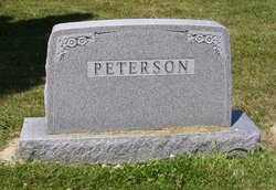
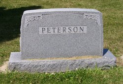
Sarah June Mills Peterson
| Birth | : | 14 Jan 1876 Illinois, USA |
| Death | : | 21 Jan 1958 Dolliver, Emmet County, Iowa, USA |
| Burial | : | Lincoln Township Cemetery, Dolliver, Emmet County, USA |
| Coordinate | : | 43.4441986, -94.6204987 |
| Description | : | Mrs. M.C. Peterson Dies at Dolliver Mrs. M.C. (Sarah) Peterson, 82, longtime resident of Emmet County, died at 11 o'clock last night at her home in Dolliver after an extended illness. She had been bedfast since Nov. 13, 1956 when she suffered a stroke. Born Jan. 14, 1876 in Illinois, she was the daughter of Samuel and Mary Mills. When a small girl, her family moved near Williams, where she received her education. She was united in marriage Dec. 27, 1892 in Estherville to M.C. Peterson. The couple lived in the Williams area until 1910 when they... Read More |
frequently asked questions (FAQ):
-
Where is Sarah June Mills Peterson's memorial?
Sarah June Mills Peterson's memorial is located at: Lincoln Township Cemetery, Dolliver, Emmet County, USA.
-
When did Sarah June Mills Peterson death?
Sarah June Mills Peterson death on 21 Jan 1958 in Dolliver, Emmet County, Iowa, USA
-
Where are the coordinates of the Sarah June Mills Peterson's memorial?
Latitude: 43.4441986
Longitude: -94.6204987
Family Members:
Parent
Spouse
Siblings
Children
Flowers:
Nearby Cemetories:
1. Lincoln Township Cemetery
Dolliver, Emmet County, USA
Coordinate: 43.4441986, -94.6204987
2. Palestine Cemetery
Dolliver, Emmet County, USA
Coordinate: 43.4880000, -94.6408000
3. Swan Lake Township Cemetery
Maple Hill, Emmet County, USA
Coordinate: 43.3850746, -94.6381378
4. Tenhassen Cemetery
Ceylon, Martin County, USA
Coordinate: 43.5293999, -94.5877991
5. Center Township Cemetery
Emmet County, USA
Coordinate: 43.3608000, -94.6790000
6. Ellsworth Cemetery
Emmet County, USA
Coordinate: 43.5005989, -94.7249985
7. Saint Marys Catholic Cemetery
Armstrong, Emmet County, USA
Coordinate: 43.3980000, -94.5048000
8. Armstrong Grove Cemetery
Armstrong, Emmet County, USA
Coordinate: 43.3985696, -94.5041425
9. Lake Belt Cemetery
Ceylon, Martin County, USA
Coordinate: 43.5353012, -94.6742020
10. Mount Calvary Cemetery
Armstrong, Emmet County, USA
Coordinate: 43.3850000, -94.5028000
11. German Evangelical Cemetery
Wilbert, Martin County, USA
Coordinate: 43.5325600, -94.5419000
12. Prosser Cemetery
Estherville, Emmet County, USA
Coordinate: 43.4422000, -94.7783000
13. Saint Pauls Lutheran Church Cemetery
Wilbert, Martin County, USA
Coordinate: 43.5444500, -94.5395800
14. Center Chain Cemetery
Martin County, USA
Coordinate: 43.5224991, -94.4483032
15. Norwegian Cemetery
Estherville, Emmet County, USA
Coordinate: 43.4291992, -94.8261032
16. Estherville Lutheran Cemetery
Estherville, Emmet County, USA
Coordinate: 43.4298000, -94.8263000
17. East Side Memorial Cemetery
Estherville, Emmet County, USA
Coordinate: 43.4267750, -94.8265600
18. East Side Cemetery
Estherville, Emmet County, USA
Coordinate: 43.4068985, -94.8264008
19. High Lake Jack Creek Cemetery
Wallingford, Emmet County, USA
Coordinate: 43.3006500, -94.7000620
20. Saint Patricks Cemetery
Estherville, Emmet County, USA
Coordinate: 43.3843994, -94.8283005
21. Lake Fremont Cemetery
Dunnell, Martin County, USA
Coordinate: 43.5691986, -94.7746964
22. Wallingford Lutheran Cemetery
Wallingford, Emmet County, USA
Coordinate: 43.3128014, -94.7731018
23. Oak Hill Cemetery
Estherville, Emmet County, USA
Coordinate: 43.3986015, -94.8518982
24. Memorial Cemetery
Ringsted, Emmet County, USA
Coordinate: 43.3009070, -94.4814670

