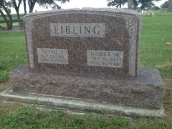
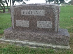
Sarah Stanyer Eibling
| Birth | : | 13 May 1882 London, Middlesex County, Ontario, Canada |
| Death | : | 21 Jan 1959 Lima, Allen County, Ohio, USA |
| Burial | : | St. Peter's Churchyard, Diddlebury, Shropshire Unitary Authority, England |
| Coordinate | : | 52.4640570, -2.7249740 |
| Description | : | Sarah Eibling DOLA - Sarah Eibling, 76, Dola, died at 10 p.m. Wednesday in Memorial Hospital after an illness of three days. She was born May 13, 1882, in London, Ontario, Canada. She was married to Henry Eibling, June 26, 1904, who died Aug. 21, 1958. Surviving are three sons, Dr. Harold Eibling of Columbus, Willis of West Covina, Calif., and Kent of Dola; one brother, Charles Stanyer of Lima and one sister, Mrs. Charlotte Miller of Ada. She was a member of the Dola Methodist Church. Funeral services will be conducted at 2 p.m. Saturday in the Keiper Funeral Home, Dunkirk. Rev. Charles Lockie... Read More |
frequently asked questions (FAQ):
-
Where is Sarah Stanyer Eibling's memorial?
Sarah Stanyer Eibling's memorial is located at: St. Peter's Churchyard, Diddlebury, Shropshire Unitary Authority, England.
-
When did Sarah Stanyer Eibling death?
Sarah Stanyer Eibling death on 21 Jan 1959 in Lima, Allen County, Ohio, USA
-
Where are the coordinates of the Sarah Stanyer Eibling's memorial?
Latitude: 52.4640570
Longitude: -2.7249740
Family Members:
Spouse
Children
Flowers:
Nearby Cemetories:
1. St. Peter's Churchyard
Diddlebury, Shropshire Unitary Authority, England
Coordinate: 52.4640570, -2.7249740
2. All Saints Churchyard
Culmington, Shropshire Unitary Authority, England
Coordinate: 52.4334800, -2.7463500
3. Westhope Chapel Burial Ground
Diddlebury, Shropshire Unitary Authority, England
Coordinate: 52.4714690, -2.7818850
4. Eaton- under- Heywood St Edith
Eaton-under-Heywood, Shropshire Unitary Authority, England
Coordinate: 52.5056520, -2.7382880
5. Clee St. Margaret Churchyard
Clee St Margaret, Shropshire Unitary Authority, England
Coordinate: 52.4554270, -2.6423086
6. Holy Trinity Churchyard
Holdgate, Shropshire Unitary Authority, England
Coordinate: 52.5024450, -2.6471900
7. St. Margaret's Churchyard
Abdon, Shropshire Unitary Authority, England
Coordinate: 52.4757240, -2.6265660
8. St Margaret's Churchyard
Acton Scott, Shropshire Unitary Authority, England
Coordinate: 52.5001670, -2.8060920
9. St. Thomas' Churchyard
Craven Arms, Shropshire Unitary Authority, England
Coordinate: 52.4450630, -2.8306870
10. St. Andrew's Churchyard
Hope Bowdler, Shropshire Unitary Authority, England
Coordinate: 52.5271160, -2.7739830
11. St. Mary the Virgin Churchyard
Bromfield, Shropshire Unitary Authority, England
Coordinate: 52.3873900, -2.7636700
12. Blackford Chapel Burial Ground
Blackford, Shropshire Unitary Authority, England
Coordinate: 52.4437470, -2.5930900
13. Greenhills Cemetery
Church Stretton, Shropshire Unitary Authority, England
Coordinate: 52.5310170, -2.8142480
14. St. James's Churchyard
Cardington, Shropshire Unitary Authority, England
Coordinate: 52.5520200, -2.7296220
15. Church Stretton Cemetery
Church Stretton, Shropshire Unitary Authority, England
Coordinate: 52.5365590, -2.8097950
16. St Laurence Churchyard
Church Stretton, Shropshire Unitary Authority, England
Coordinate: 52.5381750, -2.8087400
17. St. Mary's Churchyard
Bitterley, Shropshire Unitary Authority, England
Coordinate: 52.3922280, -2.6319790
18. St. John The Baptist Churchyard
Ditton Priors, Shropshire Unitary Authority, England
Coordinate: 52.4990090, -2.5784720
19. St Laurence Churchyard
Burwarton, Shropshire Unitary Authority, England
Coordinate: 52.4611160, -2.5637380
20. St Peter's Churchyard
Easthope, Shropshire Unitary Authority, England
Coordinate: 52.5522350, -2.6413020
21. St. Peter and St. Paul Churchyard
Cleobury North, Shropshire Unitary Authority, England
Coordinate: 52.4796420, -2.5562440
22. Knowbury, St Paul
Caynham, Shropshire Unitary Authority, England
Coordinate: 52.3734750, -2.6300130
23. St Marys Churchyard
Hopesay, Shropshire Unitary Authority, England
Coordinate: 52.4440470, -2.8999020
24. St Michael Churchyard
Edgton, Shropshire Unitary Authority, England
Coordinate: 52.4660500, -2.9044570


