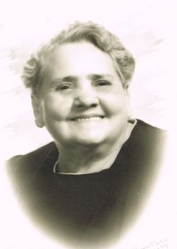
| Birth | : | 1865 Marion, Olmsted County, Minnesota, USA |
| Death | : | 1869 Union County, South Dakota, USA |
| Burial | : | Richland Cemetery, Richland, Union County, USA |
| Coordinate | : | 42.7682991, -96.6624985 |
| Plot | : | Section 1, Block 41, Lot 1, Grave 2 |
| Description | : | -- -- -- -- -- [Research of Cathy Porter-Maynard). SIDNEY CHAMP MAYNARD was the son of Solomon VanBuren Maynard and Mary Arvilla (Crane) Maynard. Sidney was born in Olmstead County, Minnesota in about 1865; and, came to Dakota Territory (now Union County, South Dakota) in 1868 with his parents and siblings. Solomon Maynard and his family first settled near the Big Sioux River, in Richland Township. The Maynards & Cranes were pioneers. As such, their lives contained not only the typical joys of life, but also the great challenges and sorrows inherent to pioneer... Read More |
frequently asked questions (FAQ):
-
Where is Sidney Champ Maynard's memorial?
Sidney Champ Maynard's memorial is located at: Richland Cemetery, Richland, Union County, USA.
-
When did Sidney Champ Maynard death?
Sidney Champ Maynard death on 1869 in Union County, South Dakota, USA
-
Where are the coordinates of the Sidney Champ Maynard's memorial?
Latitude: 42.7682991
Longitude: -96.6624985
Family Members:
Parent
Siblings
Flowers:
Nearby Cemetories:
1. Richland Cemetery
Richland, Union County, USA
Coordinate: 42.7682991, -96.6624985
2. Saint Paul Cemetery
Elk Point, Union County, USA
Coordinate: 42.7641983, -96.7061005
3. Union County Poor Farm Cemetery
Union County, USA
Coordinate: 42.7649210, -96.7077580
4. First Brule Creek Cemetery
Elk Point, Union County, USA
Coordinate: 42.7943993, -96.7069016
5. Gores Bluff Cemetery
Union County, USA
Coordinate: 42.8035069, -96.6260468
6. Westfield Township Cemetery
Westfield, Plymouth County, USA
Coordinate: 42.7510986, -96.5914001
7. Mills Family Cemetery
Westfield, Plymouth County, USA
Coordinate: 42.7188460, -96.6019280
8. Brule Creek Cemetery
Spink Township, Union County, USA
Coordinate: 42.8346510, -96.7324350
9. Elk Point Cemetery
Elk Point, Union County, USA
Coordinate: 42.6794586, -96.6794586
10. Saint Joseph Cemetery
Elk Point, Union County, USA
Coordinate: 42.6794014, -96.6797028
11. Ahlsborg Lutheran Cemetery
Union County, USA
Coordinate: 42.8228000, -96.7612000
12. Pleasant Hill Cemetery Old
Spink, Union County, USA
Coordinate: 42.8588462, -96.7215592
13. Saint Patricks Cemetery
Akron, Plymouth County, USA
Coordinate: 42.8232300, -96.5374800
14. Pleasant Hill Cemetery
Spink, Union County, USA
Coordinate: 42.8741000, -96.6876000
15. Dowlin Cemetery
Burbank, Clay County, USA
Coordinate: 42.7789001, -96.8107986
16. Riverside Cemetery
Akron, Plymouth County, USA
Coordinate: 42.8367004, -96.5453033
17. Saint Mary Cemetery
Union County, USA
Coordinate: 42.8520584, -96.7877502
18. Union Creek Cemetery
Union County, USA
Coordinate: 42.8911018, -96.5863037
19. Saint Agnes Cemetery
Vermillion, Clay County, USA
Coordinate: 42.7872009, -96.8499985
20. Mount Hope Cemetery
Union County, USA
Coordinate: 42.8885994, -96.5667038
21. Ionia Cemetery
Newcastle, Dixon County, USA
Coordinate: 42.6893997, -96.8300018
22. Dewitt Cemetery
Ponca, Dixon County, USA
Coordinate: 42.6248000, -96.7437500
23. Gibb's Cemetery
Newcastle, Dixon County, USA
Coordinate: 42.6985100, -96.8518400
24. Elmwood Cemetery
Elk Point, Union County, USA
Coordinate: 42.6036700, -96.6881900


