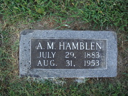
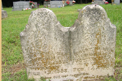
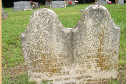
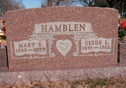
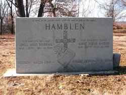
Temperance Laura Tollett Hamblen
| Birth | : | 5 Apr 1858 |
| Death | : | 5 Jan 1949 Fayetteville, Washington County, Arkansas, USA |
| Burial | : | St. Mary's Churchyard, Mellor, Ribble Valley Borough, England |
| Coordinate | : | 53.7728600, -2.5312400 |
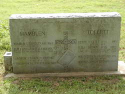
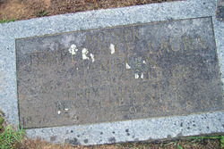
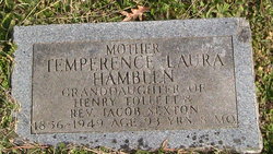
| Inscription | : | age 93 yrs 8 mos |
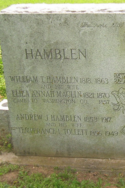
| Description | : | Temperance Laura Hamblen, 92, of Walnut Grove community, died Wednesday, January 5, 1949, at the home of a son, Milton Hamblen, of Fayetteville. Born April 5, 1858, she was a member of pioneer families who homesteaded at Walnut Grove before Arkansas became a state. She was the widow of Jack Hamblen, who died in 1917. Survived by: Daughters: Anna Phillips of Walnut Grove Saide Broyles of Fayetteville Lula Slaten of Lincoln Sons: Will and Clayton Hamblen, both of San Bernardino, Calif. Milton Hamblen of Fayetteviile Albert Hamblen of Walnut Grove Clyde Hamblen of Springdale Rev. Ralleigh Hamblen of Tampa, Fla. (Northwest Arkansas Times, January 5, 1949) |
frequently asked questions (FAQ):
-
Where is Temperance Laura Tollett Hamblen's memorial?
Temperance Laura Tollett Hamblen's memorial is located at: St. Mary's Churchyard, Mellor, Ribble Valley Borough, England.
-
When did Temperance Laura Tollett Hamblen death?
Temperance Laura Tollett Hamblen death on 5 Jan 1949 in Fayetteville, Washington County, Arkansas, USA
-
Where are the coordinates of the Temperance Laura Tollett Hamblen's memorial?
Latitude: 53.7728600
Longitude: -2.5312400
Family Members:
Parent
Spouse
Siblings
Children
Flowers:
Nearby Cemetories:
1. St. Mary's Churchyard
Mellor, Ribble Valley Borough, England
Coordinate: 53.7728600, -2.5312400
2. Mellor Methodist Churchyard
Blackburn, Blackburn with Darwen Unitary Authority, England
Coordinate: 53.7742950, -2.5255060
3. St Mary's R.C. Church Cemetery
Osbaldeston, Ribble Valley Borough, England
Coordinate: 53.7816970, -2.5350240
4. St Leonard Churchyard
Balderstone, Ribble Valley Borough, England
Coordinate: 53.7860070, -2.5609380
5. St Peter Churchyard
Salesbury, Ribble Valley Borough, England
Coordinate: 53.7915000, -2.4859100
6. Pleasington Cemetery and Crematorium
Blackburn, Blackburn with Darwen Unitary Authority, England
Coordinate: 53.7388880, -2.5368710
7. St Paul's
Blackburn, Blackburn with Darwen Unitary Authority, England
Coordinate: 53.7491222, -2.4891266
8. Blackburn Cemetery
Blackburn, Blackburn with Darwen Unitary Authority, England
Coordinate: 53.7662430, -2.4726050
9. St Wilfrid Churchyard
Ribchester, Ribble Valley Borough, England
Coordinate: 53.8102780, -2.5332650
10. Wesleyan Methodist Chapel Chapelyard
Blackburn, Blackburn with Darwen Unitary Authority, England
Coordinate: 53.7464910, -2.4848380
11. Independent Chapel Churchyard
Blackburn, Blackburn with Darwen Unitary Authority, England
Coordinate: 53.7454960, -2.4864460
12. St. Peter's Churchyard
Blackburn, Blackburn with Darwen Unitary Authority, England
Coordinate: 53.7448110, -2.4865070
13. Pleasington Priory
Pleasington, Blackburn with Darwen Unitary Authority, England
Coordinate: 53.7348590, -2.5433060
14. Blackburn Cathedral
Blackburn, Blackburn with Darwen Unitary Authority, England
Coordinate: 53.7472960, -2.4820020
15. St Alban's Churchyard
Blackburn, Blackburn with Darwen Unitary Authority, England
Coordinate: 53.7530090, -2.4748540
16. Holy Trinity Church
Blackburn with Darwen Unitary Authority, England
Coordinate: 53.7511727, -2.4747178
17. Mount St Presbyterian Chapelyard
Blackburn, Blackburn with Darwen Unitary Authority, England
Coordinate: 53.7478000, -2.4775000
18. The Church of St. Saviour The Holy House of Stydd
Ribchester, Ribble Valley Borough, England
Coordinate: 53.8188690, -2.5272770
19. St. Josephs Roman Catholic Churchyard
Brindle, Chorley Borough, England
Coordinate: 53.7350780, -2.5880640
20. St. Mary's and St. John RC Churchyard, Southworth
Samlesbury, South Ribble Borough, England
Coordinate: 53.7676690, -2.6183400
21. New Row Methodist Church
Blackburn with Darwen Unitary Authority, England
Coordinate: 53.7208950, -2.5023720
22. St. Leonard the Less Churchyard
Samlesbury, South Ribble Borough, England
Coordinate: 53.7680000, -2.6237000
23. Holy Trinity Churchyard
Hoghton, Chorley Borough, England
Coordinate: 53.7279300, -2.5848550
24. Our Lady and St. Michael Roman Catholic Churchyard
Longridge, Ribble Valley Borough, England
Coordinate: 53.8088040, -2.6133470

