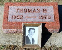
Thomas Henry Ahrens
| Birth | : | 17 Jan 1952 Clarksville, Butler County, Iowa, USA |
| Death | : | 13 May 1970 Clarksville, Butler County, Iowa, USA |
| Burial | : | Alexandra Cemetery, Alexandra, Central Otago District, New Zealand |
| Coordinate | : | -45.2397700, 169.3935560 |
| Plot | : | G19 |
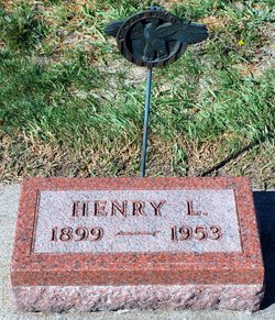
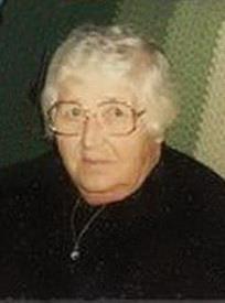
| Description | : | Son of Henry Louis & Alvina (Klunder) Ahrens From the Waterloo Daily Courier, 14 May 1970 Clarksviile Youth Killed in Crash CEDAR FALLS — The Iowa Highway Patrol Thursday morning reported the death of an 18-year-old Clarksviile youth as the result of a two car headon collision three miles west of Shell Rock on Highway 3. The patrol identified the dead youth as Thomas Henry Ahrens of Clarksviile. It was reported that Ahrens was traveling east on the highway and was passing a truck driven by William Francis Hillsman, 34, of 3304 Randolph St., Waterloo, when his car collided with another vehicle driven by Thomas... Read More |
frequently asked questions (FAQ):
-
Where is Thomas Henry Ahrens's memorial?
Thomas Henry Ahrens's memorial is located at: Alexandra Cemetery, Alexandra, Central Otago District, New Zealand.
-
When did Thomas Henry Ahrens death?
Thomas Henry Ahrens death on 13 May 1970 in Clarksville, Butler County, Iowa, USA
-
Where are the coordinates of the Thomas Henry Ahrens's memorial?
Latitude: -45.2397700
Longitude: 169.3935560
Family Members:
Parent
Flowers:
Nearby Cemetories:
1. Alexandra Cemetery
Alexandra, Central Otago District, New Zealand
Coordinate: -45.2397700, 169.3935560
2. Manuherikia Junction Cemetery
Alexandra, Central Otago District, New Zealand
Coordinate: -45.2614850, 169.3977150
3. Clyde Cemetery
Clyde, Central Otago District, New Zealand
Coordinate: -45.1941880, 169.3398930
4. St. Michael & All Angels Church Cemetery
Clyde, Central Otago District, New Zealand
Coordinate: -45.1887000, 169.3172167
5. Gorge Creek Miners' Monument
Roxburgh, Central Otago District, New Zealand
Coordinate: -45.3759790, 169.2764350
6. Moa Creek Cemetery
Moa Creek, Central Otago District, New Zealand
Coordinate: -45.2102100, 169.6869300
7. Blacks Cemetery
Omakau, Central Otago District, New Zealand
Coordinate: -45.0895900, 169.6034000
8. St. Andrew's Anglican Church
Cromwell, Central Otago District, New Zealand
Coordinate: -45.0475370, 169.2098760
9. Litany Street Cemetery
Cromwell, Central Otago District, New Zealand
Coordinate: -45.0428540, 169.2100400
10. Cromwell Cemetery
Cromwell, Central Otago District, New Zealand
Coordinate: -45.0528700, 169.1732500
11. Drybread Cemetery
Lauder, Central Otago District, New Zealand
Coordinate: -44.9974100, 169.6075300
12. Roxburgh Cemetery
Roxburgh, Central Otago District, New Zealand
Coordinate: -45.5267800, 169.3107700
13. Potters
Roxburgh, Central Otago District, New Zealand
Coordinate: -45.4702550, 169.1115970
14. Nevis Cemetery
Central Otago District, New Zealand
Coordinate: -45.2240700, 168.9529050
15. Ettrick Cemetery
Millers Flat, Central Otago District, New Zealand
Coordinate: -45.6318900, 169.3645500
16. Tarras Cemetery
Tarras, Central Otago District, New Zealand
Coordinate: -44.8356000, 169.4408100
17. Millers Flat Cemetery
Millers Flat, Central Otago District, New Zealand
Coordinate: -45.6648030, 169.4147400
18. Gimmerburn
Gimmerburn, Central Otago District, New Zealand
Coordinate: -45.1491200, 170.0042000
19. Cardrona Cemetery
Cardrona, Queenstown-Lakes District, New Zealand
Coordinate: -44.8653020, 169.0172270
20. St Bathans Public Cemetery
Saint Bathans, Central Otago District, New Zealand
Coordinate: -44.8734250, 169.7990450
21. Blackstone Cemetery
Blackstone Hill, Central Otago District, New Zealand
Coordinate: -44.9458300, 169.9061800
22. St Bathans Catholic Cemetery
Saint Bathans, Central Otago District, New Zealand
Coordinate: -44.8699930, 169.8090290
23. Kingston Cemetery
Kingston, Queenstown-Lakes District, New Zealand
Coordinate: -45.3376030, 168.7252250
24. Horseshoe Bend Cemetery
Millers Flat, Central Otago District, New Zealand
Coordinate: -45.7251920, 169.4801120


