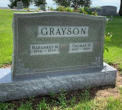
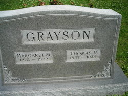
Thomas Henry Grayson
| Birth | : | 27 Nov 1857 Bowling Green, Warren County, Kentucky, USA |
| Death | : | 20 Jan 1938 Emerson, Mills County, Iowa, USA |
| Burial | : | Holy Trinity Churchyard, Holtby, York Unitary Authority, England |
| Coordinate | : | 53.9792890, -0.9719310 |
| Plot | : | 1st Addition, 10 |
| Description | : | LIFE SKETCH OF WELL KNOWN EMERSON MAN Funeral services were held Sunday afternoon, January 23, 1938, at 2 o'clock in the Methodist church in Emerson, Iowa for Thomas Grayson. The services were in charge of Rev. J. F. Stille, pastor of the Emerson Baptist Church. Music was furnished by Ray Fields, Frederic Larson, Mrs. Merritt Taylor, Mrs. E. E. Whisler, with Mrs. R. R. Honeyman at the piano. The pallbearers were I. J. Slamons, Charlie Shaw, John Russel, Ed Peterson, Ray Fields, George Thorson, Roy Davis, and Joe McLain. Interment was made in the Emerson Cemetery. ... Read More |
frequently asked questions (FAQ):
-
Where is Thomas Henry Grayson's memorial?
Thomas Henry Grayson's memorial is located at: Holy Trinity Churchyard, Holtby, York Unitary Authority, England.
-
When did Thomas Henry Grayson death?
Thomas Henry Grayson death on 20 Jan 1938 in Emerson, Mills County, Iowa, USA
-
Where are the coordinates of the Thomas Henry Grayson's memorial?
Latitude: 53.9792890
Longitude: -0.9719310
Family Members:
Spouse
Children
Flowers:
Nearby Cemetories:
1. Holy Trinity Churchyard
Holtby, York Unitary Authority, England
Coordinate: 53.9792890, -0.9719310
2. St Mary Churchyard
Warthill, Ryedale District, England
Coordinate: 53.9887610, -0.9714450
3. Dunnington Cemetery
Dunnington, York Unitary Authority, England
Coordinate: 53.9675110, -0.9823760
4. St Nicholas Churchyard
Dunnington, York Unitary Authority, England
Coordinate: 53.9661680, -0.9829590
5. St. Mary's Churchyard
Gate Helmsley, Ryedale District, England
Coordinate: 53.9883720, -0.9481980
6. Holy Trinity Churchyard
Stockton-on-the-Forest, York Unitary Authority, England
Coordinate: 53.9960220, -0.9994630
7. St Peter Churchyard
Stockton-on-the-Forest, York Unitary Authority, England
Coordinate: 53.9964440, -0.9991290
8. All Saints Churchyard
Low Catton, East Riding of Yorkshire Unitary Authority, England
Coordinate: 53.9769280, -0.9268720
9. Saint James Churchyard
Murton, York Unitary Authority, England
Coordinate: 53.9656390, -1.0125031
10. St Peter Churchyard
Upper Helmsley, Ryedale District, England
Coordinate: 54.0044650, -0.9409770
11. St Paul Churchyard
Kexby, York Unitary Authority, England
Coordinate: 53.9505970, -0.9339900
12. St Thomas Churchyard
Osbaldwick, York Unitary Authority, England
Coordinate: 53.9588640, -1.0338800
13. St. Mary's Churchyard
Sand Hutton, Ryedale District, England
Coordinate: 54.0183800, -0.9410700
14. New Lane Cemetery
Huntington, York Unitary Authority, England
Coordinate: 53.9816223, -1.0576156
15. Holy Trinity Churchyard
Heworth, York Unitary Authority, England
Coordinate: 53.9660080, -1.0596980
16. St Paul Churchyard
Heslington, York Unitary Authority, England
Coordinate: 53.9471780, -1.0445150
17. All Saints Churchyard
Huntington, York Unitary Authority, England
Coordinate: 53.9977460, -1.0633490
18. St Edward's-without-Walmgate (Defunct)
York, York Unitary Authority, England
Coordinate: 53.9547280, -1.0657383
19. Friends Burial Ground
York, York Unitary Authority, England
Coordinate: 53.9478920, -1.0618450
20. St. Lawrence's Churchyard
York, York Unitary Authority, England
Coordinate: 53.9540530, -1.0688730
21. St John the Evangelist Churchyard
Buttercrambe, Ryedale District, England
Coordinate: 54.0137300, -0.8812900
22. St Cuthbert Churchyard
York, York Unitary Authority, England
Coordinate: 53.9609180, -1.0752310
23. St Margaret Churchyard
York, York Unitary Authority, England
Coordinate: 53.9565370, -1.0729530
24. All Saints Peasholme (Defunct)
York, York Unitary Authority, England
Coordinate: 53.9597200, -1.0759220

