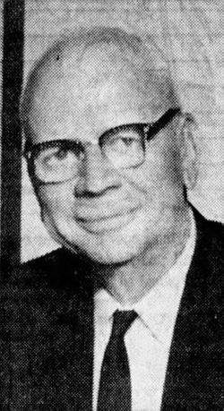
| Birth | : | 20 Nov 1871 Doniphan, Doniphan County, Kansas, USA |
| Death | : | 10 Nov 1953 Atchison, Atchison County, Kansas, USA |
| Burial | : | Marysville Cemetery, Marysville, Snohomish County, USA |
| Coordinate | : | 48.0769490, -122.1753960 |
| Description | : | Atchison Daily Globe, Atchison, Kansas on November 11, 1953, page one. A Prominent Farmer Dies Thomas Payton Armstrong, 81, a well known Atchison county farmer, died yesterday evening at his home, route 3, west of Atchison. He had been ill several weeks. Funeral services will be held Friday morning at 10:30 o'clock at the Presbyterian church with Rev. C. R. Dukelaw officiating. Burial will be in the Armstrong cemetery north of Atchison. The body will be taken from the Stanton Mortuary to the church to... Read More |
frequently asked questions (FAQ):
-
Where is Thomas Payton Armstrong's memorial?
Thomas Payton Armstrong's memorial is located at: Marysville Cemetery, Marysville, Snohomish County, USA.
-
When did Thomas Payton Armstrong death?
Thomas Payton Armstrong death on 10 Nov 1953 in Atchison, Atchison County, Kansas, USA
-
Where are the coordinates of the Thomas Payton Armstrong's memorial?
Latitude: 48.0769490
Longitude: -122.1753960
Family Members:
Parent
Spouse
Siblings
Children
Flowers:
Nearby Cemetories:
1. Marysville Cemetery
Marysville, Snohomish County, USA
Coordinate: 48.0769490, -122.1753960
2. Saint Marys Cemetery
Marysville, Snohomish County, USA
Coordinate: 48.0754690, -122.1749580
3. Priest Point Cemetery
Marysville, Snohomish County, USA
Coordinate: 48.0324170, -122.2329600
4. View Crest Abbey Mausoleum
Everett, Snohomish County, USA
Coordinate: 48.0107900, -122.1920900
5. Mission Beach Cemetery
Tulalip, Snohomish County, USA
Coordinate: 48.0498830, -122.2722540
6. Trinity Episcopal Church Columbarium
Everett, Snohomish County, USA
Coordinate: 47.9870700, -122.2094900
7. First Presbyterian Church Columbarium
Everett, Snohomish County, USA
Coordinate: 47.9784560, -122.2061570
8. Arlington Municipal Cemetery
Arlington, Snohomish County, USA
Coordinate: 48.1796989, -122.1417007
9. Mary J Clark Cemetery
Arlington, Snohomish County, USA
Coordinate: 48.1812030, -122.1179720
10. Evergreen Cemetery
Everett, Snohomish County, USA
Coordinate: 47.9603004, -122.2018967
11. Mount Carmel Cemetery
Snohomish County, USA
Coordinate: 47.9606018, -122.1231003
12. Jordan Cemetery
Jordan, Snohomish County, USA
Coordinate: 48.1372110, -122.0159630
13. Machias Community Cemetery
Machias, Snohomish County, USA
Coordinate: 47.9853730, -122.0485360
14. Our Saviors Lutheran Church Columbarium
Everett, Snohomish County, USA
Coordinate: 47.9573230, -122.2310650
15. Pioneer Cemetery
Arlington, Snohomish County, USA
Coordinate: 48.1979410, -122.1201930
16. American Legion Cemetery
Granite Falls, Snohomish County, USA
Coordinate: 48.0903015, -121.9803009
17. Valley View Cemetery
Stanwood, Snohomish County, USA
Coordinate: 48.1973500, -122.2694400
18. Zion Lutheran Cemetery
Stanwood, Snohomish County, USA
Coordinate: 48.2094350, -122.2460420
19. Saint Peter Lutheran Cemetery
Clinton, Island County, USA
Coordinate: 47.9815520, -122.3562140
20. Woodlawn Cemetery
Snohomish, Snohomish County, USA
Coordinate: 47.9233017, -122.1280975
21. Zion Lutheran Cemetery
Snohomish, Snohomish County, USA
Coordinate: 47.9244995, -122.1081009
22. Mukilteo Pioneer Cemetery
Snohomish County, USA
Coordinate: 47.9437780, -122.3072340
23. Cypress Lawn Memorial Park
Everett, Snohomish County, USA
Coordinate: 47.9178009, -122.2099991
24. Grand Army of the Republic Cemetery
Snohomish, Snohomish County, USA
Coordinate: 47.9202995, -122.1149979


