
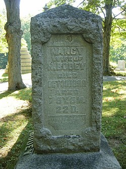
| Birth | : | 18 Jan 1828 Pennsylvania, USA |
| Death | : | 26 Nov 1900 Champaign County, Ohio, USA |
| Burial | : | Saint Agnes Cemetery, Vermillion, Clay County, USA |
| Coordinate | : | 42.7872009, -96.8499985 |
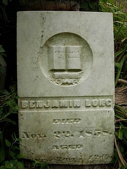
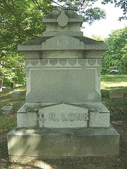
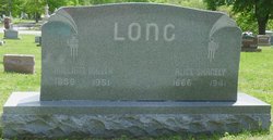
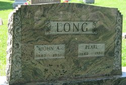
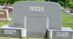
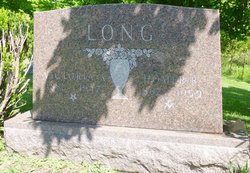
| Description | : | Champaign County Ohio Biographies THOMAS R LONG, farmer; P0 Millerstown; is a son of Benjamin and Nancy Long, both natives of Pennsylvania. She was born March 12, 1784, and he Aug 10, 1780. He was a carpenter by trade, and followed that occupation there till 1836, when he came to Ohio and purchased 60 acres of land in Sec 34 of Concord Township, Champaign Co. At this time already he was an old man, and did but little toward the improvement of his farm, but worked at the trade for a livelihood. He was the father of fourteen children; eleven of... Read More |
frequently asked questions (FAQ):
-
Where is Thomas Ratew Long's memorial?
Thomas Ratew Long's memorial is located at: Saint Agnes Cemetery, Vermillion, Clay County, USA.
-
When did Thomas Ratew Long death?
Thomas Ratew Long death on 26 Nov 1900 in Champaign County, Ohio, USA
-
Where are the coordinates of the Thomas Ratew Long's memorial?
Latitude: 42.7872009
Longitude: -96.8499985
Family Members:
Parent
Spouse
Siblings

Children
Flowers:


Nearby Cemetories:
1. Saint Agnes Cemetery
Vermillion, Clay County, USA
Coordinate: 42.7872009, -96.8499985
2. Dowlin Cemetery
Burbank, Clay County, USA
Coordinate: 42.7789001, -96.8107986
3. Bluff View Cemetery
Vermillion, Clay County, USA
Coordinate: 42.7714000, -96.9056000
4. Saint Agnes Calvary Cemetery
Vermillion, Clay County, USA
Coordinate: 42.7715900, -96.9072100
5. Ahlsborg Lutheran Cemetery
Union County, USA
Coordinate: 42.8228000, -96.7612000
6. Saint Peter Greenfield Cemetery
Vermillion, Clay County, USA
Coordinate: 42.8608017, -96.8644028
7. Saint Mary Cemetery
Union County, USA
Coordinate: 42.8520584, -96.7877502
8. Gibb's Cemetery
Newcastle, Dixon County, USA
Coordinate: 42.6985100, -96.8518400
9. Brule Creek Cemetery
Spink Township, Union County, USA
Coordinate: 42.8346510, -96.7324350
10. Ionia Cemetery
Newcastle, Dixon County, USA
Coordinate: 42.6893997, -96.8300018
11. First Brule Creek Cemetery
Elk Point, Union County, USA
Coordinate: 42.7943993, -96.7069016
12. Union County Poor Farm Cemetery
Union County, USA
Coordinate: 42.7649210, -96.7077580
13. Saint Paul Cemetery
Elk Point, Union County, USA
Coordinate: 42.7641983, -96.7061005
14. Clay Creek Cemetery
Clay County, USA
Coordinate: 42.8516998, -96.9788971
15. Pleasant Hill Cemetery Old
Spink, Union County, USA
Coordinate: 42.8588462, -96.7215592
16. Clay Point Cemetery
Prairie Center Township, Clay County, USA
Coordinate: 42.8987700, -96.9065600
17. Spirit Mound Cemetery
Clay County, USA
Coordinate: 42.8885994, -96.9424973
18. Newcastle Cemetery
Newcastle, Dixon County, USA
Coordinate: 42.6550500, -96.8708700
19. Saint Peters Calvary Cemetery
Newcastle, Dixon County, USA
Coordinate: 42.6533800, -96.8744700
20. Richland Cemetery
Richland, Union County, USA
Coordinate: 42.7682991, -96.6624985
21. Maskell Cemetery
Maskell, Dixon County, USA
Coordinate: 42.6878014, -96.9916992
22. Halverson Cemetery
Maskell, Dixon County, USA
Coordinate: 42.6908600, -97.0013500
23. Pleasant Hill Cemetery
Spink, Union County, USA
Coordinate: 42.8741000, -96.6876000
24. Rockfield Cemetery
Clay County, USA
Coordinate: 42.9397011, -96.8302994