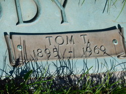
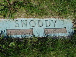
Thomas “Tom” Snoddy
| Birth | : | 2 Jul 1895 Bloomfield, Davis County, Iowa, USA |
| Death | : | 2 Feb 1969 Cedar Rapids, Linn County, Iowa, USA |
| Burial | : | Memorial Lawn Cemetery, Fairfield, Jefferson County, USA |
| Coordinate | : | 41.0068000, -91.9805000 |
| Plot | : | Devotion B 62- Space 1 |
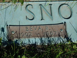
| Description | : | Note: this memorial updated August 9, 2016 and June 4, 2017: Further updated December 6, 2016 with this information received via a message: "Missouri, Marriage Records 1805-2002-- Thomas Snoddy and Rava (sic. Beva ??) were married March 26, 1920 in Schuyler Co. Missouri." ------------ Son of John Snoddy and Etta Raines (sic. a/k/a Rains) Snoddy It is being assumed that the original first given name was "Thomas", with 'Tom' used in the obituaries for he and his wife as a form of a nickname. Note: the DOB and name information for this memorial updated January 10, 2015 per edit request, but is revised on... Read More |
frequently asked questions (FAQ):
-
Where is Thomas “Tom” Snoddy's memorial?
Thomas “Tom” Snoddy's memorial is located at: Memorial Lawn Cemetery, Fairfield, Jefferson County, USA.
-
When did Thomas “Tom” Snoddy death?
Thomas “Tom” Snoddy death on 2 Feb 1969 in Cedar Rapids, Linn County, Iowa, USA
-
Where are the coordinates of the Thomas “Tom” Snoddy's memorial?
Latitude: 41.0068000
Longitude: -91.9805000
Family Members:
Parent
Spouse
Siblings
Flowers:
Nearby Cemetories:
1. Memorial Lawn Cemetery
Fairfield, Jefferson County, USA
Coordinate: 41.0068000, -91.9805000
2. Old Fairfield Cemetery
Fairfield, Jefferson County, USA
Coordinate: 41.0148000, -91.9598000
3. Evergreen Cemetery
Fairfield, Jefferson County, USA
Coordinate: 41.0138600, -91.9562100
4. Smith Family Cemetery
Libertyville, Jefferson County, USA
Coordinate: 40.9972416, -92.0362857
5. Roth Cemetery
Fairfield, Jefferson County, USA
Coordinate: 40.9589005, -91.9574966
6. Switzer Cemetery
Fairfield, Jefferson County, USA
Coordinate: 41.0368996, -91.9096985
7. Bradshaw Cemetery
Jefferson County, USA
Coordinate: 40.9766998, -91.9032974
8. Jefferson County Poor Farm Cemetery
Libertyville, Jefferson County, USA
Coordinate: 40.9416900, -91.9996200
9. Moorman Cemetery
Fairfield, Jefferson County, USA
Coordinate: 41.0452995, -92.0622025
10. Gregg Cemetery
Jefferson County, USA
Coordinate: 41.0078011, -92.0811005
11. Bethesda Cemetery
Fairfield, Jefferson County, USA
Coordinate: 41.0019000, -91.8796000
12. McCleary Cemetery
Jefferson County, USA
Coordinate: 40.9892006, -92.0805969
13. Cumberland Cemetery
Jefferson County, USA
Coordinate: 40.9248000, -91.9903000
14. Galliher Cemetery
Glasgow, Jefferson County, USA
Coordinate: 40.9666892, -91.8835038
15. Pattison Cemetery
Fairfield, Jefferson County, USA
Coordinate: 40.9444008, -91.9049988
16. Wheeler Cemetery
Jefferson County, USA
Coordinate: 41.0797000, -91.9185500
17. Brooks Cemetery
Jefferson County, USA
Coordinate: 41.0635986, -92.0693970
18. Koons Cemetery
Locust Grove Township, Jefferson County, USA
Coordinate: 41.0286410, -92.0948960
19. Morgan Burial Plot
Des Moines Township, Jefferson County, USA
Coordinate: 40.9837160, -92.0964340
20. Thompson Cemetery
Jefferson County, USA
Coordinate: 40.9155998, -91.9772034
21. Upper Richwoods Cemetery
Salina, Jefferson County, USA
Coordinate: 41.0602989, -91.8807983
22. Perlee Cemetery
Perlee, Jefferson County, USA
Coordinate: 41.0805750, -91.8993380
23. Wright Cemetery
Fairfield, Jefferson County, USA
Coordinate: 40.9524000, -91.8728000
24. Gantz Cemetery
Abingdon, Jefferson County, USA
Coordinate: 41.0464000, -92.1017000


