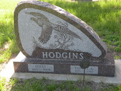
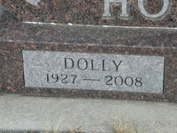
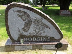
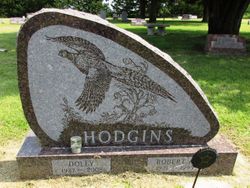
Ulla “Dolly” Halverson Hodgins
| Birth | : | 27 May 1927 Newman Grove, Madison County, Nebraska, USA |
| Death | : | 13 Jun 2008 Minnesota, USA |
| Burial | : | Sherwood Cemetery, Sherwood, Defiance County, USA |
| Coordinate | : | 41.2900009, -84.5507965 |
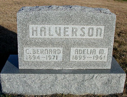
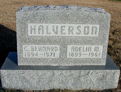
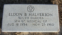
| Description | : | Dolly Hodgins, age 81, of Burnsville, Minnesota, died Friday, June 13, 2008, of chronic lymphocytic leukemia. Ulla "Dolly" (Halverson) Hodgins was born May 27, 1927, at Newman Grove, Nebraska, to Christian Bernard and Adelia M. (Powell) Halverson. She moved with her family to Gregory County, South Dakota, in 1929. She graduated from Bonesteel High School in 1945. On November 2, 1946, she married Robert A. Hodgins at Bonesteel, South Dakota. They lived in Bonesteel, Hill City, Watertown, and Pierre, before moving to Burnsville in 1973. Bob died June 13, 1995. Dolly's family was her passion, and favorite things in life included... Read More |
frequently asked questions (FAQ):
-
Where is Ulla “Dolly” Halverson Hodgins's memorial?
Ulla “Dolly” Halverson Hodgins's memorial is located at: Sherwood Cemetery, Sherwood, Defiance County, USA.
-
When did Ulla “Dolly” Halverson Hodgins death?
Ulla “Dolly” Halverson Hodgins death on 13 Jun 2008 in Minnesota, USA
-
Where are the coordinates of the Ulla “Dolly” Halverson Hodgins's memorial?
Latitude: 41.2900009
Longitude: -84.5507965
Family Members:
Parent
Spouse
Siblings
Flowers:
Nearby Cemetories:
1. Sherwood Cemetery
Sherwood, Defiance County, USA
Coordinate: 41.2900009, -84.5507965
2. Blair Cemetery
Sherwood, Defiance County, USA
Coordinate: 41.2677994, -84.5436020
3. Saint Stephens New Catholic Cemetery
The Bend, Defiance County, USA
Coordinate: 41.2820100, -84.5150800
4. Glore Cemetery
Sherwood, Defiance County, USA
Coordinate: 41.2639008, -84.5342026
5. Liggett Scouts Burial Ground
The Bend, Defiance County, USA
Coordinate: 41.2761100, -84.5154500
6. Shirley Family Cemetery
The Bend, Defiance County, USA
Coordinate: 41.2821360, -84.5071690
7. Blue Cemetery
The Bend, Defiance County, USA
Coordinate: 41.2871500, -84.5033200
8. Saint Johns Lutheran Cemetery
Sherwood, Defiance County, USA
Coordinate: 41.3092003, -84.5931015
9. Saint Stephens Old Cemetery
Defiance County, USA
Coordinate: 41.2747002, -84.4955978
10. Moats Cemetery
Defiance County, USA
Coordinate: 41.3330420, -84.5194530
11. Colby Cemetery
Defiance County, USA
Coordinate: 41.2532997, -84.5952988
12. Eaton Cemetery
Paulding County, USA
Coordinate: 41.2402992, -84.5783005
13. Funk Cemetery
Defiance County, USA
Coordinate: 41.3396988, -84.5164032
14. Auglaize Village Cemetery
Defiance, Defiance County, USA
Coordinate: 41.3399760, -84.5165610
15. Hill Cemetery
Sherwood, Defiance County, USA
Coordinate: 41.2824550, -84.4687870
16. Immaculate Conception Cemetery
Crane Township, Paulding County, USA
Coordinate: 41.2325500, -84.5905100
17. Rochester Cemetery
Cecil, Paulding County, USA
Coordinate: 41.2313995, -84.5914001
18. Tuttle Cemetery
Defiance, Defiance County, USA
Coordinate: 41.2756004, -84.4475021
19. Lintz Cemetery
Ney, Defiance County, USA
Coordinate: 41.3760986, -84.5402985
20. Renollet Cemetery
Paulding County, USA
Coordinate: 41.2122002, -84.5000000
21. Pioneer Cemetery
Defiance County, USA
Coordinate: 41.2641200, -84.4404200
22. Gordon Cemetery
Paulding County, USA
Coordinate: 41.2318993, -84.6433029
23. Blair-Adams Sun Valley Cemetery
Cecil, Paulding County, USA
Coordinate: 41.2177180, -84.4772200
24. Marysdale Immaculate Conception Catholic Cemetery
Ney, Defiance County, USA
Coordinate: 41.3499985, -84.4580994


