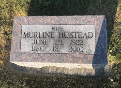
Verna Murline Meyer Hustead
| Birth | : | 23 Jun 1922 Gorin, Scotland County, Missouri, USA |
| Death | : | 12 Dec 2010 Memphis, Scotland County, Missouri, USA |
| Burial | : | Stone United Church Cemetery, Eramosa Township, Wellington County, Canada |
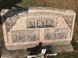
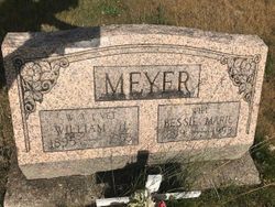
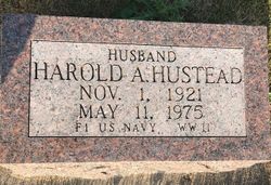
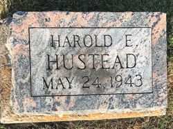
| Description | : | Verna Murline (Meyer) Hustead, 88, of Gorin, MO, died Sunday evening, December 12, 2010, at Scotland County Hospital in Memphis, MO. The daughter of Henry and Marie (Reed) Meyer, Murline was born on June 23, 1922. She was born and raised in Gorin, graduating with the Class of 1940. She operated the "Eureka Café" in Gorin for many years with her parents and sister. Murline married Harold Hustead. She and Harold lived in Gorin, except for a few years when they lived in Chicago, IL while he was in the United States Navy. They moved to Ft. Madison, IA when Harold was employed... Read More |
frequently asked questions (FAQ):
-
Where is Verna Murline Meyer Hustead's memorial?
Verna Murline Meyer Hustead's memorial is located at: Stone United Church Cemetery, Eramosa Township, Wellington County, Canada.
-
When did Verna Murline Meyer Hustead death?
Verna Murline Meyer Hustead death on 12 Dec 2010 in Memphis, Scotland County, Missouri, USA
Family Members:
Parent
Spouse
Children
Flowers:
Nearby Cemetories:
1. Maple View Mennonite Cemetery
Alma, Wellington County, Canada
2. Arkell United Church Cemetery
Arkell, Wellington County, Canada
Coordinate: 43.6863861, -80.5634460
3. Church of the Good Shepherd Cemetery
Arthur, Wellington County, Canada
Coordinate: 43.4236600, -80.1533300
4. Greenfield Cemetery
Arthur, Wellington County, Canada
Coordinate: 43.7525000, -80.6641670
5. Saint John the Evangelist Roman Catholic Cemetery
Arthur, Wellington County, Canada
Coordinate: 43.7651972, -80.6629083
6. Ballinafad Cemetery
Ballinafad, Wellington County, Canada
Coordinate: 43.7973382, -80.6375023
7. Mount Carmel Cemetery
Belwood, Wellington County, Canada
Coordinate: 43.5724940, -80.1523020
8. Bethel Pioneer Cemetery
Wellington County, Canada
Coordinate: 43.6720009, -80.5111160
9. Berea Mennonite Cemetery
Bosworth, Wellington County, Canada
Coordinate: 43.6876259, -80.4413986
10. Bloomsbury Methodist Cemetery
Centre Wellington Township, Wellington County, Canada
11. Mount Pleasant Cemetery
Centre Wellington Township, Wellington County, Canada
Coordinate: 43.6756940, -80.4300500
12. Coningsby Cemetery
Coningsby, Wellington County, Canada
Coordinate: 43.6868510, -80.4414870
13. Meadowside Mennonite
Conn, Wellington County, Canada
14. Creek Bank Mennonite Cemetery
Creek Bank, Wellington County, Canada
Coordinate: 43.6863861, -80.5634460
15. Sunset Mindepark
Crieff, Wellington County, Canada
Coordinate: 43.4236600, -80.1533300
16. Drayton Methodist Church and Cemetery
Drayton, Wellington County, Canada
Coordinate: 43.7525000, -80.6641670
17. Drayton Victoria Cemetery
Drayton, Wellington County, Canada
Coordinate: 43.7651972, -80.6629083
18. Zion United Church Cemetery
Drayton, Wellington County, Canada
Coordinate: 43.7973382, -80.6375023
19. Eden Mills Cemetery
Eden Mills, Wellington County, Canada
Coordinate: 43.5724940, -80.1523020
20. Bethel Mennonite Cemetery
Elora, Wellington County, Canada
Coordinate: 43.6720009, -80.5111160
21. Elora Cemetery
Elora, Wellington County, Canada
Coordinate: 43.6876259, -80.4413986
22. Municipal Cemetery
Elora, Wellington County, Canada
23. Saint John the Evangelist Anglican Cairn
Elora, Wellington County, Canada
Coordinate: 43.6756940, -80.4300500
24. St. Mary's Roman Catholic Cemetery
Elora, Wellington County, Canada
Coordinate: 43.6868510, -80.4414870

