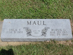
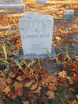
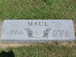
Vola Yolantha Clausen Maul Lamontagne
| Birth | : | 9 Jun 1920 Boelus, Howard County, Nebraska, USA |
| Death | : | 17 Jan 2010 Kearney, Buffalo County, Nebraska, USA |
| Burial | : | Aramoho Cemetery, Whanganui, Whanganui District, New Zealand |
| Coordinate | : | -39.8926494, 175.0922441 |
| Description | : | Vola Yolantha (Clausen) Maul Lamontagne, 89, of Miller, died Sunday, Jan. 17, 2010, in her sleep at St. Luke's Good Samaritan Village. She operated a dairy adjoining Fort Kearny on the Platte River for Ravenna cheese with her husband, the late Rufus Maul of Amherst, before running the bar/restaurant with him at Miller for 30 years. Vola is spoken of for her favorite recipe of hamburger soup, her love of music and her strong work ethic. She was fond of quoting homegrown sayings, helping neighbors, and there was a smile on her face up to the last day of her... Read More |
frequently asked questions (FAQ):
-
Where is Vola Yolantha Clausen Maul Lamontagne's memorial?
Vola Yolantha Clausen Maul Lamontagne's memorial is located at: Aramoho Cemetery, Whanganui, Whanganui District, New Zealand.
-
When did Vola Yolantha Clausen Maul Lamontagne death?
Vola Yolantha Clausen Maul Lamontagne death on 17 Jan 2010 in Kearney, Buffalo County, Nebraska, USA
-
Where are the coordinates of the Vola Yolantha Clausen Maul Lamontagne's memorial?
Latitude: -39.8926494
Longitude: 175.0922441
Family Members:
Parent
Spouse
Siblings
Children
Flowers:
Nearby Cemetories:
1. Aramoho Cemetery
Whanganui, Whanganui District, New Zealand
Coordinate: -39.8926494, 175.0922441
2. St. Mary's Anglican Church Cemetery
Upokongaro, Whanganui District, New Zealand
Coordinate: -39.8656100, 175.1132820
3. Heads Road Cemetery
Whanganui, Whanganui District, New Zealand
Coordinate: -39.9393300, 175.0473400
4. Putiki Urupā
Whanganui District, New Zealand
Coordinate: -39.9466140, 175.0499350
5. Matarawa Presbyterian Cemetery
Whanganui, Whanganui District, New Zealand
Coordinate: -39.9461300, 175.1433100
6. Matarawa Cemetery
Fordell, Whanganui District, New Zealand
Coordinate: -39.9468100, 175.1452700
7. Brunswick Cemetery
Brunswick, Whanganui District, New Zealand
Coordinate: -39.8417750, 175.0216400
8. Papanui Urupā
Kai Iwi, Whanganui District, New Zealand
Coordinate: -39.8435190, 174.9216230
9. Kauangaroa Pa Cemetery
Kauangaroa, Whanganui District, New Zealand
Coordinate: -39.9231800, 175.2788000
10. Ratana Cemetery
Ratana, Rangitikei District, New Zealand
Coordinate: -40.0311470, 175.1771200
11. Turakina Cemetery
Turakina, Rangitikei District, New Zealand
Coordinate: -40.0461300, 175.2140160
12. Turakina Catholic Cemetery
Turakina, Rangitikei District, New Zealand
Coordinate: -40.0453000, 175.2239600
13. Te Mangungu Churchyard
Turakina, Rangitikei District, New Zealand
Coordinate: -40.0633110, 175.1818200
14. Maxwell Cemetery
Whanganui, Whanganui District, New Zealand
Coordinate: -39.8224020, 174.8530960
15. Grant Family Makirikiri Cemetery
Turakina, Rangitikei District, New Zealand
Coordinate: -40.0625400, 175.2258200
16. Pakaraka Māori Cemetery
Maxwell, Whanganui District, New Zealand
Coordinate: -39.8226300, 174.8460700
17. Marshall Family Cemetery
Matahiwi, Whanganui District, New Zealand
Coordinate: -39.6757200, 175.1595964
18. Bonny Glen Cemetery
Marton, Rangitikei District, New Zealand
Coordinate: -40.0496200, 175.3410200
19. Upper Tutaenui Cemetery
Marton, Rangitikei District, New Zealand
Coordinate: -40.0086900, 175.4093900
20. Marton Lutheran Cemetery Tutaenui
Marton, Rangitikei District, New Zealand
Coordinate: -40.0772400, 175.3692700
21. St Stephens Anglican Cemetery
Marton, Rangitikei District, New Zealand
Coordinate: -40.0618230, 175.4258020
22. Mount View Cemetery
Marton, Rangitikei District, New Zealand
Coordinate: -40.0631570, 175.4252250
23. St John's Anglican Church Cemetery
Marton, Rangitikei District, New Zealand
Coordinate: -40.0298860, 175.4759430
24. Jerusalem - Hiruhārama Urupā
Jerusalem, Whanganui District, New Zealand
Coordinate: -39.5521740, 175.0788340


