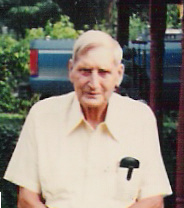
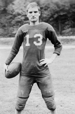
Weldon Monroe White
| Birth | : | 3 Jan 1915 Wharton, Boone County, West Virginia, USA |
| Death | : | 29 Dec 2008 Madison, Boone County, West Virginia, USA |
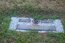
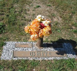
| Burial | : | Olive Branch Cemetery, White Cloud, Doniphan County, USA |
| Coordinate | : | 39.9729400, -95.3129400 |
| Description | : | Weldon M. White, better known as Buckshot passed away December 29, 2008, at Boone Memorial Hospital, Madison. He was a driller for many years by trade, with an accident on the job left him disabled for the rest of his life. He loved to fish and hunt, had won many prizes for his skills. He loved the mountains, he made weekly trips for roots to make his canes. His canes are all over the United State of over seas. Living on Madison Avenue, in Madison for most of his ilfe, he was known for his beautiful flowers he kept on his front porch... Read More |
frequently asked questions (FAQ):
-
Where is Weldon Monroe White's memorial?
Weldon Monroe White's memorial is located at: Olive Branch Cemetery, White Cloud, Doniphan County, USA.
-
When did Weldon Monroe White death?
Weldon Monroe White death on 29 Dec 2008 in Madison, Boone County, West Virginia, USA
-
Where are the coordinates of the Weldon Monroe White's memorial?
Latitude: 39.9729400
Longitude: -95.3129400
Family Members:
Parent
Spouse
Siblings
Flowers:
Nearby Cemetories:
1. Olive Branch Cemetery
White Cloud, Doniphan County, USA
Coordinate: 39.9729400, -95.3129400
2. Kelley Cemetery
White Cloud, Doniphan County, USA
Coordinate: 39.9797100, -95.3042800
3. Tesson Cemetery
Brown County, USA
Coordinate: 39.9763985, -95.3407974
4. Partlow Cemetery
Hiawatha, Brown County, USA
Coordinate: 39.9994011, -95.3602982
5. Collins Family Cemetery
White Cloud, Doniphan County, USA
Coordinate: 39.9221992, -95.2969284
6. Roy and Franklin Cemetery
Richardson County, USA
Coordinate: 40.0036011, -95.3878021
7. Franklin Cemetery
Rulo, Richardson County, USA
Coordinate: 40.0035000, -95.3884700
8. Campbell Cemetery
Reserve, Brown County, USA
Coordinate: 39.9905980, -95.3961750
9. Iowa Point Cemetery
Iowa Point, Doniphan County, USA
Coordinate: 39.9157982, -95.2275009
10. Kenyon Cemetery
Robinson, Brown County, USA
Coordinate: 39.9122000, -95.3964600
11. Walnut Grove Cemetery
Highland, Doniphan County, USA
Coordinate: 39.9000702, -95.2438736
12. Boyd Cemetery
Holt County, USA
Coordinate: 40.0466995, -95.2453003
13. Wilson Cemetery
Forest City, Holt County, USA
Coordinate: 40.0060997, -95.2027969
14. Tarkio Chapel Cemetery
Fortescue, Holt County, USA
Coordinate: 40.0659400, -95.3152200
15. Pleasant Hill Cemetery
Irving Township, Brown County, USA
Coordinate: 39.9435997, -95.4328232
16. Roderick Cemetery
Forest City, Holt County, USA
Coordinate: 40.0271988, -95.2071991
17. Union Cemetery
Forest City, Holt County, USA
Coordinate: 39.9872017, -95.1761017
18. Catron Cemetery
Fortescue, Holt County, USA
Coordinate: 40.0736300, -95.3629800
19. Laus Creek Cemetery
Reserve, Brown County, USA
Coordinate: 39.9754105, -95.4699936
20. Immaculate Conception Cemetery
Rulo, Richardson County, USA
Coordinate: 40.0480200, -95.4431800
21. Highland Cemetery
Highland, Doniphan County, USA
Coordinate: 39.8555984, -95.2514038
22. Sauer Cemetery
Bigelow, Holt County, USA
Coordinate: 40.1002100, -95.3339900
23. Benton Church Cemetery
Forest City, Holt County, USA
Coordinate: 40.0621430, -95.1918980
24. Rulo City Cemetery
Rulo, Richardson County, USA
Coordinate: 40.0561218, -95.4420471

