
| Birth | : | 26 Feb 1882 |
| Death | : | 12 May 1918 Clay County, Kansas, USA |
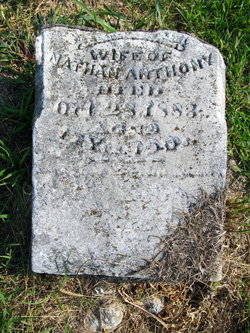
| Burial | : | Shields Cemetery, Clay County, USA |
| Coordinate | : | 39.3208008, -97.3507996 |
frequently asked questions (FAQ):
-
Where is William A Halbedel's memorial?
William A Halbedel's memorial is located at: Shields Cemetery, Clay County, USA.
-
When did William A Halbedel death?
William A Halbedel death on 12 May 1918 in Clay County, Kansas, USA
-
Where are the coordinates of the William A Halbedel's memorial?
Latitude: 39.3208008
Longitude: -97.3507996
Family Members:
Parent

Siblings
Flowers:


Nearby Cemetories:
1. Shields Cemetery
Clay County, USA
Coordinate: 39.3208008, -97.3507996
2. Table Mound Cemetery
Idana, Clay County, USA
Coordinate: 39.3141300, -97.2792300
3. Hebron Cemetery
Clay County, USA
Coordinate: 39.3213800, -97.2601400
4. Idana Cemetery
Idana, Clay County, USA
Coordinate: 39.3574500, -97.2693300
5. Miltonvale Cemetery
Miltonvale, Cloud County, USA
Coordinate: 39.3358002, -97.4447021
6. Smith Grave
Miltonvale, Cloud County, USA
Coordinate: 39.3645300, -97.4308700
7. Pleasant Valley Cemetery
Oak Hill, Clay County, USA
Coordinate: 39.2468987, -97.2889023
8. Mount Liberty Church Cemetery
Ottawa County, USA
Coordinate: 39.2489400, -97.4356200
9. Rose Meron Cemetery
Oak Hill, Clay County, USA
Coordinate: 39.2194700, -97.3338900
10. Lincoln Cemetery
Clay Center, Clay County, USA
Coordinate: 39.4230995, -97.2930984
11. Wesleyan Cemetery
Oak Hill, Clay County, USA
Coordinate: 39.2268982, -97.2572021
12. French Presbyterian Church Cemetery
Cloud County, USA
Coordinate: 39.4395200, -97.4148290
13. Iwacura Cemetery
Morganville, Clay County, USA
Coordinate: 39.4550000, -97.3510000
14. Pleasant Ridge Cemetery
Clay County, USA
Coordinate: 39.2789001, -97.1841965
15. Wilson Cemetery
Clay County, USA
Coordinate: 39.3800011, -97.1896973
16. Fairview Cemetery
Lamar, Ottawa County, USA
Coordinate: 39.2928009, -97.5299988
17. Bloom Cemetery
Morganville, Clay County, USA
Coordinate: 39.4519005, -97.2778015
18. Sulphur Springs Cemetery
Aurora, Cloud County, USA
Coordinate: 39.4086610, -97.4986840
19. Republican City Cemetery
Clay Center, Clay County, USA
Coordinate: 39.3431015, -97.1628036
20. Zion Lutheran Cemetery
Clay County, USA
Coordinate: 39.2928009, -97.1557999
21. Thomas Cemetery
Miltonvale, Cloud County, USA
Coordinate: 39.3300000, -97.5750000
22. Oakland Union Cemetery
Miltonvale, Cloud County, USA
Coordinate: 39.3647003, -97.5824966
23. Princeville Cemetery
Aurora, Cloud County, USA
Coordinate: 39.4672012, -97.5010986
24. Swartwood Cemetery
Longford, Clay County, USA
Coordinate: 39.1323200, -97.3431500