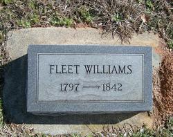
| Birth | : | 25 Jan 1813 |
| Death | : | 5 Mar 1905 |
| Burial | : | Randwick General Cemetery, South Coogee, Randwick City, Australia |
| Coordinate | : | -33.9295780, 151.2549810 |
| Description | : | Death of a Patriarch. Mr. William Ervin Williams - "Uncle Billie Ervin" - died at his home in east Monroe township early Sunday morning. He was 93 years old last September. He was one of the finest specimens of physical manhood that this section has ever seen, standing six feet two, large limbed and muscular. Possessed of an iron constitution, he scarcely knew what sickness was, and was hale and hearty until within a few months of his death. He was as robust a man morally as well as physically. He was a constant church goer, but never held membership in... Read More |
frequently asked questions (FAQ):
-
Where is William Ervin Williams's memorial?
William Ervin Williams's memorial is located at: Randwick General Cemetery, South Coogee, Randwick City, Australia.
-
When did William Ervin Williams death?
William Ervin Williams death on 5 Mar 1905 in
-
Where are the coordinates of the William Ervin Williams's memorial?
Latitude: -33.9295780
Longitude: 151.2549810
Family Members:
Parent
Spouse
Siblings
Children
Flowers:
Nearby Cemetories:
1. Randwick General Cemetery
South Coogee, Randwick City, Australia
Coordinate: -33.9295780, 151.2549810
2. Holy Trinity Church
Kingsford, Randwick City, Australia
Coordinate: -33.9267060, 151.2321180
3. Saint Jude's Cemetery
Randwick, Randwick City, Australia
Coordinate: -33.9115460, 151.2417130
4. Eastern Suburbs Memorial Park
Matraville, Randwick City, Australia
Coordinate: -33.9732410, 151.2297940
5. Botany Wesleyan Cemetery (Defunct)
Botany Bay, Bayside Council, Australia
Coordinate: -33.9421070, 151.1961480
6. Coast Hospital Cemetery
La Perouse, Randwick City, Australia
Coordinate: -33.9906780, 151.2503300
7. Botany Bay National Park
Sydney, City of Sydney, Australia
Coordinate: -33.9881750, 151.2321090
8. Devonshire Street Cemetery (Defunct)
Sydney, City of Sydney, Australia
Coordinate: -33.8828080, 151.2066180
9. St. Peters Cooks River Cemetery
Saint Peters, Inner West Council, Australia
Coordinate: -33.9139390, 151.1775670
10. Saint Mary's Cathedral
Sydney, City of Sydney, Australia
Coordinate: -33.8708540, 151.2135820
11. Old Sydney Burial Ground
Sydney, City of Sydney, Australia
Coordinate: -33.8731750, 151.2063850
12. Parish Church of Saint James
Sydney, City of Sydney, Australia
Coordinate: -33.8693760, 151.2111540
13. Camperdown Cemetery
Newtown, City of Sydney, Australia
Coordinate: -33.8942220, 151.1804900
14. Garden Island
Potts Point, City of Sydney, Australia
Coordinate: -33.8613635, 151.2280308
15. Royal Botanic Gardens
Sydney, City of Sydney, Australia
Coordinate: -33.8647440, 151.2170610
16. St Luke's Anglican Church
Enmore, Inner West Council, Australia
Coordinate: -33.8989218, 151.1700724
17. Rawson Park
Mosman, Mosman Municipality, Australia
Coordinate: -33.8350640, 151.2504980
18. Pioneers Memorial Park
Leichhardt, Inner West Council, Australia
Coordinate: -33.8780800, 151.1575000
19. St Thomas Becket Churchyard
Lewisham, Inner West Council, Australia
Coordinate: -33.8928760, 151.1480490
20. Balmain Catholic Cemetery (Defunct)
Leichhardt, Inner West Council, Australia
Coordinate: -33.8797270, 151.1523730
21. Rockdale Uniting Church Cemetery
Rockdale, Bayside Council, Australia
Coordinate: -33.9533350, 151.1381840
22. Mary MacKillop Memorial Chapel
North Sydney, North Sydney Council, Australia
Coordinate: -33.8388250, 151.2049160
23. St David’s Presbyterian Cemetery
Haberfield, Inner West Council, Australia
Coordinate: -33.8823220, 151.1378500
24. St. Paul's Anglican Church Cemetery
Canterbury, Canterbury-Bankstown Council, Australia
Coordinate: -33.9081600, 151.1236000


