
| Birth | : | 9 Dec 1876 Palmer, Washington County, Missouri, USA |
| Death | : | 20 Oct 1965 Shannon County, Missouri, USA |
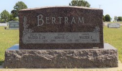
| Burial | : | Pleasant Grove Cemetery, Teresita, Shannon County, USA |
| Coordinate | : | 36.9742012, -91.6206970 |
| Inscription | : | Our Beloved Father |
| Description | : | William Joshua "Bunk" FARRAR married Caledonia "Callie" Dona KEY 25 December 1896 Shannon County, MO by his Uncle, the Rev. William BELEW husband of Emily Jane FARRAR, the younger sister of his father Joshua Kinworthy FARRAR |
frequently asked questions (FAQ):
-
Where is William Joshua “Bunk” Farrar's memorial?
William Joshua “Bunk” Farrar's memorial is located at: Pleasant Grove Cemetery, Teresita, Shannon County, USA.
-
When did William Joshua “Bunk” Farrar death?
William Joshua “Bunk” Farrar death on 20 Oct 1965 in Shannon County, Missouri, USA
-
Where are the coordinates of the William Joshua “Bunk” Farrar's memorial?
Latitude: 36.9742012
Longitude: -91.6206970
Family Members:
Parent

Spouse
Siblings
Children
Flowers:


Nearby Cemetories:
1. Pleasant Grove Cemetery
Teresita, Shannon County, USA
Coordinate: 36.9742012, -91.6206970
2. Montier Cemetery
Montier, Shannon County, USA
Coordinate: 36.9847984, -91.5754013
3. Pilgrim Rest Cemetery
Teresita, Shannon County, USA
Coordinate: 37.0189018, -91.6485977
4. New Salem Cemetery
Teresita, Shannon County, USA
Coordinate: 36.9239006, -91.6027985
5. Veterans Memorial Cemetery
Mountain View, Howell County, USA
Coordinate: 36.9975014, -91.6869965
6. Turkey Oak Cemetery
Montier, Shannon County, USA
Coordinate: 37.0203018, -91.5768967
7. Greenlawn Cemetery
Mountain View, Howell County, USA
Coordinate: 36.9975014, -91.6892014
8. Mountain View Cemetery
Mountain View, Howell County, USA
Coordinate: 36.9972992, -91.6904984
9. Chapel Hill Cemetery
Chapel, Howell County, USA
Coordinate: 36.9358290, -91.6826140
10. Dunkard Cemetery
Montier, Shannon County, USA
Coordinate: 37.0208015, -91.5580978
11. Corinth Cemetery
Birch Tree, Shannon County, USA
Coordinate: 36.9169998, -91.5661011
12. Saint John Vianney Catholic Cemetery
Mountain View, Howell County, USA
Coordinate: 37.0037498, -91.7072525
13. Padgett Cemetery
Mountain View, Howell County, USA
Coordinate: 36.9727173, -91.7155533
14. Old Baptist Cemetery
Birch Tree, Shannon County, USA
Coordinate: 36.9798775, -91.5186768
15. Brown-DePriest Cemetery
Birch Tree, Shannon County, USA
Coordinate: 36.9674988, -91.5000000
16. Bethlehem Cemetery
Thomasville, Oregon County, USA
Coordinate: 36.8861389, -91.5680008
17. Berea Mennonite Cemetery
Birch Tree, Shannon County, USA
Coordinate: 37.0246010, -91.5110016
18. Forest Dell Ebenezer Cemetery
Mountain View, Howell County, USA
Coordinate: 36.9328003, -91.7403030
19. Warm Corners Cemetery
Birch Tree, Shannon County, USA
Coordinate: 36.9653015, -91.4880981
20. Oak Forest Cemetery
Birch Tree, Shannon County, USA
Coordinate: 36.9818993, -91.4847031
21. Gill Cemetery
Mountain View, Howell County, USA
Coordinate: 37.0224991, -91.7500000
22. Center Hill Cemetery
Chapel, Howell County, USA
Coordinate: 36.9415016, -91.7610016
23. Ledbetter Cemetery
Spring Creek, Oregon County, USA
Coordinate: 36.8566080, -91.5501210
24. New Salem Cemetery
Mountain View, Howell County, USA
Coordinate: 37.0278015, -91.7727966