
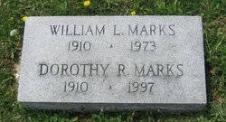
William Lawrence Marks Sr.
| Birth | : | 22 Jan 1910 Harrison County, Ohio, USA |
| Death | : | 1 May 1973 Washington, Daviess County, Indiana, USA |
| Burial | : | St Andrew Churchyard, South Stoke, South Oxfordshire District, England |
| Coordinate | : | 51.5479065, -1.1377167 |
| Plot | : | Section 10 |
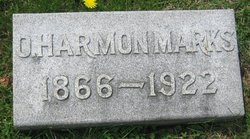
| Description | : | He was a Boy Scout Leader and was awarded the Golden Beaver, highest Scouting honor. Indiana, Death Certificates, 1899-2011 Name: William Lawrence Marks Sr Gender: Male Race: White Age: 63 Birth Date: 22 Jan 1910 Birth Place: Ohio Death Date: 1 May 1973 Death Place: Washington, Daviess, Indiana, USA Marital Status: Married Spouse: Dorothy Marks Father: Otto Harmon Marks Mother: Edith Cheeseman |
frequently asked questions (FAQ):
-
Where is William Lawrence Marks Sr.'s memorial?
William Lawrence Marks Sr.'s memorial is located at: St Andrew Churchyard, South Stoke, South Oxfordshire District, England.
-
When did William Lawrence Marks Sr. death?
William Lawrence Marks Sr. death on 1 May 1973 in Washington, Daviess County, Indiana, USA
-
Where are the coordinates of the William Lawrence Marks Sr.'s memorial?
Latitude: 51.5479065
Longitude: -1.1377167
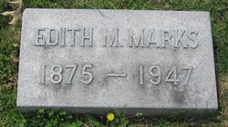
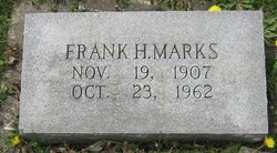
Family Members:
Parent
Spouse

Siblings
Flowers:


Nearby Cemetories:
1. St Andrew Churchyard
South Stoke, South Oxfordshire District, England
Coordinate: 51.5479065, -1.1377167
2. St John the Baptist
Moulsford, South Oxfordshire District, England
Coordinate: 51.5531050, -1.1482640
3. St. Mary Churchyard
Streatley, West Berkshire Unitary Authority, England
Coordinate: 51.5240170, -1.1449500
4. St. Mary's Churchyard
North Stoke, South Oxfordshire District, England
Coordinate: 51.5714910, -1.1228080
5. St. Thomas of Canterbury Churchyard
Goring, South Oxfordshire District, England
Coordinate: 51.5221440, -1.1399970
6. Whitehill Burial Ground
Goring, South Oxfordshire District, England
Coordinate: 51.5214730, -1.1180180
7. St. Mary's Churchyard
Cholsey, South Oxfordshire District, England
Coordinate: 51.5788078, -1.1589500
8. St. Mary the Virgin Cemetery
Ipsden, South Oxfordshire District, England
Coordinate: 51.5674164, -1.0866686
9. St. John the Baptist Church (Defunct)
Mongwell, South Oxfordshire District, England
Coordinate: 51.5860980, -1.1233580
10. St. Leonard's Churchyard
Woodcote, South Oxfordshire District, England
Coordinate: 51.5348117, -1.0731299
11. St Michael's Cemetery
Aston Tirrold, South Oxfordshire District, England
Coordinate: 51.5730994, -1.1967145
12. All Saints Churchyard
Aston Upthorpe, South Oxfordshire District, England
Coordinate: 51.5715900, -1.2037500
13. St. Leonard's Churchyard
Wallingford, South Oxfordshire District, England
Coordinate: 51.5972711, -1.1230712
14. St. John the Baptist South Moreton
South Moreton, South Oxfordshire District, England
Coordinate: 51.5881630, -1.1895850
15. St. Mary-le-More Churchyard
Wallingford, South Oxfordshire District, England
Coordinate: 51.5993878, -1.1249488
16. St Mary Magdalene Churchyard
Crowmarsh Gifford, South Oxfordshire District, England
Coordinate: 51.5992169, -1.1139564
17. Saint Peter's Churchyard
Wallingford, South Oxfordshire District, England
Coordinate: 51.6005819, -1.1215970
18. South Moreton Strict Baptist Chapel
South Moreton, South Oxfordshire District, England
Coordinate: 51.5900300, -1.1924310
19. All Hallows Graveyard
Wallingford, South Oxfordshire District, England
Coordinate: 51.6020520, -1.1242267
20. St. John the Baptist Churchyard
Whitchurch Hill, South Oxfordshire District, England
Coordinate: 51.5050469, -1.0824315
21. St. Mary the Virgin Churchyard
Aldworth, West Berkshire Unitary Authority, England
Coordinate: 51.5106800, -1.2030150
22. Checkendon Churchyard
Checkendon, South Oxfordshire District, England
Coordinate: 51.5424461, -1.0449720
23. Wallingford Cemetery
Wallingford, South Oxfordshire District, England
Coordinate: 51.6058200, -1.1232000
24. All Saints Churchyard
North Moreton, South Oxfordshire District, England
Coordinate: 51.6021922, -1.1898247