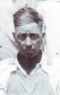
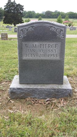
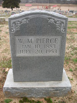
William Mathew Pierce
| Birth | : | 10 Jan 1883 Franklin County, Arkansas, USA |
| Death | : | 20 Jul 1953 Arkansas, USA |
| Burial | : | All Saints Churchyard, Biddenden, Ashford Borough, England |
| Coordinate | : | 51.1150740, 0.6403990 |
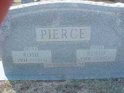
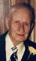
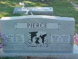
| Description | : | My great grandfather William Mathew Pierce son of Mathew Pierce and Matilda Williams. He married Minnie Elizabeth Rice on June 7, 1905 Franklin County, Arkansas. From this union eight children were born Isaac Pierce, Harvey Lee Pierce, Preston Pierce, Luvada Pierce, Ruby Mae Pierce, Garland D. Pierce, Cleveland B. Pierce and Regina Zola Pierce. Their children: Isaac Pierce buried in Vanndale Cemetery, Vanndale, Arkansas. He married 1st. Margaret L. Arnett. 2nd married Francis Williams. Burial of both wives not known. Harvey Lee Pierce married Opal Lois Andrews. Both buried in Vanndale Cemetery, Vanndale, Arkansas. Preston Pierce married Bell Zora Holland. Both buried in Vanndale... Read More |
frequently asked questions (FAQ):
-
Where is William Mathew Pierce's memorial?
William Mathew Pierce's memorial is located at: All Saints Churchyard, Biddenden, Ashford Borough, England.
-
When did William Mathew Pierce death?
William Mathew Pierce death on 20 Jul 1953 in Arkansas, USA
-
Where are the coordinates of the William Mathew Pierce's memorial?
Latitude: 51.1150740
Longitude: 0.6403990
Family Members:
Parent
Spouse
Siblings
Children
Flowers:
Nearby Cemetories:
1. All Saints Churchyard
Biddenden, Ashford Borough, England
Coordinate: 51.1150740, 0.6403990
2. Ebeneezer Chapel
Biddenden, Ashford Borough, England
Coordinate: 51.1383320, 0.6416030
3. St. Mary's Churchyard
Frittenden, Tunbridge Wells Borough, England
Coordinate: 51.1391190, 0.5904720
4. St. Michael and All Angels Churchyard
Tenterden, Ashford Borough, England
Coordinate: 51.0867424, 0.6894140
5. Frittenden Burial Gound
Frittenden, Tunbridge Wells Borough, England
Coordinate: 51.1428480, 0.5870820
6. St. Michael the Archangel Churchyard
Smarden, Ashford Borough, England
Coordinate: 51.1490030, 0.6861940
7. St. Mary the Virgin Churchyard
High Halden, Ashford Borough, England
Coordinate: 51.1028950, 0.7148620
8. Sissinghurst Cemetery
Sissinghurst, Tunbridge Wells Borough, England
Coordinate: 51.1095310, 0.5629240
9. Tenterden Cemetery
Tenterden, Ashford Borough, England
Coordinate: 51.0676820, 0.6737140
10. Headcorn Baptist Churchyard
Headcorn, Maidstone Borough, England
Coordinate: 51.1674156, 0.6247670
11. Headcorn Parish Burial Ground
Headcorn, Maidstone Borough, England
Coordinate: 51.1671257, 0.6204750
12. Unitarian Old Meeting House
Tenterden, Ashford Borough, England
Coordinate: 51.0717468, 0.6906880
13. Headcorn Methodist Churchyard
Headcorn, Maidstone Borough, England
Coordinate: 51.1674940, 0.6205670
14. Headcorn War Memorial
Headcorn, Maidstone Borough, England
Coordinate: 51.1677480, 0.6212560
15. St. Peter and St. Paul Churchyard
Headcorn, Maidstone Borough, England
Coordinate: 51.1678543, 0.6203760
16. Station Road Extension
Tenterden, Ashford Borough, England
Coordinate: 51.0686640, 0.6852830
17. St. Mildred's Churchyard
Tenterden, Ashford Borough, England
Coordinate: 51.0686264, 0.6870960
18. Cranbrook Cemetery
Cranbrook, Tunbridge Wells Borough, England
Coordinate: 51.0962250, 0.5541360
19. St. George Parish Churchyard
Benenden, Tunbridge Wells Borough, England
Coordinate: 51.0648720, 0.5794570
20. St. Mary the Virgin Churchyard
Rolvenden, Ashford Borough, England
Coordinate: 51.0506590, 0.6310280
21. St David's Bridge Strict Baptist Chapel
Cranbrook, Tunbridge Wells Borough, England
Coordinate: 51.0953430, 0.5378980
22. St Dunstan's Churchyard
Cranbrook, Tunbridge Wells Borough, England
Coordinate: 51.0973030, 0.5363690
23. All Saints Church
Staplehurst, Maidstone Borough, England
Coordinate: 51.1582160, 0.5527170
24. St. Margaret's Churchyard
Bethersden, Ashford Borough, England
Coordinate: 51.1291440, 0.7538760


