
| Birth | : | 18 Aug 1836 New York, USA |
| Death | : | 4 Aug 1903 Forest, Hardin County, Ohio, USA |
| Burial | : | All Saints, Welborne, South Norfolk District, England |
| Coordinate | : | 52.6496860, 1.0546670 |
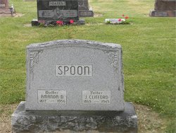
| Description | : | William was the son of Solomon Spoon & Hannah Cooney (Kuney). He married Mary Amanda Flack, 14 Apr 1862, Wyandot Co., OH. She died in 1882 and is buried at Wharton Cemetery in Wyandot Co. They had at least two children: Willie A. & John Clifford. William served during the Civil War in Co. I, 15th Ohio Volunteer Infantry. |
frequently asked questions (FAQ):
-
Where is William Spoon's memorial?
William Spoon's memorial is located at: All Saints, Welborne, South Norfolk District, England.
-
When did William Spoon death?
William Spoon death on 4 Aug 1903 in Forest, Hardin County, Ohio, USA
-
Where are the coordinates of the William Spoon's memorial?
Latitude: 52.6496860
Longitude: 1.0546670
Family Members:
Parent

Spouse
Siblings
Children
Flowers:


Nearby Cemetories:
1. All Saints, Welborne
South Norfolk District, England
Coordinate: 52.6496860, 1.0546670
2. All Saints Churchyard
Mattishall, Breckland Borough, England
Coordinate: 52.6498440, 1.0551390
3. All Saints' Churchyard
Mattishall, Breckland Borough, England
Coordinate: 52.6580670, 1.0346230
4. Mattishall cemetery
Mattishall, Breckland Borough, England
Coordinate: 52.6597100, 1.0353800
5. St Peter's Church Mattishall Burgh
Mattishall, Breckland Borough, England
Coordinate: 52.6647174, 1.0396513
6. All Saints Churchyard
East Tuddenham, Breckland Borough, England
Coordinate: 52.6602410, 1.0813620
7. St. Peter and St. Paul Churchyard
Barnham Broom, South Norfolk District, England
Coordinate: 52.6281830, 1.0749820
8. St. Mary's Churchyard
North Tuddenham, Breckland Borough, England
Coordinate: 52.6753000, 1.0389600
9. St. Michael's Churchyard
Hockering, Breckland Borough, England
Coordinate: 52.6771691, 1.0629078
10. All Saints Churchyard
Runhall, South Norfolk District, England
Coordinate: 52.6209876, 1.0390341
11. St. Andrew's Churchyard
Colton, South Norfolk District, England
Coordinate: 52.6407700, 1.1089300
12. St Botolphs
Barford, South Norfolk District, England
Coordinate: 52.6287000, 1.1118000
13. St Paul's Church Thuxton
Dereham, Breckland Borough, England
Coordinate: 52.6239060, 1.0013630
14. St Andrew's Churchyard
Honingham, Broadland District, England
Coordinate: 52.6573170, 1.1244600
15. St Mary's Churchyard
Carleton Forehoe, South Norfolk District, England
Coordinate: 52.6100400, 1.0847490
16. St. Margaret's Churchyard
Garvestone, Breckland Borough, England
Coordinate: 52.6264200, 0.9889550
17. St. George's Churchyard
Hardingham, Breckland Borough, England
Coordinate: 52.6058090, 1.0040050
18. St. Peter's Churchyard
Kimberley, South Norfolk District, England
Coordinate: 52.5958100, 1.0572070
19. St. Mary's Churchyard
Marlingford, South Norfolk District, England
Coordinate: 52.6310660, 1.1416800
20. St. Peter's Churchyard
Reymerston, Breckland Borough, England
Coordinate: 52.6144500, 0.9827500
21. St. Peter's Churchyard
Easton, South Norfolk District, England
Coordinate: 52.6543660, 1.1478070
22. Saint Mary the Virgin Churchyard
Elsing, Breckland Borough, England
Coordinate: 52.7076070, 1.0354460
23. All Saints Churchyard
Weston Longville, Broadland District, England
Coordinate: 52.6990630, 1.1257670
24. All Saints Churchyard
Weston Longville, Broadland District, England
Coordinate: 52.6993460, 1.1262510