
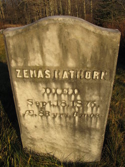

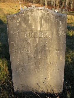
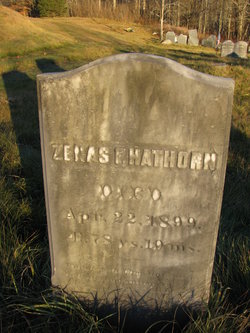
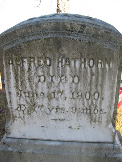
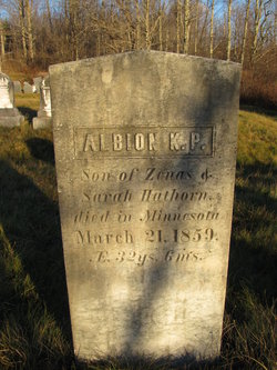
Zenas Hathorn
| Birth | : | 24 Mar 1792 Bowdoinham, Sagadahoc County, Maine, USA |
| Death | : | 18 Sep 1875 Athens, Somerset County, Maine, USA |
| Burial | : | St. Giles' Churchyard, Horspath, South Oxfordshire District, England |
| Coordinate | : | 51.7397190, -1.1738770 |
| Description | : | Occupation: Farmer |
frequently asked questions (FAQ):
-
Where is Zenas Hathorn's memorial?
Zenas Hathorn's memorial is located at: St. Giles' Churchyard, Horspath, South Oxfordshire District, England.
-
When did Zenas Hathorn death?
Zenas Hathorn death on 18 Sep 1875 in Athens, Somerset County, Maine, USA
-
Where are the coordinates of the Zenas Hathorn's memorial?
Latitude: 51.7397190
Longitude: -1.1738770
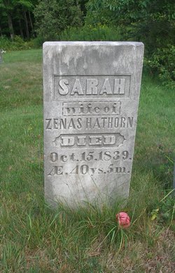
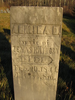
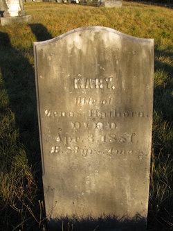
Family Members:
Spouse
Children
Flowers:


Nearby Cemetories:
1. St. Giles' Churchyard
Horspath, South Oxfordshire District, England
Coordinate: 51.7397190, -1.1738770
2. Wheatley War Memorial
Wheatley, South Oxfordshire District, England
Coordinate: 51.7468630, -1.1388780
3. Holy Trinity Churchyard
Headington, City of Oxford, England
Coordinate: 51.7577500, -1.1979980
4. St Mary the Virgin Churchyard
Wheatley, South Oxfordshire District, England
Coordinate: 51.7476020, -1.1366080
5. Cornerstone Church Cemetery
Headington, City of Oxford, England
Coordinate: 51.7587275, -1.1995588
6. St. Aldate's Churchyard
Oxford, City of Oxford, England
Coordinate: 51.7497900, -1.2118500
7. St. Nicholas' Church
Forest Hill, South Oxfordshire District, England
Coordinate: 51.7641400, -1.1567200
8. Forest Hill Church Cemetery
Forest Hill, South Oxfordshire District, England
Coordinate: 51.7641700, -1.1567100
9. Saint Mary's Churchyard
Garsington, South Oxfordshire District, England
Coordinate: 51.7140100, -1.1600700
10. St. James Churchyard
Cowley, City of Oxford, England
Coordinate: 51.7305878, -1.2202638
11. All Saints Churchyard
Cuddesdon, South Oxfordshire District, England
Coordinate: 51.7230140, -1.1316130
12. Rose Hill Cemetery
Oxford, City of Oxford, England
Coordinate: 51.7320960, -1.2254070
13. The Priory
Headington, City of Oxford, England
Coordinate: 51.7638260, -1.2108100
14. St Bartholomew Churchyard
Holton, South Oxfordshire District, England
Coordinate: 51.7529490, -1.1246510
15. Oxford Crematorium
Headington, City of Oxford, England
Coordinate: 51.7719240, -1.1904020
16. St Andrew Churchyard
Headington, City of Oxford, England
Coordinate: 51.7647100, -1.2121400
17. St Lawrence Churchyard
Toot Baldon, South Oxfordshire District, England
Coordinate: 51.7051720, -1.1750220
18. St Mary and St Nicholas Churchyard
Littlemore, City of Oxford, England
Coordinate: 51.7210753, -1.2232272
19. St Mary and St John Church
Oxford, City of Oxford, England
Coordinate: 51.7452501, -1.2314021
20. Littlemore Chapel
Littlemore, City of Oxford, England
Coordinate: 51.7208320, -1.2270330
21. Headington Cemetery
Headington, City of Oxford, England
Coordinate: 51.7668050, -1.2179280
22. Saint John the Baptist
Stanton St John, South Oxfordshire District, England
Coordinate: 51.7800350, -1.1642830
23. St. Clements Churchyard
Oxford, City of Oxford, England
Coordinate: 51.7527790, -1.2369920
24. Greyfriars
Oxford, City of Oxford, England
Coordinate: 51.7437920, -1.2401460