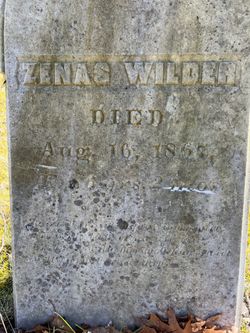
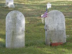
Zenas Wilder Jr.
| Birth | : | 28 Jun 1781 Hingham, Plymouth County, Massachusetts, USA |
| Death | : | 16 Aug 1867 Dennysville, Washington County, Maine, USA |
| Burial | : | Saint Andrews Church Cemetery, LeRoy, Dodge County, USA |
| Coordinate | : | 43.5732994, -88.5500336 |
| Description | : | Zenas WILDER Born: 28 Jun 1781 Hingham, Plymouth, Ma Died: 16 Aug 1867 Dennysville, Washington, Me Married: Abt 1805 Father: Zenas WILDER Mother: Bathsheba WILDER Wife's Name Hannah CLARK Born: 10 Jun 1780 Hingham, Plymouth, Ma Died: 6 Mar 1874 Dennysville, Washington, Me Married: 1805 Children 1. Isaac... Read More |
frequently asked questions (FAQ):
-
Where is Zenas Wilder Jr.'s memorial?
Zenas Wilder Jr.'s memorial is located at: Saint Andrews Church Cemetery, LeRoy, Dodge County, USA.
-
When did Zenas Wilder Jr. death?
Zenas Wilder Jr. death on 16 Aug 1867 in Dennysville, Washington County, Maine, USA
-
Where are the coordinates of the Zenas Wilder Jr.'s memorial?
Latitude: 43.5732994
Longitude: -88.5500336
Family Members:
Spouse
Children
Flowers:
Left by Anonymous on 20 Sep 2017

Left by Anonymous on 09 Sep 2010
Left by Anonymous on 01 Oct 2018

The Zenus Wilder that was the father of Piam was alive in the 1860 Census
Left by Anonymous on 24 Apr 2016
Zenas is to me; 1st cousin 4x removed of wife of 2nd cousin 3x removed
Left by Anonymous on 03 Oct 2018
Left by Anonymous on 22 Jun 2022
Nearby Cemetories:
1. Saint Andrews Church Cemetery
LeRoy, Dodge County, USA
Coordinate: 43.5732994, -88.5500336
2. Tidyman Cemetery
LeRoy, Dodge County, USA
Coordinate: 43.5482370, -88.5810470
3. Saint Luke Evangelical Lutheran Church Cemetery
Knowles, Dodge County, USA
Coordinate: 43.5718720, -88.5016540
4. Saint Paul Cemetery
Kekoskee, Dodge County, USA
Coordinate: 43.5455310, -88.5809180
5. Emanuel Cemetery
Knowles, Dodge County, USA
Coordinate: 43.5877991, -88.4997025
6. Brownsville Community Cemetery
Brownsville, Dodge County, USA
Coordinate: 43.5995380, -88.5053440
7. Mount Pleasant Cemetery
LeRoy, Dodge County, USA
Coordinate: 43.6167800, -88.5263000
8. Kekoskee Cemetery
Kekoskee, Dodge County, USA
Coordinate: 43.5263390, -88.5612850
9. Miles Farm Cemetery
LeRoy, Dodge County, USA
Coordinate: 43.6251880, -88.5917650
10. Saint Pauls Evangelical Lutheran Cemetery
Brownsville, Dodge County, USA
Coordinate: 43.6167200, -88.4889100
11. Saint Peters Cemetery
Theresa, Dodge County, USA
Coordinate: 43.5367012, -88.4794006
12. Mount Pleasant Cemetery
Oakfield, Fond du Lac County, USA
Coordinate: 43.6391983, -88.5460968
13. Saint Marys Cemetery
Lomira, Dodge County, USA
Coordinate: 43.5903015, -88.4518967
14. Saint Johns Lutheran Cemetery
Lomira, Dodge County, USA
Coordinate: 43.5877266, -88.4469833
15. Salem Cemetery
Lomira, Dodge County, USA
Coordinate: 43.5872530, -88.4463790
16. Saint Gobki Cemetery
Theresa, Dodge County, USA
Coordinate: 43.5144005, -88.4803009
17. Old Saint Marys Catholic Cemetery
Mayville, Dodge County, USA
Coordinate: 43.4935200, -88.5394100
18. Saint Pauls Evangelical Lutheran Cemetery
Lomira, Dodge County, USA
Coordinate: 43.5510050, -88.4430740
19. Old Community Cemetery
Lomira, Dodge County, USA
Coordinate: 43.6086590, -88.4499060
20. Oak Center Cemetery
Oak Center, Fond du Lac County, USA
Coordinate: 43.6466600, -88.6009400
21. Graceland Cemetery
Mayville, Dodge County, USA
Coordinate: 43.4900818, -88.5464325
22. Saint Pauls Cemetery
Theresa, Dodge County, USA
Coordinate: 43.4935989, -88.5141983
23. Saint Johns Cemetery
Mayville, Dodge County, USA
Coordinate: 43.4880500, -88.5473200
24. Union Cemetery
Theresa, Dodge County, USA
Coordinate: 43.5261002, -88.4514008


