
| Memorials | : | 0 |
| Location | : | Louisville, Jefferson County, USA |
| Coordinate | : | 38.2097080, -85.7392200 |
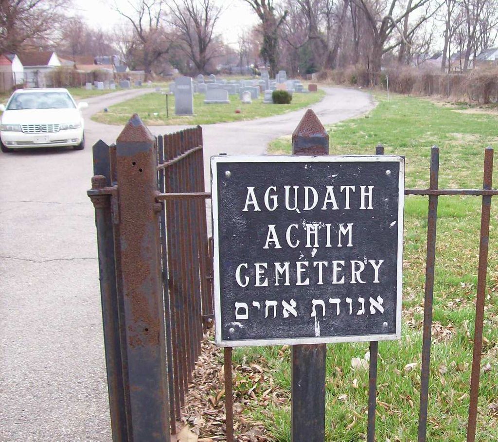
| Description | : | Agudath Achim was founded by Orthodox Jewish families living in Louisville's west end, who felt that the other synagogues were too far to walk on holy days. The congregation met for many years in homes and rented spaces before finally acquiring its own synagogue. With more Jewish families leaving downtown and moving to east Louisville, and with its synagogue taken for urban renewal, Agudath Achim did not have the resources to remain a separate congregation. In 1971, it merged with Anshei Sfard. Four of the five Jewish cemeteries in Louisville are in what is basically a cemetery complex off... Read More |
frequently asked questions (FAQ):
-
Where is Agudath Achim Cemetery?
Agudath Achim Cemetery is located at Louisville, Jefferson County ,Kentucky ,USA.
-
Agudath Achim Cemetery cemetery's updated grave count on graveviews.com?
0 memorials
-
Where are the coordinates of the Agudath Achim Cemetery?
Latitude: 38.2097080
Longitude: -85.7392200
Nearby Cemetories:
1. Adath Jeshurun Cemetery
Louisville, Jefferson County, USA
Coordinate: 38.2075500, -85.7381470
2. Keneseth Israel Cemetery
Louisville, Jefferson County, USA
Coordinate: 38.2070250, -85.7397510
3. Anshei Sfard Cemetery
Louisville, Jefferson County, USA
Coordinate: 38.2070420, -85.7413660
4. Mulberry Hill Cemetery
Louisville, Jefferson County, USA
Coordinate: 38.2139200, -85.7289130
5. Clark Cemetery
Parkway Village, Jefferson County, USA
Coordinate: 38.2139015, -85.7285995
6. Oldham Family Cemetery
Louisville, Jefferson County, USA
Coordinate: 38.1985870, -85.7459520
7. Louisville Cemetery
Louisville, Jefferson County, USA
Coordinate: 38.2226905, -85.7276820
8. Louisville Crematorium Custodial Storage
Louisville, Jefferson County, USA
Coordinate: 38.2149200, -85.7583300
9. Louis D. Brandeis School of Law
Louisville, Jefferson County, USA
Coordinate: 38.2155450, -85.7608910
10. Fort George Cemetery
Louisville, Jefferson County, USA
Coordinate: 38.2320530, -85.7522260
11. Prather Cemetery
Louisville, Jefferson County, USA
Coordinate: 38.2096570, -85.7075220
12. Churchill Downs Derby Museum Garden
Louisville, Jefferson County, USA
Coordinate: 38.2052820, -85.7705320
13. Calvary Cemetery
Louisville, Jefferson County, USA
Coordinate: 38.2256300, -85.7134700
14. Phillips-Durrett-Clark Cemetery
Louisville, Jefferson County, USA
Coordinate: 38.2052780, -85.7052780
15. Evergreen Cemetery
Louisville, Jefferson County, USA
Coordinate: 38.1828003, -85.7142029
16. First Unitarian Memorial Garden
Louisville, Jefferson County, USA
Coordinate: 38.2437920, -85.7583330
17. Calvary Episcopal Church Burial Grounds
Louisville, Jefferson County, USA
Coordinate: 38.2437866, -85.7593283
18. Eastern Cemetery
Louisville, Jefferson County, USA
Coordinate: 38.2470500, -85.7249100
19. Cave Hill Cemetery
Louisville, Jefferson County, USA
Coordinate: 38.2453600, -85.7146400
20. Cave Hill National Cemetery
Louisville, Jefferson County, USA
Coordinate: 38.2483800, -85.7196000
21. Beverly Ebbs Burial Site
Louisville, Jefferson County, USA
Coordinate: 38.1774980, -85.7762830
22. Cathedral of the Assumption
Louisville, Jefferson County, USA
Coordinate: 38.2525680, -85.7588370
23. Doup Family Cemetery
Louisville, Jefferson County, USA
Coordinate: 38.2211500, -85.6821200
24. Hackberry Cemetery
Louisville, Jefferson County, USA
Coordinate: 38.2514500, -85.7032170