
| Memorials | : | 0 |
| Location | : | Louisville, Jefferson County, USA |
| Coordinate | : | 38.2514500, -85.7032170 |
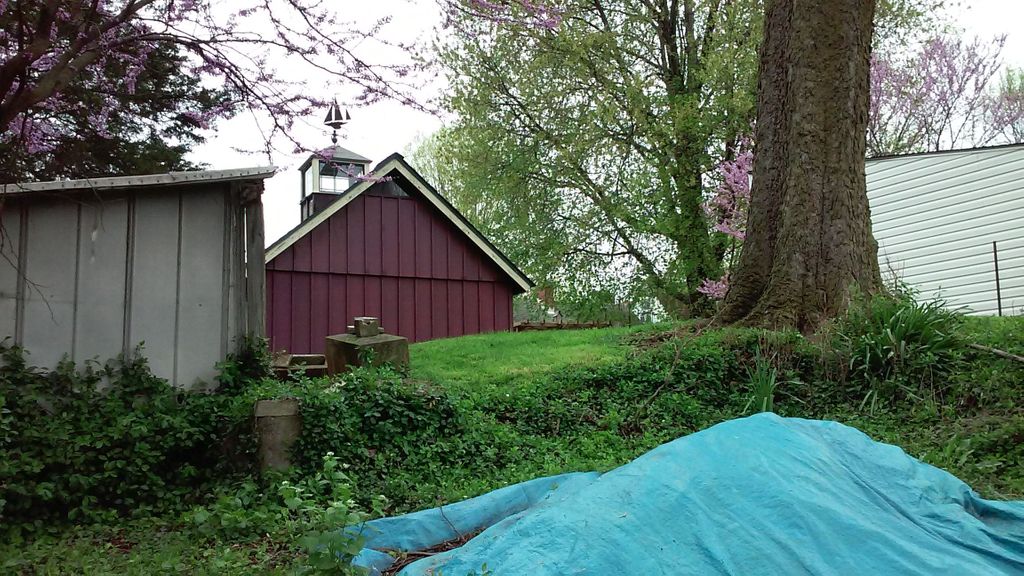
| Description | : | Louisville Metro Government has the cemetery listed as the Hackberry Cemetery, but it is listed in a book as the Stock Cemetery. It is located in the back of a house on Saunders Street, so it is actually accessed from Jane Street. Philip Stock was listed in the 1850 census as Philip Stouch or Stouck (born in Germany around 1809). His wife was Elizabeth (born in Germany around 1810), and their children were Philip (born around 1838), Magdalena (born around 1840), Frederick (born around 1844), and Jacob (born around 1848). According to the book, the Stock Cemetery was located in... Read More |
frequently asked questions (FAQ):
-
Where is Hackberry Cemetery?
Hackberry Cemetery is located at Jane Street/Saunders Avenue Louisville, Jefferson County ,Kentucky , 40206USA.
-
Hackberry Cemetery cemetery's updated grave count on graveviews.com?
0 memorials
-
Where are the coordinates of the Hackberry Cemetery?
Latitude: 38.2514500
Longitude: -85.7032170
Nearby Cemetories:
1. Cave Hill Cemetery
Louisville, Jefferson County, USA
Coordinate: 38.2453600, -85.7146400
2. Cave Hill National Cemetery
Louisville, Jefferson County, USA
Coordinate: 38.2483800, -85.7196000
3. Eastern Cemetery
Louisville, Jefferson County, USA
Coordinate: 38.2470500, -85.7249100
4. Louisville Presbyterian Seminary Memorial Garden
Louisville, Jefferson County, USA
Coordinate: 38.2387380, -85.6861190
5. Calvary Cemetery
Louisville, Jefferson County, USA
Coordinate: 38.2256300, -85.7134700
6. Civil War Cemetery #2
Jeffersonville, Clark County, USA
Coordinate: 38.2818400, -85.7206700
7. Arterburn Cemetery
Saint Matthews, Jefferson County, USA
Coordinate: 38.2552000, -85.6609900
8. Doup Family Cemetery
Louisville, Jefferson County, USA
Coordinate: 38.2211500, -85.6821200
9. Louisville Cemetery
Louisville, Jefferson County, USA
Coordinate: 38.2226905, -85.7276820
10. Civil War Cemetery #3
Jeffersonville, Clark County, USA
Coordinate: 38.2848790, -85.7217790
11. Old City Cemetery
Jeffersonville, Clark County, USA
Coordinate: 38.2706220, -85.7429770
12. Civil War Cemetery
Jeffersonville, Clark County, USA
Coordinate: 38.2705400, -85.7436300
13. Eastern Cemetery
Jeffersonville, Clark County, USA
Coordinate: 38.2832985, -85.7292023
14. Saint Anthony Cemetery
Jeffersonville, Clark County, USA
Coordinate: 38.2844009, -85.7281036
15. Prather Cemetery
Louisville, Jefferson County, USA
Coordinate: 38.2096570, -85.7075220
16. Clark Cemetery
Parkway Village, Jefferson County, USA
Coordinate: 38.2139015, -85.7285995
17. Mulberry Hill Cemetery
Louisville, Jefferson County, USA
Coordinate: 38.2139200, -85.7289130
18. Fort George Cemetery
Louisville, Jefferson County, USA
Coordinate: 38.2320530, -85.7522260
19. Cathedral of the Assumption
Louisville, Jefferson County, USA
Coordinate: 38.2525680, -85.7588370
20. First Unitarian Memorial Garden
Louisville, Jefferson County, USA
Coordinate: 38.2437920, -85.7583330
21. Calvary Episcopal Church Burial Grounds
Louisville, Jefferson County, USA
Coordinate: 38.2437866, -85.7593283
22. Parks Cemetery
Plymouth Village, Jefferson County, USA
Coordinate: 38.2377280, -85.6486690
23. Floyd-Breckinridge Cemetery
Plymouth Village, Jefferson County, USA
Coordinate: 38.2366982, -85.6489029
24. Phillips-Durrett-Clark Cemetery
Louisville, Jefferson County, USA
Coordinate: 38.2052780, -85.7052780