
| Memorials | : | 0 |
| Location | : | Louisville, Jefferson County, USA |
| Coordinate | : | 38.2139200, -85.7289130 |
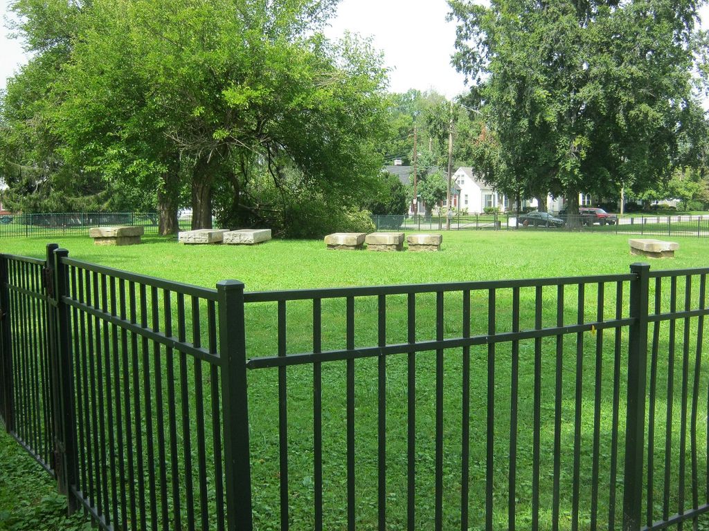
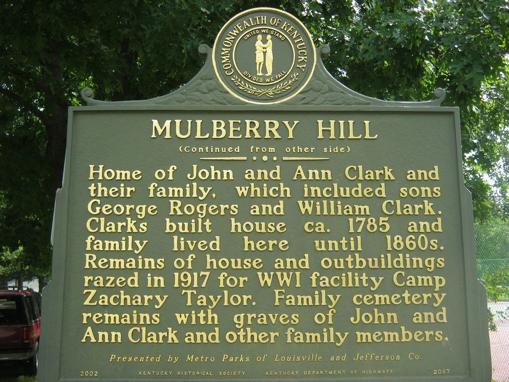
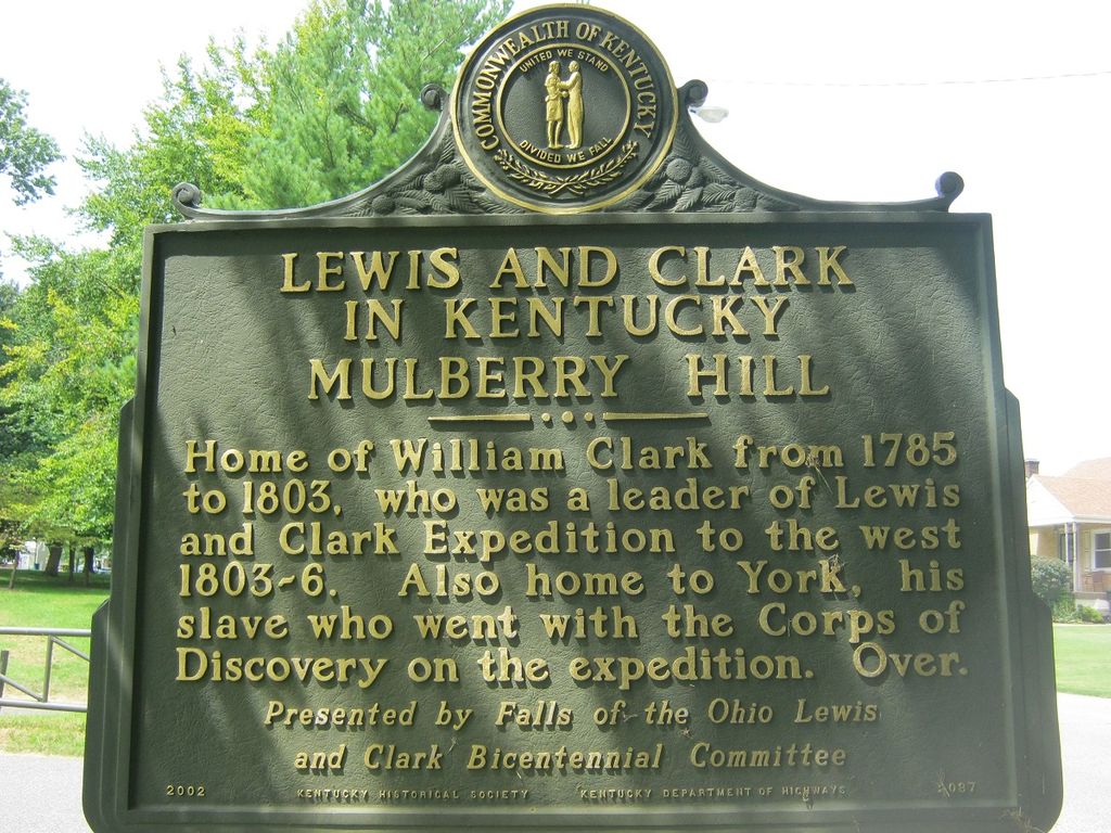
| Description | : | The cemetery is in the back of George Rogers Clark Park. From Poplar Level Road, turn onto Thruston Drive, then left onto Filson Avenue. The cemetery is in the park, at the end of Filson Avenue. It is surrounded by a black iron fence. |
frequently asked questions (FAQ):
-
Where is Mulberry Hill Cemetery?
Mulberry Hill Cemetery is located at 1024 Thruston Avenue Louisville, Jefferson County ,Kentucky , 40217USA.
-
Mulberry Hill Cemetery cemetery's updated grave count on graveviews.com?
0 memorials
-
Where are the coordinates of the Mulberry Hill Cemetery?
Latitude: 38.2139200
Longitude: -85.7289130
Nearby Cemetories:
1. Clark Cemetery
Parkway Village, Jefferson County, USA
Coordinate: 38.2139015, -85.7285995
2. Louisville Cemetery
Louisville, Jefferson County, USA
Coordinate: 38.2226905, -85.7276820
3. Agudath Achim Cemetery
Louisville, Jefferson County, USA
Coordinate: 38.2097080, -85.7392200
4. Adath Jeshurun Cemetery
Louisville, Jefferson County, USA
Coordinate: 38.2075500, -85.7381470
5. Keneseth Israel Cemetery
Louisville, Jefferson County, USA
Coordinate: 38.2070250, -85.7397510
6. Anshei Sfard Cemetery
Louisville, Jefferson County, USA
Coordinate: 38.2070420, -85.7413660
7. Calvary Cemetery
Louisville, Jefferson County, USA
Coordinate: 38.2256300, -85.7134700
8. Prather Cemetery
Louisville, Jefferson County, USA
Coordinate: 38.2096570, -85.7075220
9. Oldham Family Cemetery
Louisville, Jefferson County, USA
Coordinate: 38.1985870, -85.7459520
10. Phillips-Durrett-Clark Cemetery
Louisville, Jefferson County, USA
Coordinate: 38.2052780, -85.7052780
11. Louisville Crematorium Custodial Storage
Louisville, Jefferson County, USA
Coordinate: 38.2149200, -85.7583300
12. Louis D. Brandeis School of Law
Louisville, Jefferson County, USA
Coordinate: 38.2155450, -85.7608910
13. Fort George Cemetery
Louisville, Jefferson County, USA
Coordinate: 38.2320530, -85.7522260
14. Evergreen Cemetery
Louisville, Jefferson County, USA
Coordinate: 38.1828003, -85.7142029
15. Eastern Cemetery
Louisville, Jefferson County, USA
Coordinate: 38.2470500, -85.7249100
16. Cave Hill Cemetery
Louisville, Jefferson County, USA
Coordinate: 38.2453600, -85.7146400
17. Churchill Downs Derby Museum Garden
Louisville, Jefferson County, USA
Coordinate: 38.2052820, -85.7705320
18. Cave Hill National Cemetery
Louisville, Jefferson County, USA
Coordinate: 38.2483800, -85.7196000
19. Doup Family Cemetery
Louisville, Jefferson County, USA
Coordinate: 38.2211500, -85.6821200
20. First Unitarian Memorial Garden
Louisville, Jefferson County, USA
Coordinate: 38.2437920, -85.7583330
21. Calvary Episcopal Church Burial Grounds
Louisville, Jefferson County, USA
Coordinate: 38.2437866, -85.7593283
22. Louisville Presbyterian Seminary Memorial Garden
Louisville, Jefferson County, USA
Coordinate: 38.2387380, -85.6861190
23. Hackberry Cemetery
Louisville, Jefferson County, USA
Coordinate: 38.2514500, -85.7032170
24. Cathedral of the Assumption
Louisville, Jefferson County, USA
Coordinate: 38.2525680, -85.7588370