
| Memorials | : | 158 |
| Location | : | Heathfield, Wealden District, England |
| Coordinate | : | 50.9599190, 0.2748190 |
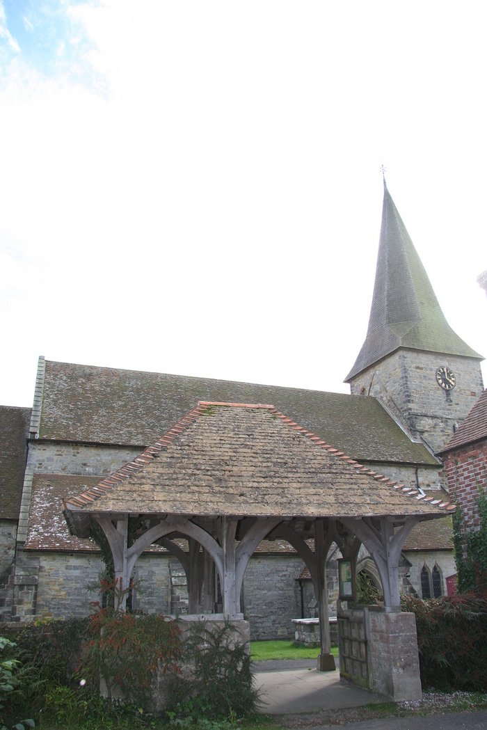
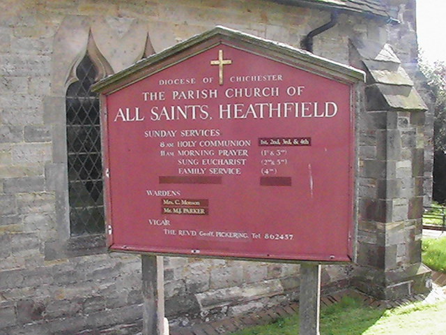
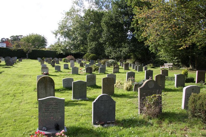
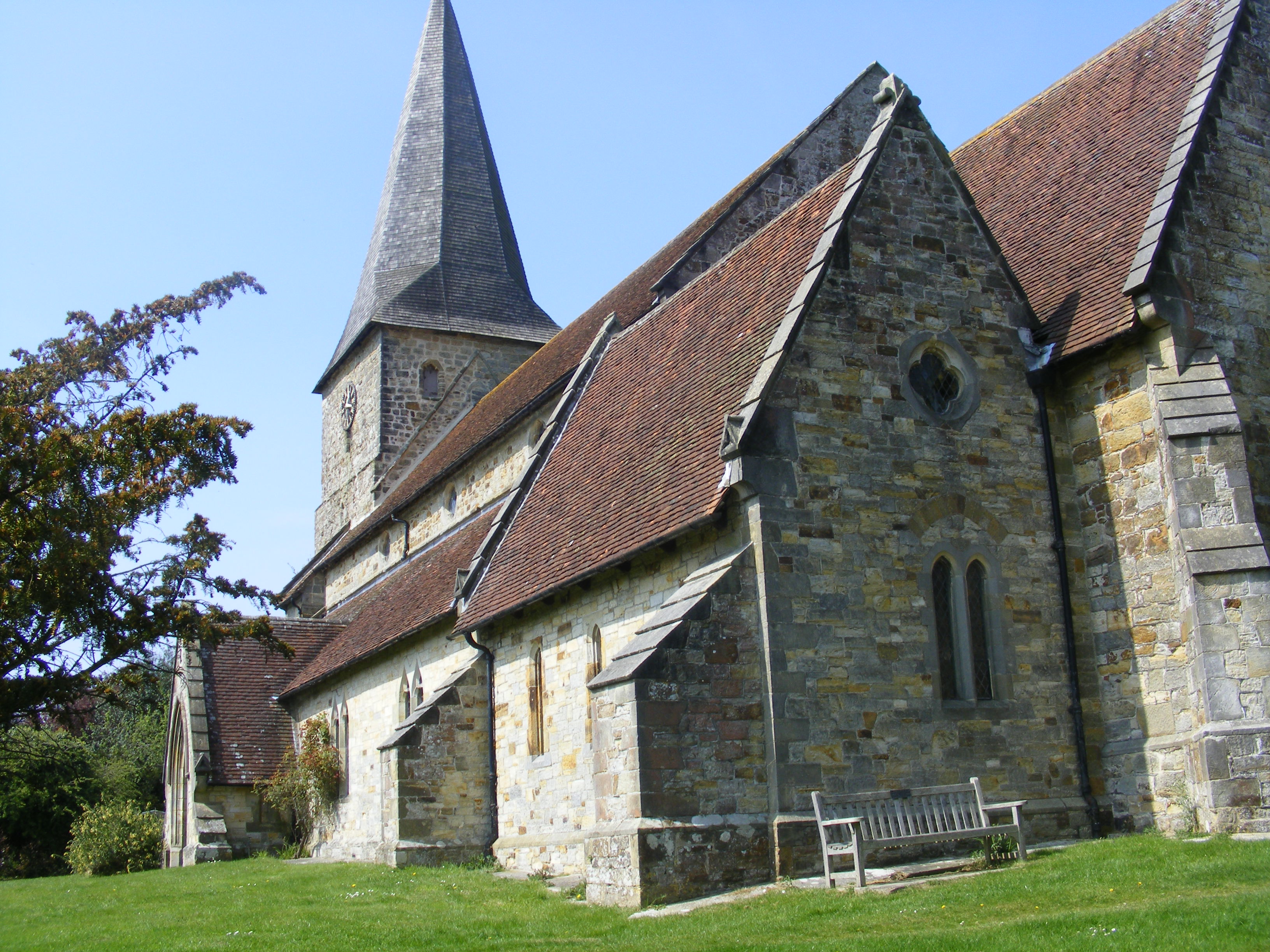
| Description | : | The church of Heathfield is situated in the old village, away from the newer town which grew up around the railway station. It has therefore remained in a quiet location away from the main roads. The parish church in Heathfield is dedicated to All Saints: an example of a Harmer terracotta decorated gravestone is in the churchyard. The town is the home of Heathfield Park Cricket Club, formed in 1878, and enjoying one of the most scenic positions of any cricket ground in Sussex. Approximately one mile from the town is the Heathfield transmitting station, a 135 m high mast which... Read More |
frequently asked questions (FAQ):
-
Where is All Saints Churchyard?
All Saints Churchyard is located at Old Heathfield Heathfield, Wealden District ,East Sussex , TN21 9AHEngland.
-
All Saints Churchyard cemetery's updated grave count on graveviews.com?
158 memorials
-
Where are the coordinates of the All Saints Churchyard?
Latitude: 50.9599190
Longitude: 0.2748190


Nearby Cemetories:
1. Punnett's Town Chapel Cemetery
Heathfield, Wealden District, England
Coordinate: 50.9617720, 0.2979720
2. Theobalds Green Burial Ground
Heathfield, Wealden District, England
Coordinate: 50.9542157, 0.2485328
3. Broad Oak Chapel
Heathfield, Wealden District, England
Coordinate: 50.9783950, 0.2860630
4. St. Mary the Virgin Churchyard
Warbleton, Wealden District, England
Coordinate: 50.9407250, 0.2885880
5. St Bartholomew Churchyard
Wealden District, England
Coordinate: 50.9715490, 0.2338890
6. All Saints Churchyard
Waldron, Wealden District, England
Coordinate: 50.9522090, 0.2034190
7. St Philips Churchyard
Burwash, Rother District, England
Coordinate: 50.9889020, 0.3350510
8. Holy Cross Priory
Heathfield, Wealden District, England
Coordinate: 50.9715880, 0.1994160
9. St. Giles' Churchyard
Dallington, Rother District, England
Coordinate: 50.9470960, 0.3585090
10. St. Dunstan Churchyard
Mayfield, Wealden District, England
Coordinate: 51.0207710, 0.2605280
11. Mayfield School Chapel
Mayfield, Wealden District, England
Coordinate: 51.0212245, 0.2614751
12. Convent of the Holy Child
Mayfield, Wealden District, England
Coordinate: 51.0216780, 0.2609150
13. Ebenezer Baptist Chapel
Bodle Street Green, Wealden District, England
Coordinate: 50.9102250, 0.3438700
14. St Mark Churchyard
Hadlow Down, Wealden District, England
Coordinate: 50.9967460, 0.1786580
15. St. John the Evangelist Churchyard
Bodle Street Green, Wealden District, England
Coordinate: 50.9041214, 0.3465680
16. Chiddingly Parish Churchyard
Chiddingly, Wealden District, England
Coordinate: 50.9056710, 0.1957580
17. St. Peter and St. Paul Churchyard
Hellingly, Wealden District, England
Coordinate: 50.8885260, 0.2460540
18. St. Joseph's Roman Catholic Churchyard
Burwash, Rother District, England
Coordinate: 50.9963500, 0.3782670
19. Hope Strict Baptist Chapel
Framfield, Wealden District, England
Coordinate: 50.9496115, 0.1567075
20. St. Thomas A. Becket Churchyard
Brightling, Rother District, England
Coordinate: 50.9638440, 0.3961020
21. Hellingly Cemetery
Hellingly, Wealden District, England
Coordinate: 50.8852690, 0.2415280
22. East Hoathly Parish Church
East Hoathly, Wealden District, England
Coordinate: 50.9248990, 0.1616530
23. East Hoathly Parish Churchyard
East Hoathly, Wealden District, England
Coordinate: 50.9249039, 0.1615840
24. St. Bartholomew's Churchyard
Burwash, Rother District, England
Coordinate: 50.9976470, 0.3887490