
| Memorials | : | 0 |
| Location | : | Burwash, Rother District, England |
| Coordinate | : | 50.9889020, 0.3350510 |
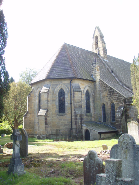
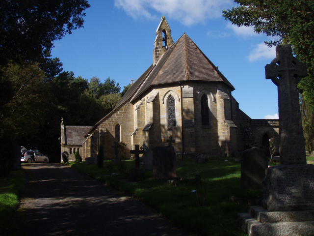
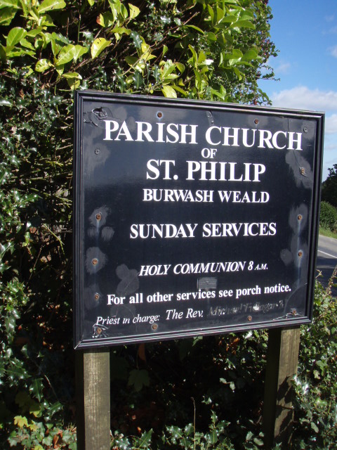
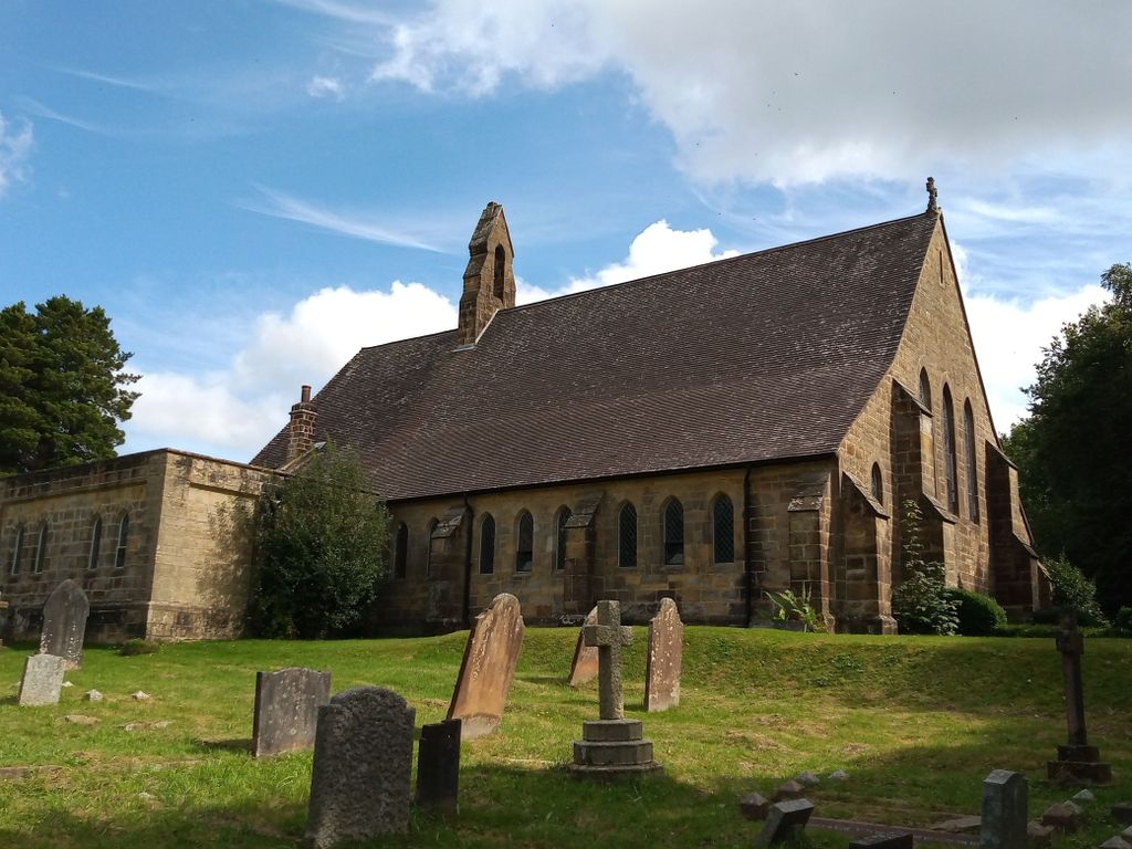
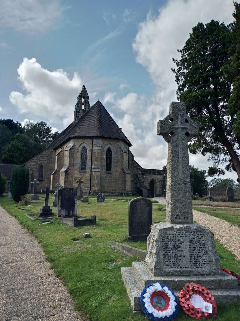
| Description | : | Built 141 years ago it was a result of the vision of the Trower Sisters. The site of the church was given by Miss Georgina Trower of Hollyhurst Farm (now Buckles), Burwash Common; the foundation stone was laid on 20 August 1866 and the Bishop of Chichester consecrated the church on 29 August 1867. The architect was William Slater, and the builders were Messrs Baldock and Brooker of Hurst Green. Burwash Weald was constituted a consolidated chapelry in October 1877, created from the parishes of Burwash, Mayfield and Heathfield. Added By Wertypop |
frequently asked questions (FAQ):
-
Where is St Philips Churchyard?
St Philips Churchyard is located at Burwash Weald Burwash, Rother District ,East Sussex ,England.
-
St Philips Churchyard cemetery's updated grave count on graveviews.com?
0 memorials
-
Where are the coordinates of the St Philips Churchyard?
Latitude: 50.9889020
Longitude: 0.3350510
Nearby Cemetories:
1. St. Joseph's Roman Catholic Churchyard
Burwash, Rother District, England
Coordinate: 50.9963500, 0.3782670
2. Broad Oak Chapel
Heathfield, Wealden District, England
Coordinate: 50.9783950, 0.2860630
3. St. Bartholomew's Churchyard
Burwash, Rother District, England
Coordinate: 50.9976470, 0.3887490
4. Punnett's Town Chapel Cemetery
Heathfield, Wealden District, England
Coordinate: 50.9617720, 0.2979720
5. St. Giles' Churchyard
Dallington, Rother District, England
Coordinate: 50.9470960, 0.3585090
6. St. Thomas A. Becket Churchyard
Brightling, Rother District, England
Coordinate: 50.9638440, 0.3961020
7. All Saints Churchyard
Heathfield, Wealden District, England
Coordinate: 50.9599190, 0.2748190
8. St. Peter's Churchyard
Stonegate, Rother District, England
Coordinate: 51.0303090, 0.3747690
9. St. Mary the Virgin Churchyard
Warbleton, Wealden District, England
Coordinate: 50.9407250, 0.2885880
10. Mayfield School Chapel
Mayfield, Wealden District, England
Coordinate: 51.0212245, 0.2614751
11. St. Dunstan Churchyard
Mayfield, Wealden District, England
Coordinate: 51.0207710, 0.2605280
12. Convent of the Holy Child
Mayfield, Wealden District, England
Coordinate: 51.0216780, 0.2609150
13. Tidebrook Churchyard
Wadhurst, Wealden District, England
Coordinate: 51.0467700, 0.3013730
14. Theobalds Green Burial Ground
Heathfield, Wealden District, England
Coordinate: 50.9542157, 0.2485328
15. St Bartholomew Churchyard
Wealden District, England
Coordinate: 50.9715490, 0.2338890
16. Assumption of Blessed Mary & St. Nicholas Church
Etchingham, Rother District, England
Coordinate: 51.0095830, 0.4416420
17. St. Mary's Churchyard
Ticehurst, Rother District, England
Coordinate: 51.0454030, 0.4077110
18. St. Peter & St. Paul Churchyard
Wadhurst, Wealden District, England
Coordinate: 51.0626960, 0.3400690
19. Darvell Bruderhof Cemetery
Robertsbridge, Rother District, England
Coordinate: 50.9790497, 0.4561470
20. Ebenezer Baptist Chapel
Bodle Street Green, Wealden District, England
Coordinate: 50.9102250, 0.3438700
21. St Michael the Archangel Churchyard
Penhurst, Rother District, England
Coordinate: 50.9235920, 0.4092830
22. St. John the Evangelist Churchyard
Bodle Street Green, Wealden District, England
Coordinate: 50.9041214, 0.3465680
23. Holy Cross Priory
Heathfield, Wealden District, England
Coordinate: 50.9715880, 0.1994160
24. St John The Baptist Churchyard
Mountfield, Rother District, England
Coordinate: 50.9404170, 0.4512760