
| Memorials | : | 244 |
| Location | : | Dallington, Rother District, England |
| Coordinate | : | 50.9470960, 0.3585090 |
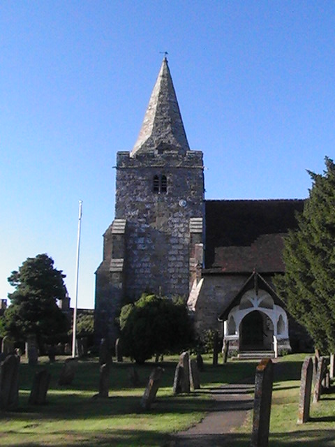
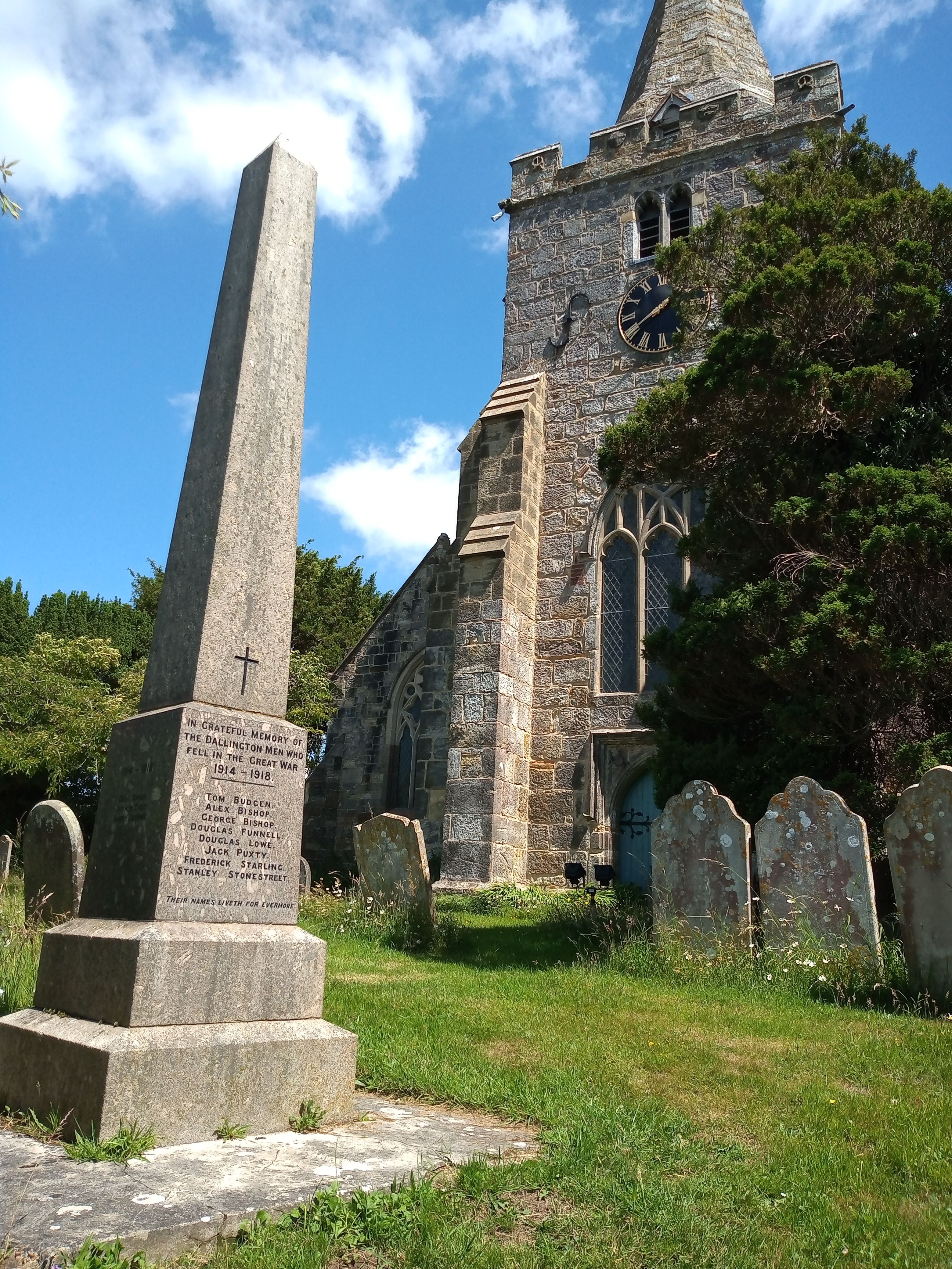
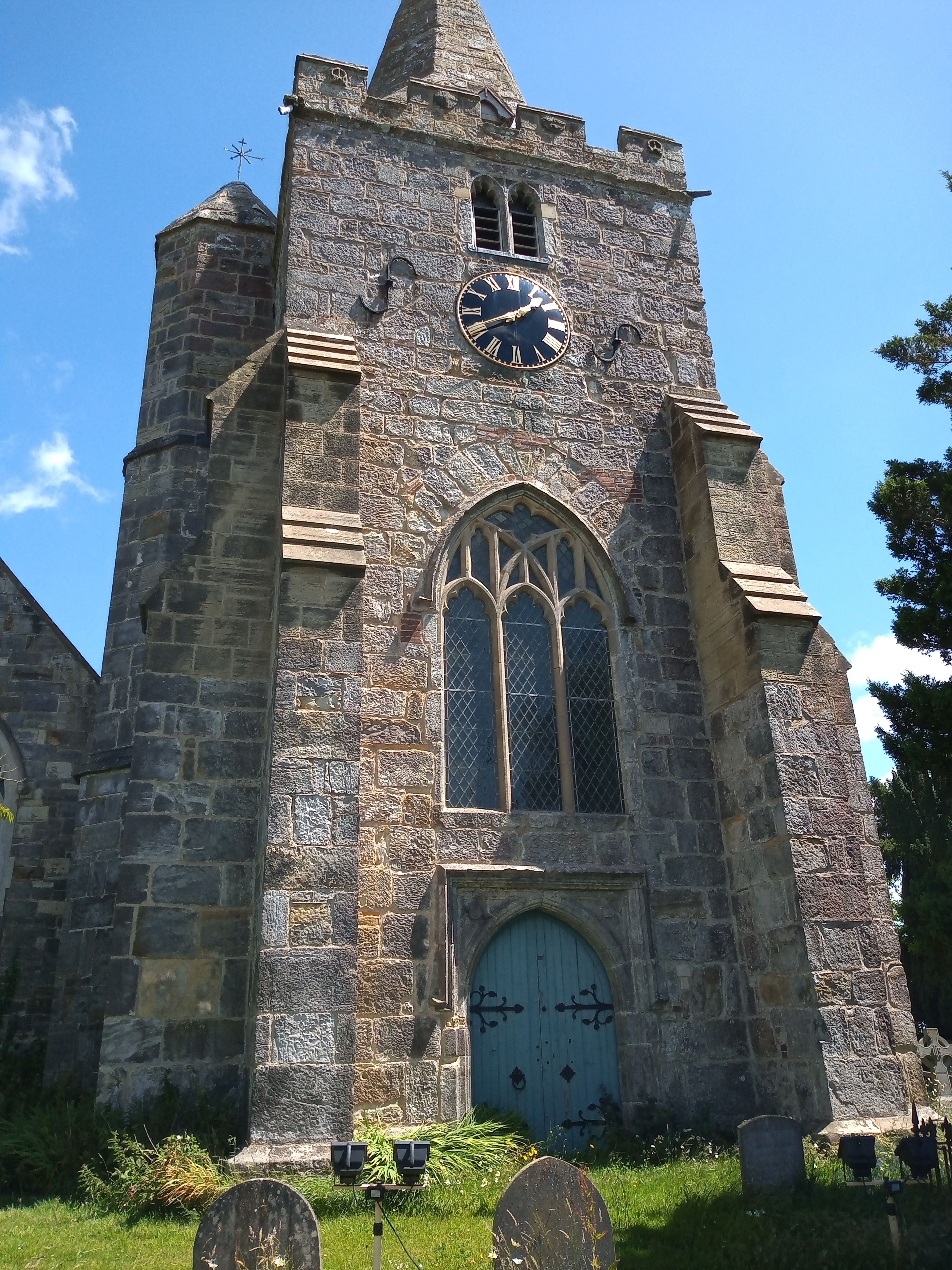
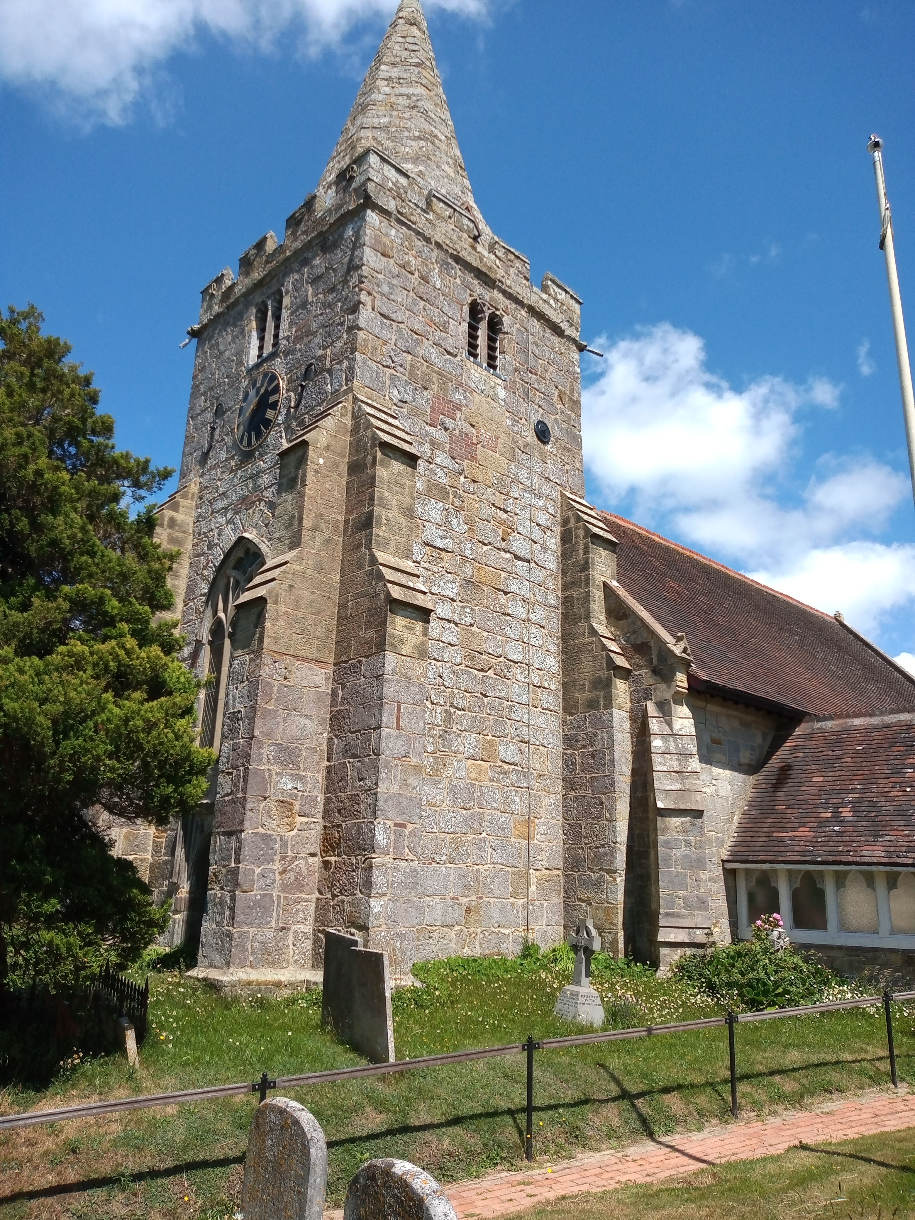
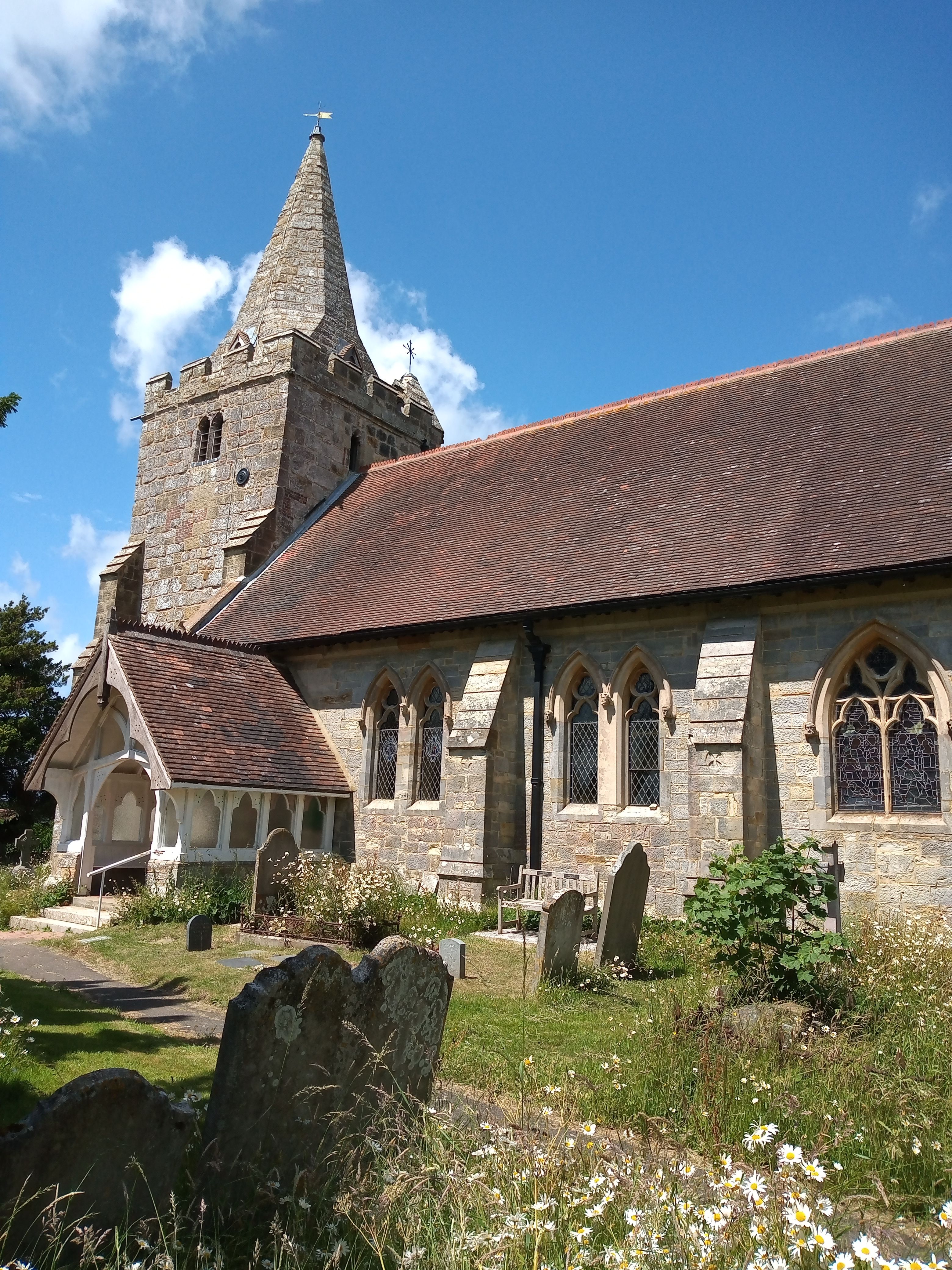
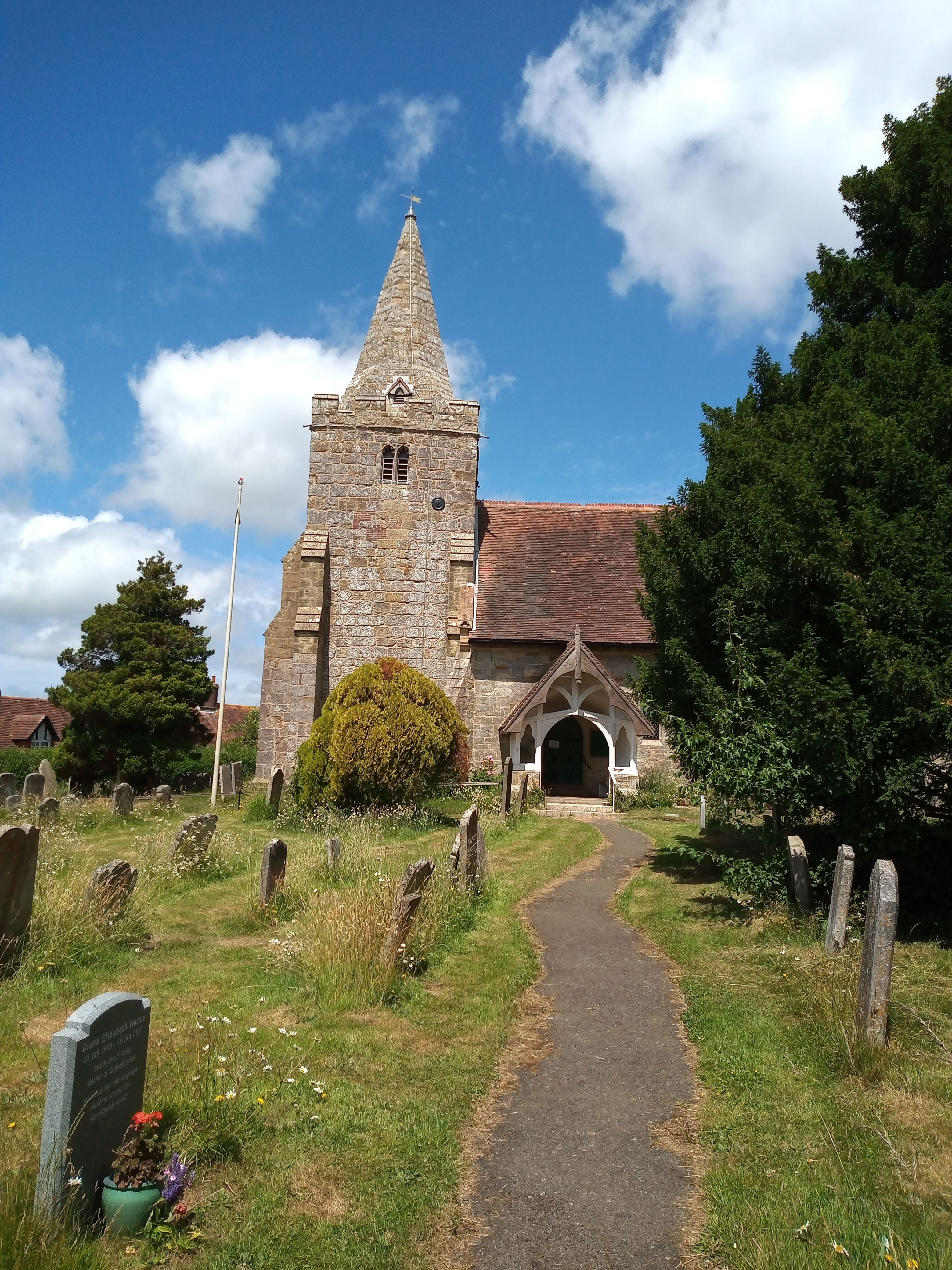
| Description | : | Dallington is a village and civil parish in the Rother District of East Sussex, England. It is located eight miles (13 km) west of Battle and five miles (8 km) east of Heathfield. The parish church of St Giles is a Grade II* listed building. The unusual tower and spire date from the early 16th century, but the remainder was rebuilt in 1864 by architects Habershon and Brock. |
frequently asked questions (FAQ):
-
Where is St. Giles' Churchyard?
St. Giles' Churchyard is located at Dallington, Rother District ,East Sussex ,England.
-
St. Giles' Churchyard cemetery's updated grave count on graveviews.com?
0 memorials
-
Where are the coordinates of the St. Giles' Churchyard?
Latitude: 50.9470960
Longitude: 0.3585090
Nearby Cemetories:
1. St. Thomas A. Becket Churchyard
Brightling, Rother District, England
Coordinate: 50.9638440, 0.3961020
2. Ebenezer Baptist Chapel
Bodle Street Green, Wealden District, England
Coordinate: 50.9102250, 0.3438700
3. St Michael the Archangel Churchyard
Penhurst, Rother District, England
Coordinate: 50.9235920, 0.4092830
4. Punnett's Town Chapel Cemetery
Heathfield, Wealden District, England
Coordinate: 50.9617720, 0.2979720
5. St. John the Evangelist Churchyard
Bodle Street Green, Wealden District, England
Coordinate: 50.9041214, 0.3465680
6. St Philips Churchyard
Burwash, Rother District, England
Coordinate: 50.9889020, 0.3350510
7. St. Mary the Virgin Churchyard
Warbleton, Wealden District, England
Coordinate: 50.9407250, 0.2885880
8. St. Peter's Churchyard
Ashburnham, Rother District, England
Coordinate: 50.9056730, 0.4014650
9. St. Joseph's Roman Catholic Churchyard
Burwash, Rother District, England
Coordinate: 50.9963500, 0.3782670
10. St. Bartholomew's Churchyard
Burwash, Rother District, England
Coordinate: 50.9976470, 0.3887490
11. All Saints Churchyard
Heathfield, Wealden District, England
Coordinate: 50.9599190, 0.2748190
12. Broad Oak Chapel
Heathfield, Wealden District, England
Coordinate: 50.9783950, 0.2860630
13. St John The Baptist Churchyard
Mountfield, Rother District, England
Coordinate: 50.9404170, 0.4512760
14. Herstmonceux Free Church
Herstmonceux, Wealden District, England
Coordinate: 50.8855160, 0.3278300
15. Darvell Bruderhof Cemetery
Robertsbridge, Rother District, England
Coordinate: 50.9790497, 0.4561470
16. Theobalds Green Burial Ground
Heathfield, Wealden District, England
Coordinate: 50.9542157, 0.2485328
17. All Saints Churchyard
Mountfield, Rother District, England
Coordinate: 50.9558449, 0.4685820
18. St. Mary the Virgin Churchyard
Ninfield, Wealden District, England
Coordinate: 50.8848760, 0.4224590
19. All Saints Churchyard
Herstmonceux, Wealden District, England
Coordinate: 50.8678627, 0.3330980
20. St. Laurence Churchyard
Catsfield, Rother District, England
Coordinate: 50.8938230, 0.4563190
21. Assumption of Blessed Mary & St. Nicholas Church
Etchingham, Rother District, England
Coordinate: 51.0095830, 0.4416420
22. St Bartholomew Churchyard
Wealden District, England
Coordinate: 50.9715490, 0.2338890
23. St. Peter's Churchyard
Stonegate, Rother District, England
Coordinate: 51.0303090, 0.3747690
24. Battle Abbey
Battle, Rother District, England
Coordinate: 50.9144940, 0.4875140