
| Memorials | : | 107 |
| Location | : | Fawley, New Forest District, England |
| Coordinate | : | 50.8297700, -1.3522200 |
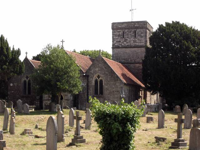
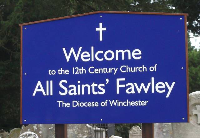
| Description | : | There are 27 wargraves here, mostly WWII airmen;until 1961, ten German airmen were buried in the Churchyard but in that year their remains were exhumed and reinterred in Cannock Chase. Also in the Churchyard is the grave of Alfred Charles Cossor, founder of the eponymous electronics firm. |
frequently asked questions (FAQ):
-
Where is All Saints Churchyard?
All Saints Churchyard is located at Marsh Lane Fawley, New Forest District ,Hampshire , SO45 1DLEngland.
-
All Saints Churchyard cemetery's updated grave count on graveviews.com?
107 memorials
-
Where are the coordinates of the All Saints Churchyard?
Latitude: 50.8297700
Longitude: -1.3522200
Nearby Cemetories:
1. Waterside Methodist Chapelyard
Fawley, New Forest District, England
Coordinate: 50.8245300, -1.3597900
2. Blackfield Cemetery
Blackfield, New Forest District, England
Coordinate: 50.8146700, -1.3756600
3. St Andrew the Apostle Churchyard
Hamble-le-Rice, Eastleigh Borough, England
Coordinate: 50.8589100, -1.3179090
4. St Katherine Churchyard
Exbury and Lepe, New Forest District, England
Coordinate: 50.8003950, -1.3957510
5. Netley Military Cemetery
Netley, Eastleigh Borough, England
Coordinate: 50.8682632, -1.3317170
6. St Mary Churchyard
Warsash, Fareham Borough, England
Coordinate: 50.8473220, -1.2910610
7. St Mary the Virgin Churchyard
Hound, Eastleigh Borough, England
Coordinate: 50.8762820, -1.3322160
8. St John the Baptist Churchyard
Hythe, New Forest District, England
Coordinate: 50.8688500, -1.3985000
9. Holly Hill Cemetery
Sarisbury, Fareham Borough, England
Coordinate: 50.8678930, -1.2888890
10. Holy Trinity Churchyard
Southampton, Southampton Unitary Authority, England
Coordinate: 50.8896750, -1.3659150
11. St Paul Churchyard
Sarisbury, Fareham Borough, England
Coordinate: 50.8756100, -1.2870670
12. St. Leonard Churchyard
Bursledon, Eastleigh Borough, England
Coordinate: 50.8850230, -1.3068370
13. Blessed Virgin and Holy Child Churchyard
Beaulieu, New Forest District, England
Coordinate: 50.8216320, -1.4501550
14. St John's Cemetery
Locks Heath, Fareham Borough, England
Coordinate: 50.8608400, -1.2651570
15. St Mary Extra Cemetery
Southampton, Southampton Unitary Authority, England
Coordinate: 50.8948700, -1.3522600
16. St Mary Churchyard
Sholing, Southampton Unitary Authority, England
Coordinate: 50.8991260, -1.3571350
17. All Saints Churchyard
Dibden, New Forest District, England
Coordinate: 50.8753020, -1.4362590
18. Holy Trinity Churchyard
Cowes, Isle of Wight Unitary Authority, England
Coordinate: 50.7661800, -1.3024540
19. Beaulieu Cemetery
Beaulieu, New Forest District, England
Coordinate: 50.8046600, -1.4594000
20. Posbrook Lane Cemetery
Titchfield, Fareham Borough, England
Coordinate: 50.8463100, -1.2403000
21. St Mary's Churchyard
Cowes, Isle of Wight Unitary Authority, England
Coordinate: 50.7629580, -1.3015790
22. St. Julien's Church
Southampton, Southampton Unitary Authority, England
Coordinate: 50.8965000, -1.4036000
23. St. Mary Extra Churchyard
Southampton, Southampton Unitary Authority, England
Coordinate: 50.9040000, -1.3743000
24. St Lawrence with St John Churchyard
Southampton, Southampton Unitary Authority, England
Coordinate: 50.8977570, -1.4052470