
| Memorials | : | 1095 |
| Location | : | Netley, Eastleigh Borough, England |
| Coordinate | : | 50.8682632, -1.3317170 |
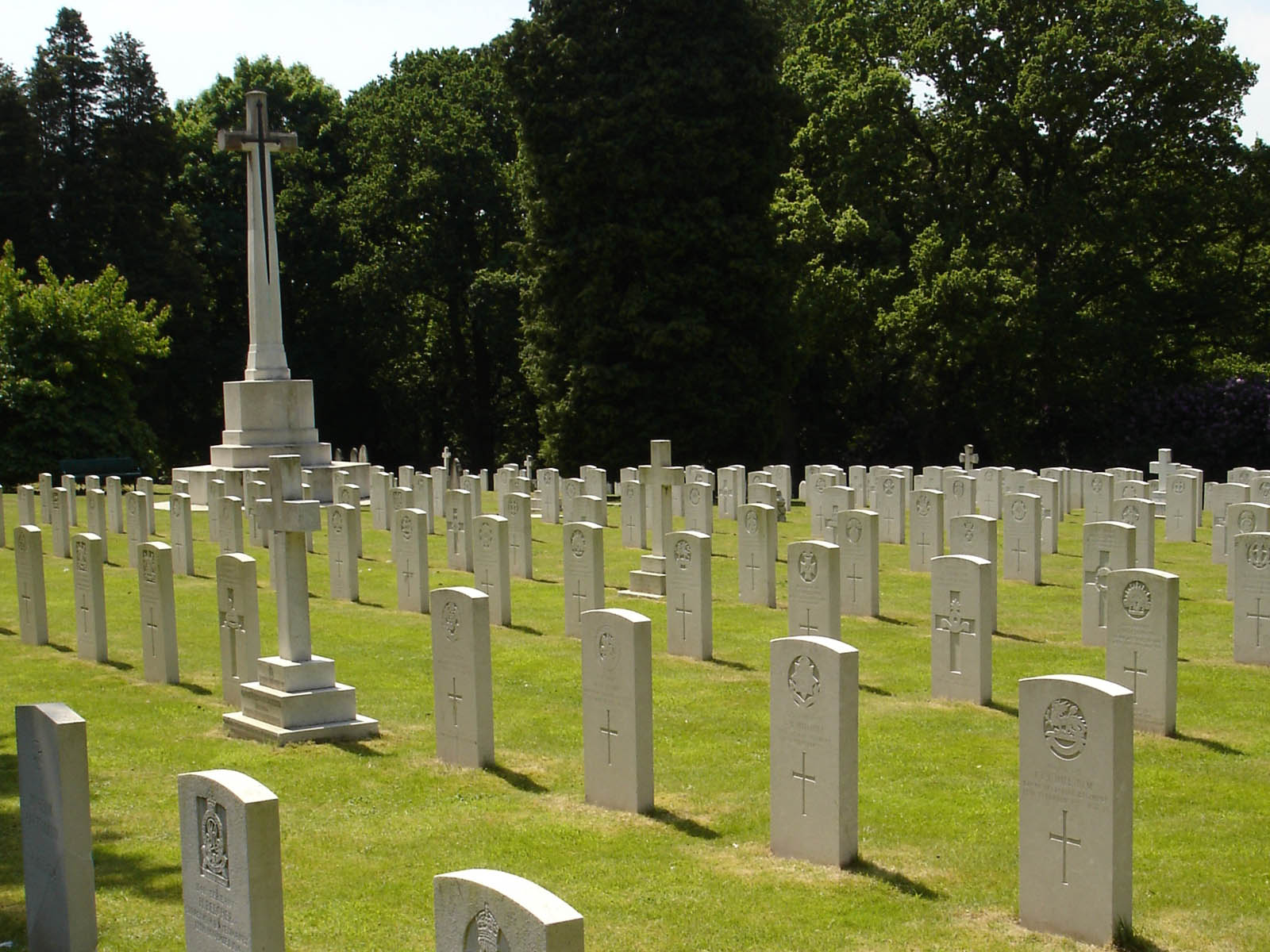
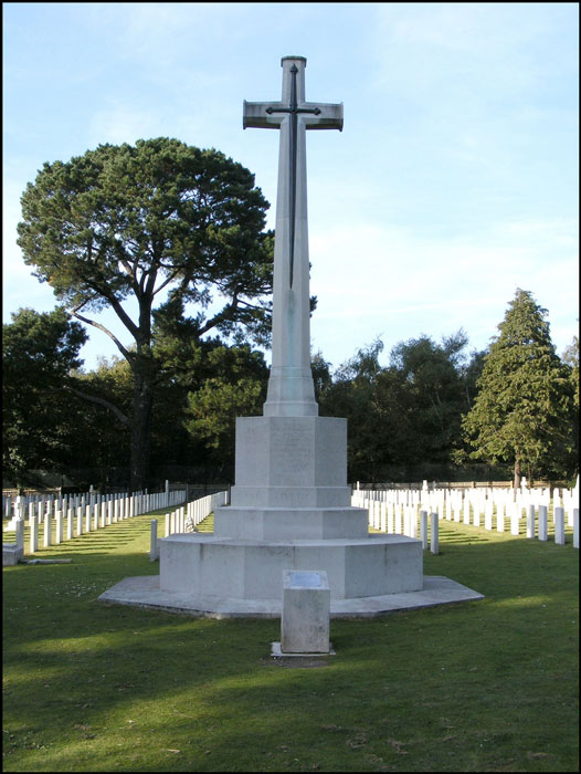
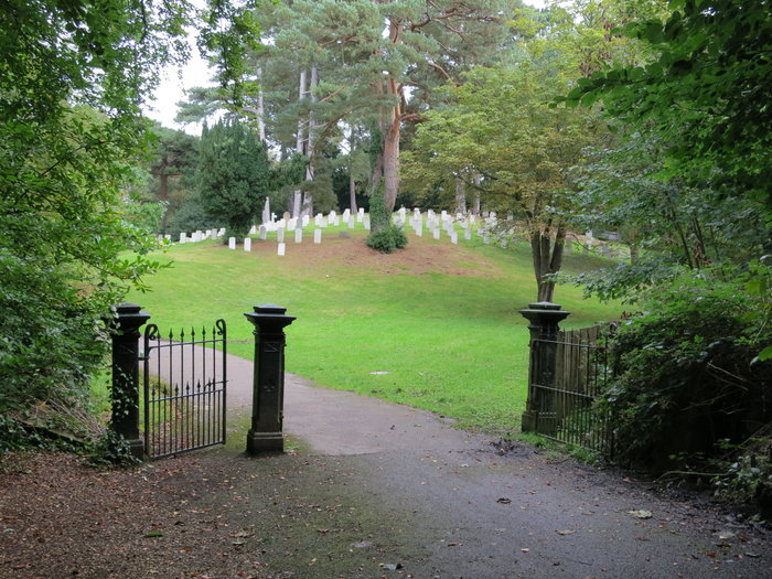
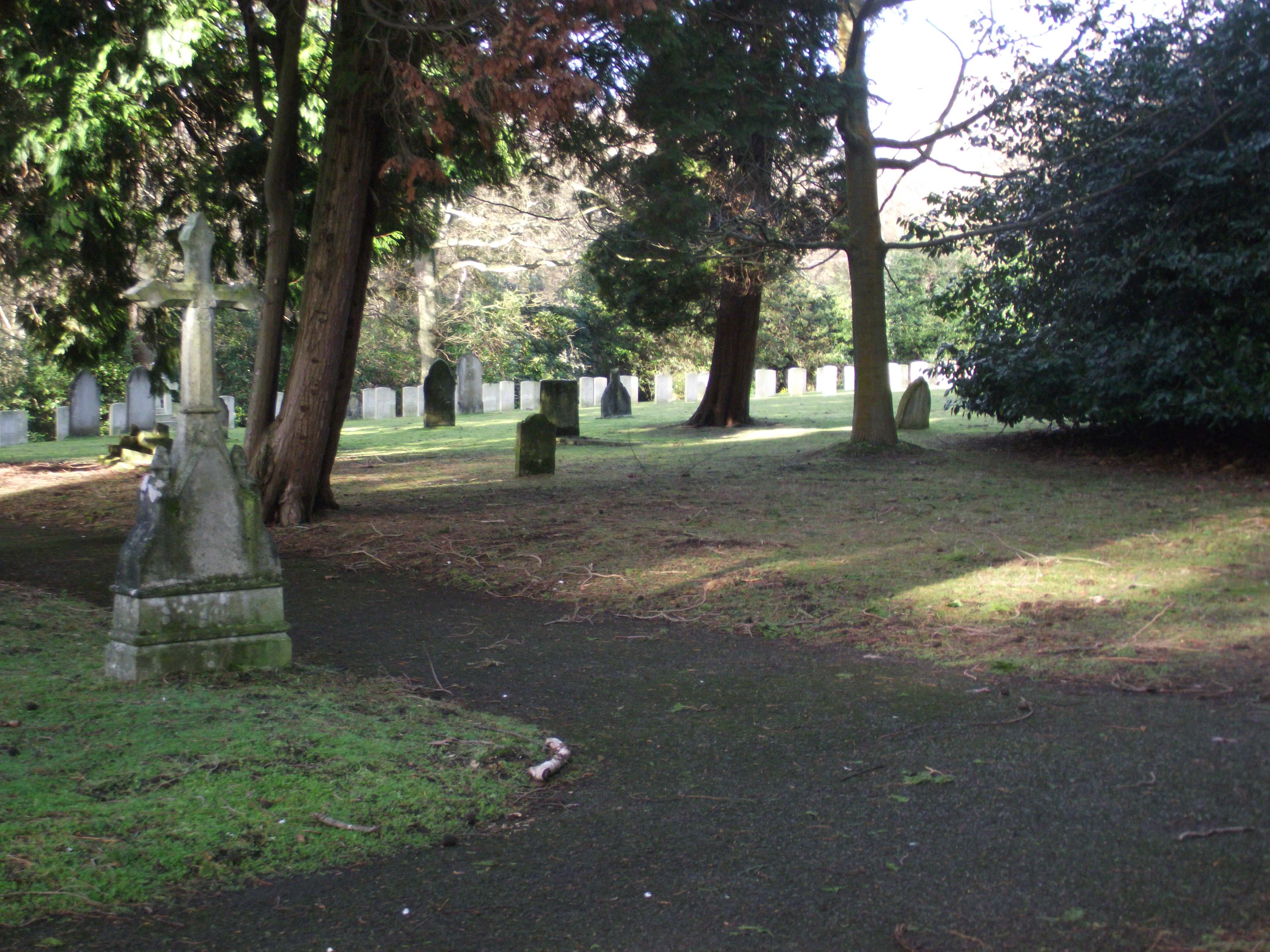
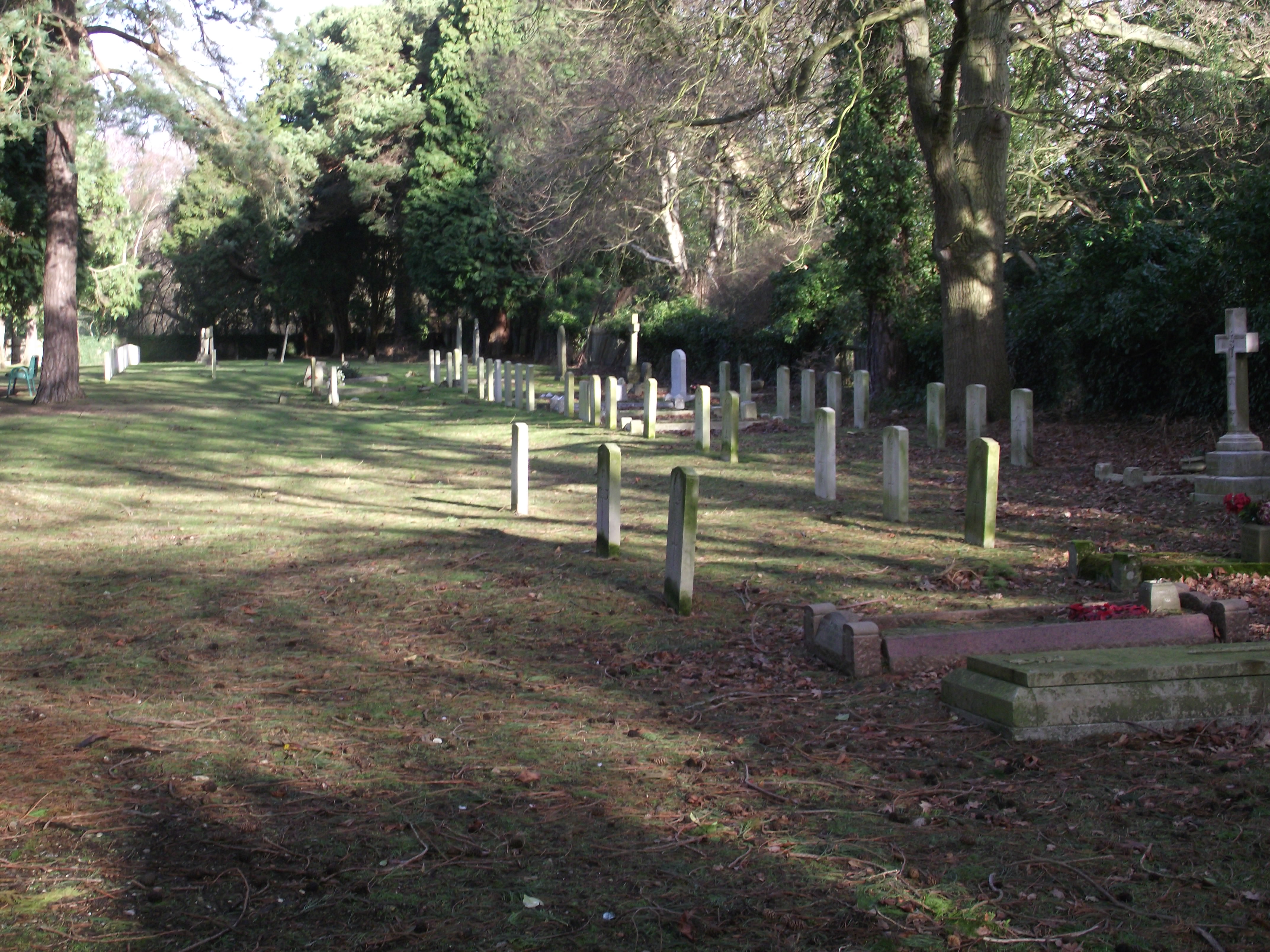
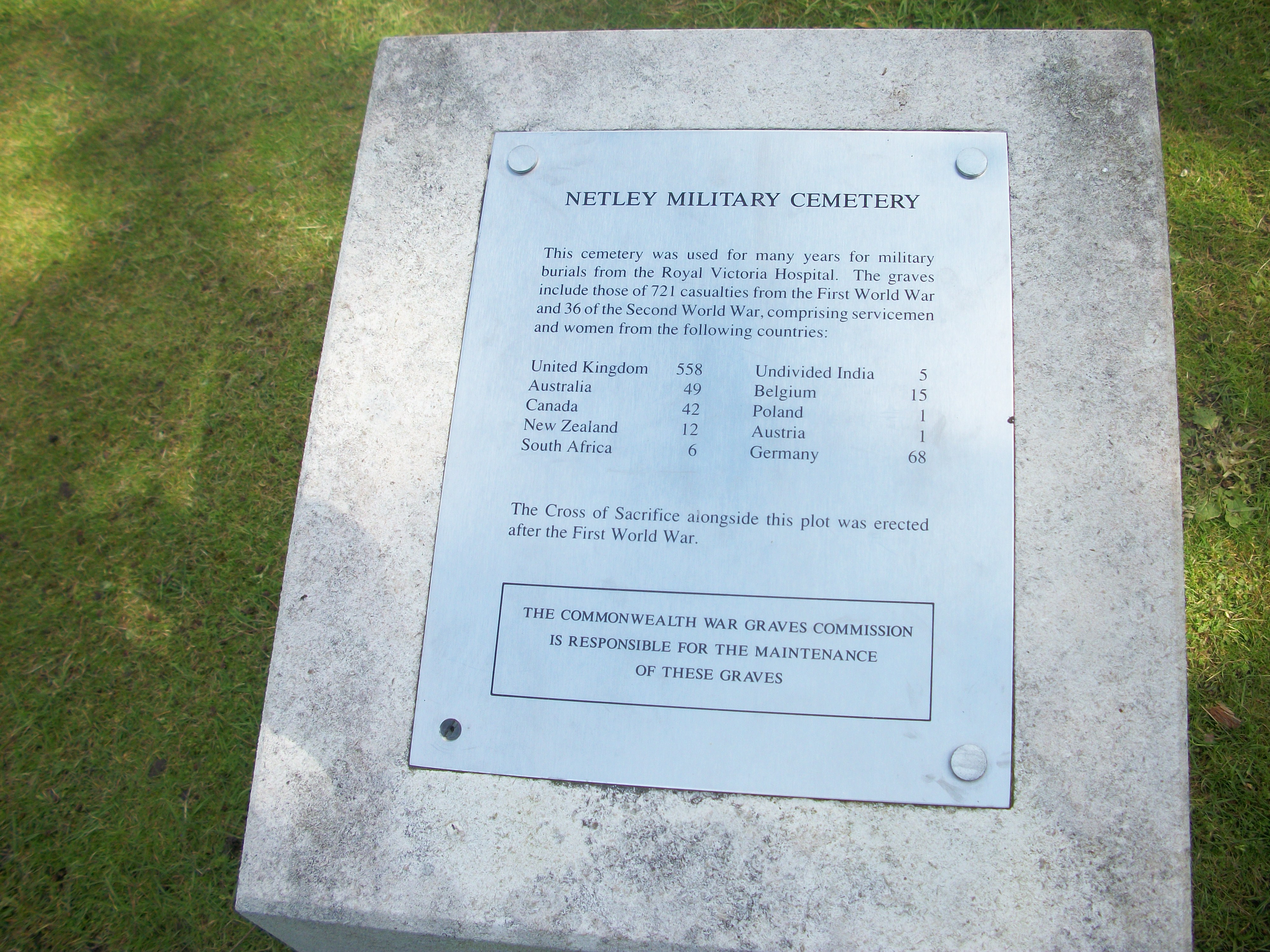
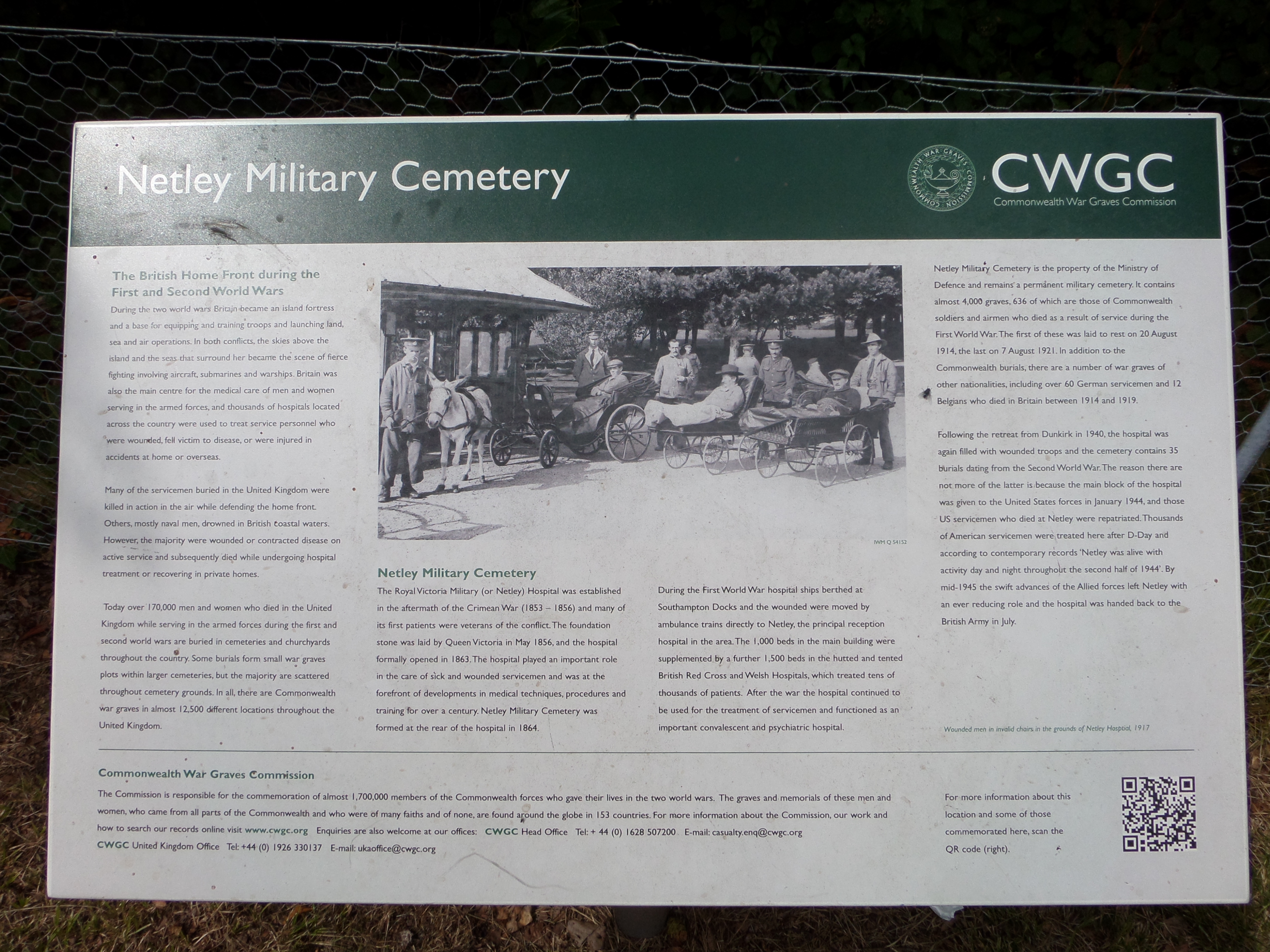
| Description | : | Netley Military Cemetery is a permanent military cemetery, the property of the Ministry of Defence.The cemetery lies within a park maintained by Hampshire County Council on the site of the former hospital, and access is by way of a private road with a lockable security barrier. The cemetery was at the back of the Royal Victoria Military Hospital and was used during both wars for burials from the hospital. The cemetery contains 636 First World War burials but only 35 from the Second World War. In addition to the Commonwealth graves, there are a number of war graves of other... Read More |
frequently asked questions (FAQ):
-
Where is Netley Military Cemetery?
Netley Military Cemetery is located at West Wood Netley, Eastleigh Borough ,Hampshire , SO31 4TSEngland.
-
Netley Military Cemetery cemetery's updated grave count on graveviews.com?
110 memorials
-
Where are the coordinates of the Netley Military Cemetery?
Latitude: 50.8682632
Longitude: -1.3317170
Nearby Cemetories:
1. St Mary the Virgin Churchyard
Hound, Eastleigh Borough, England
Coordinate: 50.8762820, -1.3322160
2. St Andrew the Apostle Churchyard
Hamble-le-Rice, Eastleigh Borough, England
Coordinate: 50.8589100, -1.3179090
3. St. Leonard Churchyard
Bursledon, Eastleigh Borough, England
Coordinate: 50.8850230, -1.3068370
4. Holly Hill Cemetery
Sarisbury, Fareham Borough, England
Coordinate: 50.8678930, -1.2888890
5. St Paul Churchyard
Sarisbury, Fareham Borough, England
Coordinate: 50.8756100, -1.2870670
6. St Mary Extra Cemetery
Southampton, Southampton Unitary Authority, England
Coordinate: 50.8948700, -1.3522600
7. Holy Trinity Churchyard
Southampton, Southampton Unitary Authority, England
Coordinate: 50.8896750, -1.3659150
8. St Mary Churchyard
Warsash, Fareham Borough, England
Coordinate: 50.8473220, -1.2910610
9. St Mary Churchyard
Sholing, Southampton Unitary Authority, England
Coordinate: 50.8991260, -1.3571350
10. All Saints Churchyard
Fawley, New Forest District, England
Coordinate: 50.8297700, -1.3522200
11. Albert Road Cemetery
Hedge End, Eastleigh Borough, England
Coordinate: 50.9066535, -1.3099266
12. St John the Baptist Churchyard
Hythe, New Forest District, England
Coordinate: 50.8688500, -1.3985000
13. St John's Cemetery
Locks Heath, Fareham Borough, England
Coordinate: 50.8608400, -1.2651570
14. St John the Evangelist Churchyard
Hedge End, Eastleigh Borough, England
Coordinate: 50.9089200, -1.3091100
15. St. Mary Extra Churchyard
Southampton, Southampton Unitary Authority, England
Coordinate: 50.9040000, -1.3743000
16. Waterside Methodist Chapelyard
Fawley, New Forest District, England
Coordinate: 50.8245300, -1.3597900
17. Holy Saviour Churchyard
Bitterne, Southampton Unitary Authority, England
Coordinate: 50.9138840, -1.3583560
18. Redcote Convent Cemetery
Bitterne, Southampton Unitary Authority, England
Coordinate: 50.9168600, -1.3510700
19. St Bartholomew Churchyard
Botley, Eastleigh Borough, England
Coordinate: 50.9048000, -1.2754000
20. St Mary Churchyard
Southampton, Southampton Unitary Authority, England
Coordinate: 50.9027100, -1.3960800
21. St. Julien's Church
Southampton, Southampton Unitary Authority, England
Coordinate: 50.8965000, -1.4036000
22. St Lawrence with St John Churchyard
Southampton, Southampton Unitary Authority, England
Coordinate: 50.8977570, -1.4052470
23. Holyrood Churchyard
Southampton, Southampton Unitary Authority, England
Coordinate: 50.8996600, -1.4035300
24. Holyrood Church
Southampton Unitary Authority, England
Coordinate: 50.8997498, -1.4034560