
| Memorials | : | 1 |
| Location | : | Southampton, Southampton Unitary Authority, England |
| Coordinate | : | 50.8896750, -1.3659150 |
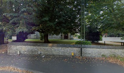
| Description | : | Located in the Weston suburb of Southampton. The church was consecrated in July 1865. It was built on land given by Thomas Chamberlayne of Weston Grove House, but construction costs were paid for its first incumbent, the Reverend William Preston Hulton. The architect was Alfred Bedborough. |
frequently asked questions (FAQ):
-
Where is Holy Trinity Churchyard?
Holy Trinity Churchyard is located at Weston Lane Southampton, Southampton Unitary Authority ,Hampshire , SO19 9HGEngland.
-
Holy Trinity Churchyard cemetery's updated grave count on graveviews.com?
1 memorials
-
Where are the coordinates of the Holy Trinity Churchyard?
Latitude: 50.8896750
Longitude: -1.3659150
Nearby Cemetories:
1. St Mary Extra Cemetery
Southampton, Southampton Unitary Authority, England
Coordinate: 50.8948700, -1.3522600
2. St Mary Churchyard
Sholing, Southampton Unitary Authority, England
Coordinate: 50.8991260, -1.3571350
3. St. Mary Extra Churchyard
Southampton, Southampton Unitary Authority, England
Coordinate: 50.9040000, -1.3743000
4. St Mary Churchyard
Southampton, Southampton Unitary Authority, England
Coordinate: 50.9027100, -1.3960800
5. Holy Saviour Churchyard
Bitterne, Southampton Unitary Authority, England
Coordinate: 50.9138840, -1.3583560
6. St. Julien's Church
Southampton, Southampton Unitary Authority, England
Coordinate: 50.8965000, -1.4036000
7. St Mary the Virgin Churchyard
Hound, Eastleigh Borough, England
Coordinate: 50.8762820, -1.3322160
8. All Saints Catacombs and Burial Ground (Defunct)
Southampton, Southampton Unitary Authority, England
Coordinate: 50.9013350, -1.4021500
9. Holyrood Church
Southampton Unitary Authority, England
Coordinate: 50.8997498, -1.4034560
10. Holyrood Churchyard
Southampton, Southampton Unitary Authority, England
Coordinate: 50.8996600, -1.4035300
11. St Lawrence with St John Churchyard
Southampton, Southampton Unitary Authority, England
Coordinate: 50.8977570, -1.4052470
12. St Michael the Archangel Churchyard
Southampton, Southampton Unitary Authority, England
Coordinate: 50.8996200, -1.4056900
13. Redcote Convent Cemetery
Bitterne, Southampton Unitary Authority, England
Coordinate: 50.9168600, -1.3510700
14. St John the Baptist Churchyard
Hythe, New Forest District, England
Coordinate: 50.8688500, -1.3985000
15. Netley Military Cemetery
Netley, Eastleigh Borough, England
Coordinate: 50.8682632, -1.3317170
16. St. Leonard Churchyard
Bursledon, Eastleigh Borough, England
Coordinate: 50.8850230, -1.3068370
17. St James Churchyard
West End, Eastleigh Borough, England
Coordinate: 50.9243200, -1.3382300
18. Albert Road Cemetery
Hedge End, Eastleigh Borough, England
Coordinate: 50.9066535, -1.3099266
19. St John the Evangelist Churchyard
Hedge End, Eastleigh Borough, England
Coordinate: 50.9089200, -1.3091100
20. St. James' Church Cemetery
West End, Eastleigh Borough, England
Coordinate: 50.9267690, -1.3326580
21. Southampton Old Cemetery
Southampton, Southampton Unitary Authority, England
Coordinate: 50.9202900, -1.4130650
22. St Andrew the Apostle Churchyard
Hamble-le-Rice, Eastleigh Borough, England
Coordinate: 50.8589100, -1.3179090
23. Highfield Churchyard
Portswood, Southampton Unitary Authority, England
Coordinate: 50.9295400, -1.3949800
24. All Saints Churchyard
Dibden, New Forest District, England
Coordinate: 50.8753020, -1.4362590