
| Memorials | : | 5 |
| Location | : | Highland Heights, Campbell County, USA |
| Coordinate | : | 39.0304527, -84.4519882 |
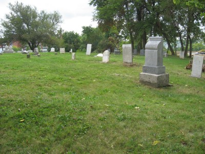
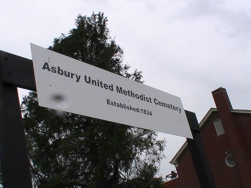
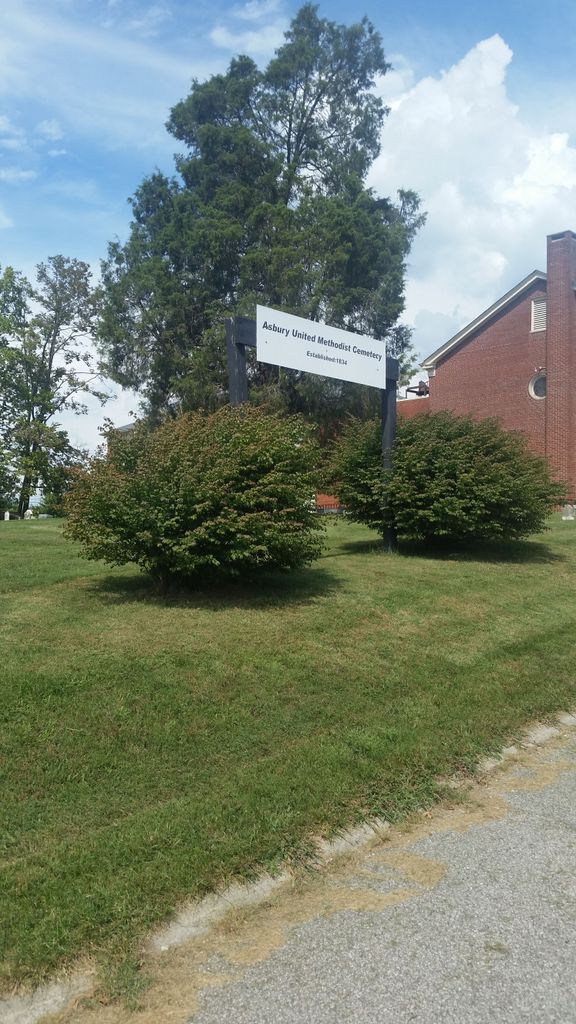
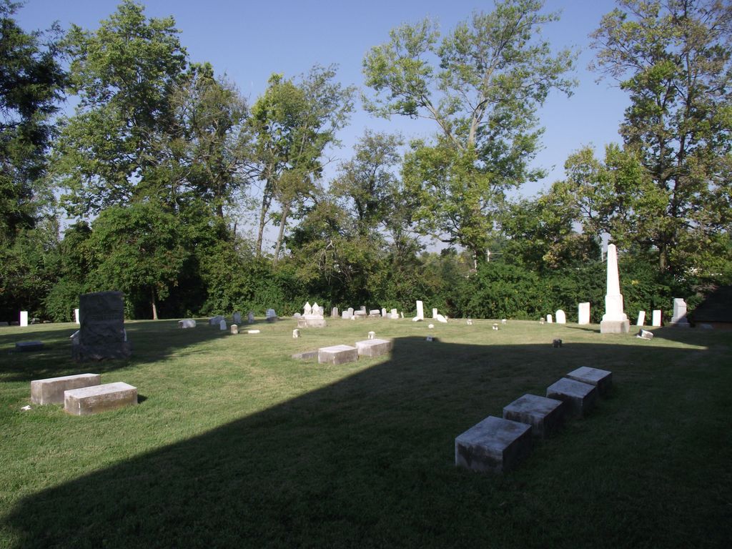
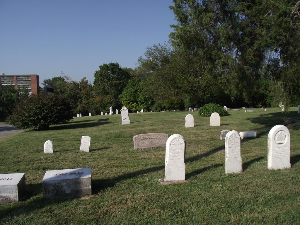
| Description | : | The cemetery lies behind the Asbury United Methodist Church along N. Martha Layne Collins Drive. The cemetery was established in 1834. The U.S. Geological Survey (USGS) Geographic Names Information System (GNIS) feature ID for the cemetery is 2089469 (Asbury Methodist Church Cemetery). |
frequently asked questions (FAQ):
-
Where is Asbury Methodist Church Cemetery?
Asbury Methodist Church Cemetery is located at 2916 Alexandria Pike Highland Heights, Campbell County ,Kentucky , 41076USA.
-
Asbury Methodist Church Cemetery cemetery's updated grave count on graveviews.com?
5 memorials
-
Where are the coordinates of the Asbury Methodist Church Cemetery?
Latitude: 39.0304527
Longitude: -84.4519882
Nearby Cemetories:
1. Potter Field Cemetery
Highland Heights, Campbell County, USA
Coordinate: 39.0252991, -84.4552994
2. Cold Spring First Baptist Church Cemetery
Cold Spring, Campbell County, USA
Coordinate: 39.0248800, -84.4462900
3. Saint Joseph Cemetery
Cold Spring, Campbell County, USA
Coordinate: 39.0257700, -84.4443650
4. Johns Hill Cemetery
Wilder, Campbell County, USA
Coordinate: 39.0299988, -84.4738998
5. Saint Johns Cemetery
Wilder, Campbell County, USA
Coordinate: 39.0347170, -84.4750830
6. Saint Stephen Cemetery
Fort Thomas, Campbell County, USA
Coordinate: 39.0511017, -84.4503021
7. Murnan Cemetery
Cold Spring, Campbell County, USA
Coordinate: 39.0064690, -84.4436530
8. Saint Josephs Cemetery
Wilder, Campbell County, USA
Coordinate: 39.0469017, -84.4841995
9. Saint John German Protestant Cemetery
Wilder, Campbell County, USA
Coordinate: 39.0478440, -84.4854430
10. William Culbertson Family Cemetery (Defunct)
Springlake, Kenton County, USA
Coordinate: 38.9971400, -84.4592900
11. Locust Pike Pentecostal Church Cemetery
Kenton County, USA
Coordinate: 38.9940500, -84.4630000
12. Culbertson Cemetery
Taylor Mill, Kenton County, USA
Coordinate: 38.9939390, -84.4629340
13. Evergreen Cemetery
Southgate, Campbell County, USA
Coordinate: 39.0667000, -84.4721985
14. Webb Cemetery
Sunny Acres, Kenton County, USA
Coordinate: 39.0185470, -84.5035620
15. Buena Vista Cemetery
Covington, Kenton County, USA
Coordinate: 39.0595200, -84.5040000
16. Armstrong Cemetery #2
Ryland Heights, Kenton County, USA
Coordinate: 38.9820600, -84.4695400
17. Floral Hills Memorial Gardens
Taylor Mill, Kenton County, USA
Coordinate: 38.9986000, -84.5028000
18. Wolf Family Cemetery
Taylor Mill, Kenton County, USA
Coordinate: 38.9926920, -84.4980570
19. Mother Of God Cemetery
Kenton Vale, Kenton County, USA
Coordinate: 39.0480995, -84.5171967
20. Martin Family Cemetery
Taylor Mill, Kenton County, USA
Coordinate: 38.9909400, -84.4997650
21. Hillcrest Cemetery
Hamilton County, USA
Coordinate: 39.0691986, -84.4030991
22. Saint Anne Convent Cemetery
Melbourne, Campbell County, USA
Coordinate: 39.0284030, -84.3801510
23. Saint John Lutheran Church Cemetery
Camp Springs, Campbell County, USA
Coordinate: 39.0144150, -84.3826140
24. Stamper Family Cemetery
Grant, Kenton County, USA
Coordinate: 38.9746130, -84.4338000