
| Memorials | : | 0 |
| Location | : | Ryland Heights, Kenton County, USA |
| Coordinate | : | 38.9820600, -84.4695400 |
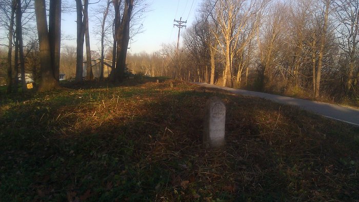
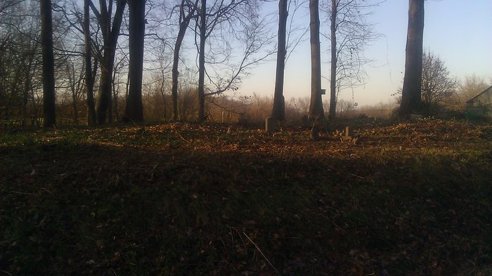
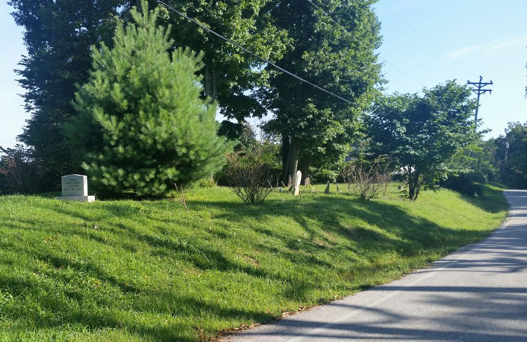
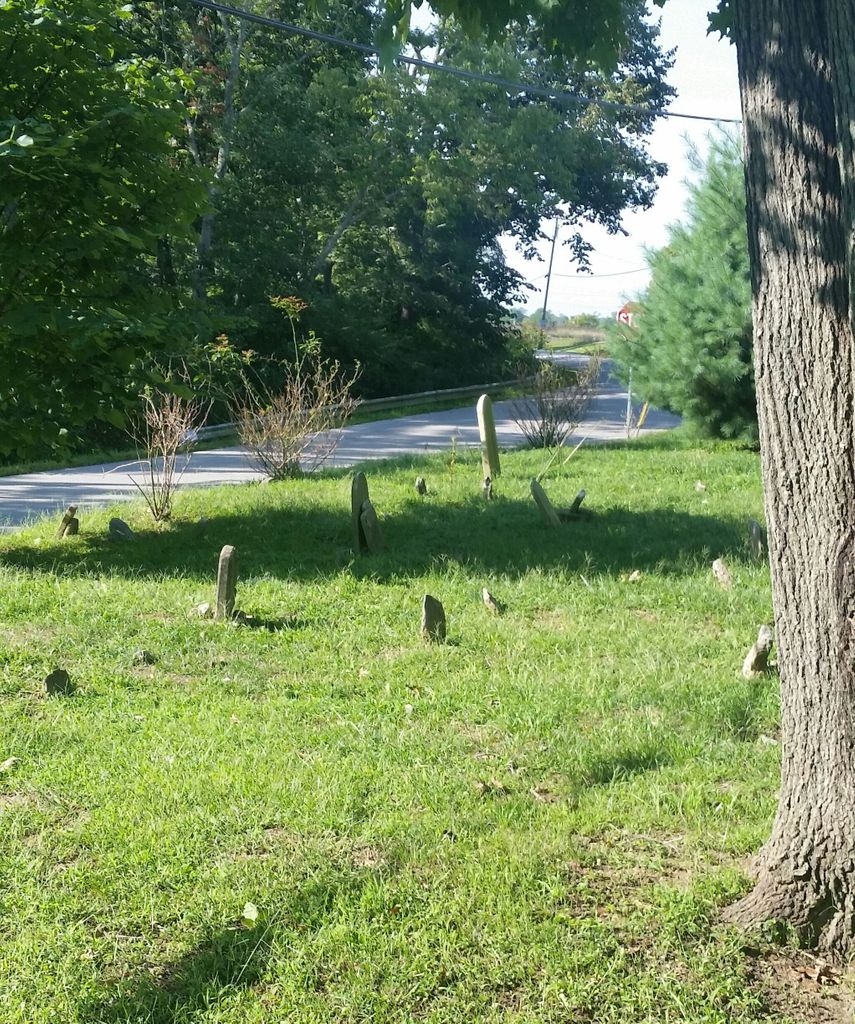
| Description | : | PRIVATE PROPERTY Farm was granted to John James Armstrong Sr. for his service in the Revolutionary War. Virigina Land Grants or Kentucky Land Grants for service in the American Revolutionary War. He was a 2nd. Lieutant in the Pennsylvania Continental Line 3rd. Regt. under General George Washington. John Sr. died in 1800. His youngest son John Jr is buried here. The U.S. Geological Survey (USGS) Geographic Names Information System (GNIS) feature ID for the cemetery is 208949 (Armstrong Cemetery). |
frequently asked questions (FAQ):
-
Where is Armstrong Cemetery #2?
Armstrong Cemetery #2 is located at Porter Road and Feiser Road Ryland Heights, Kenton County ,Kentucky , 41015USA.
-
Armstrong Cemetery #2 cemetery's updated grave count on graveviews.com?
0 memorials
-
Where are the coordinates of the Armstrong Cemetery #2?
Latitude: 38.9820600
Longitude: -84.4695400
Nearby Cemetories:
1. Culbertson Cemetery
Taylor Mill, Kenton County, USA
Coordinate: 38.9939390, -84.4629340
2. Locust Pike Pentecostal Church Cemetery
Kenton County, USA
Coordinate: 38.9940500, -84.4630000
3. William Culbertson Family Cemetery (Defunct)
Springlake, Kenton County, USA
Coordinate: 38.9971400, -84.4592900
4. George W Perry Cemetery
Latonia Lakes, Kenton County, USA
Coordinate: 38.9728800, -84.4883400
5. White Cemetery
Ryland Heights, Kenton County, USA
Coordinate: 38.9628600, -84.4642900
6. White Cemetery
Ryland Heights, Kenton County, USA
Coordinate: 38.9625000, -84.4583330
7. Lipscomb-Richardson Cemetery
Latonia Lakes, Kenton County, USA
Coordinate: 38.9736100, -84.4958300
8. William Mardis Family Cemetery
Independence, Kenton County, USA
Coordinate: 38.9613800, -84.4800100
9. Wolf Family Cemetery
Taylor Mill, Kenton County, USA
Coordinate: 38.9926920, -84.4980570
10. Martin Family Cemetery
Taylor Mill, Kenton County, USA
Coordinate: 38.9909400, -84.4997650
11. Richard Richardson Cemetery
Latonia Lakes, Kenton County, USA
Coordinate: 38.9741670, -84.5027780
12. Klette Cemetery
Latonia Lakes, Kenton County, USA
Coordinate: 38.9616670, -84.4944400
13. Oak Ridge Church Cemetery
Latonia Lakes, Kenton County, USA
Coordinate: 38.9691460, -84.5024180
14. Stamper Family Cemetery
Grant, Kenton County, USA
Coordinate: 38.9746130, -84.4338000
15. Lighthouse Memorial Gardens
Covington, Kenton County, USA
Coordinate: 38.9689350, -84.5025500
16. Osborn Cemetery
Latonia Lakes, Kenton County, USA
Coordinate: 38.9661110, -84.5016670
17. Grant Family Cemetery
Grant, Kenton County, USA
Coordinate: 38.9743710, -84.4326160
18. Woodsdale Cemetery
Taylor Mill, Kenton County, USA
Coordinate: 38.9898900, -84.5064530
19. Floral Hills Memorial Gardens
Taylor Mill, Kenton County, USA
Coordinate: 38.9986000, -84.5028000
20. Murnan Cemetery
Cold Spring, Campbell County, USA
Coordinate: 39.0064690, -84.4436530
21. William Richardson Cemetery
Taylor Mill, Kenton County, USA
Coordinate: 38.9905560, -84.5094440
22. Bannister Cemetery
Taylor Mill, Kenton County, USA
Coordinate: 38.9758333, -84.5111110
23. Ashford Road Cemetery
Independence, Kenton County, USA
Coordinate: 38.9528850, -84.4892100
24. Minter Cemetery
Covington, Kenton County, USA
Coordinate: 38.9642300, -84.5055100