
| Memorials | : | 6 |
| Location | : | Wilder, Campbell County, USA |
| Coordinate | : | 39.0347170, -84.4750830 |
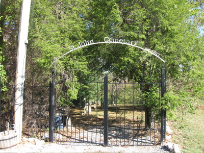
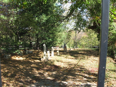
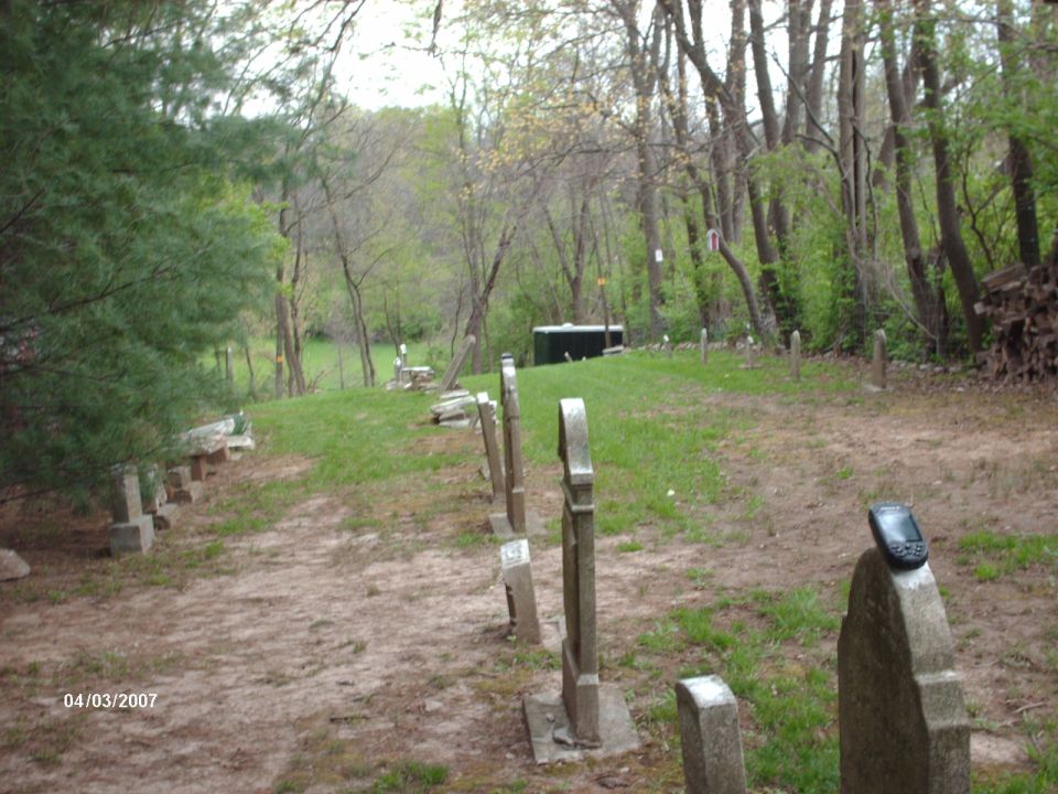
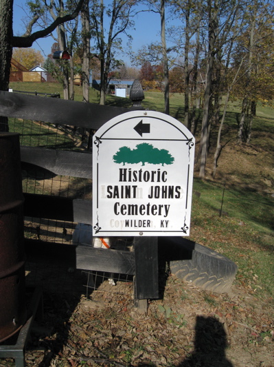
| Description | : | St John Cemetery is the oldest in Campbell County. When it was started, it was next to the original St John the Baptist Church. That church burned down and the new one was built in 1858 in its current place. It is on the northeast side Johns Hill Road near Langview. This is an old Catholic Cemetery on Johns Hill Road between St. Joseph's Cemetery and Johns Hill Cemetery. The current property owner is Darrin Zepf, who is the owner of the Wilder Iron Works. He has restored this cemetery to its present condition, installed new... Read More |
frequently asked questions (FAQ):
-
Where is Saint Johns Cemetery?
Saint Johns Cemetery is located at 739 Johns Hill Road Wilder, Campbell County ,Kentucky , 41076USA.
-
Saint Johns Cemetery cemetery's updated grave count on graveviews.com?
6 memorials
-
Where are the coordinates of the Saint Johns Cemetery?
Latitude: 39.0347170
Longitude: -84.4750830
Nearby Cemetories:
1. Johns Hill Cemetery
Wilder, Campbell County, USA
Coordinate: 39.0299988, -84.4738998
2. Saint Josephs Cemetery
Wilder, Campbell County, USA
Coordinate: 39.0469017, -84.4841995
3. Saint John German Protestant Cemetery
Wilder, Campbell County, USA
Coordinate: 39.0478440, -84.4854430
4. Potter Field Cemetery
Highland Heights, Campbell County, USA
Coordinate: 39.0252991, -84.4552994
5. Asbury Methodist Church Cemetery
Highland Heights, Campbell County, USA
Coordinate: 39.0304527, -84.4519882
6. Cold Spring First Baptist Church Cemetery
Cold Spring, Campbell County, USA
Coordinate: 39.0248800, -84.4462900
7. Saint Stephen Cemetery
Fort Thomas, Campbell County, USA
Coordinate: 39.0511017, -84.4503021
8. Saint Joseph Cemetery
Cold Spring, Campbell County, USA
Coordinate: 39.0257700, -84.4443650
9. Webb Cemetery
Sunny Acres, Kenton County, USA
Coordinate: 39.0185470, -84.5035620
10. Evergreen Cemetery
Southgate, Campbell County, USA
Coordinate: 39.0667000, -84.4721985
11. Buena Vista Cemetery
Covington, Kenton County, USA
Coordinate: 39.0595200, -84.5040000
12. Mother Of God Cemetery
Kenton Vale, Kenton County, USA
Coordinate: 39.0480995, -84.5171967
13. Murnan Cemetery
Cold Spring, Campbell County, USA
Coordinate: 39.0064690, -84.4436530
14. William Culbertson Family Cemetery (Defunct)
Springlake, Kenton County, USA
Coordinate: 38.9971400, -84.4592900
15. Locust Pike Pentecostal Church Cemetery
Kenton County, USA
Coordinate: 38.9940500, -84.4630000
16. Culbertson Cemetery
Taylor Mill, Kenton County, USA
Coordinate: 38.9939390, -84.4629340
17. Floral Hills Memorial Gardens
Taylor Mill, Kenton County, USA
Coordinate: 38.9986000, -84.5028000
18. Wolf Family Cemetery
Taylor Mill, Kenton County, USA
Coordinate: 38.9926920, -84.4980570
19. Cox Cemetery
Taylor Mill, Kenton County, USA
Coordinate: 39.0005560, -84.5166670
20. Martin Family Cemetery
Taylor Mill, Kenton County, USA
Coordinate: 38.9909400, -84.4997650
21. Holy Guardian Angels Cemetery
Edgewood, Kenton County, USA
Coordinate: 39.0269444, -84.5358330
22. Dedman Cemetery
Covington, Kenton County, USA
Coordinate: 39.0080560, -84.5294440
23. Linden Grove Cemetery
Covington, Kenton County, USA
Coordinate: 39.0738983, -84.5152969
24. Ellis Cemetery
Covington, Kenton County, USA
Coordinate: 39.0069440, -84.5288890