
| Memorials | : | 12 |
| Location | : | Petaluma, Sonoma County, USA |
| Phone | : | (707) 763-8365 |
| Coordinate | : | 38.2454700, -122.6490000 |
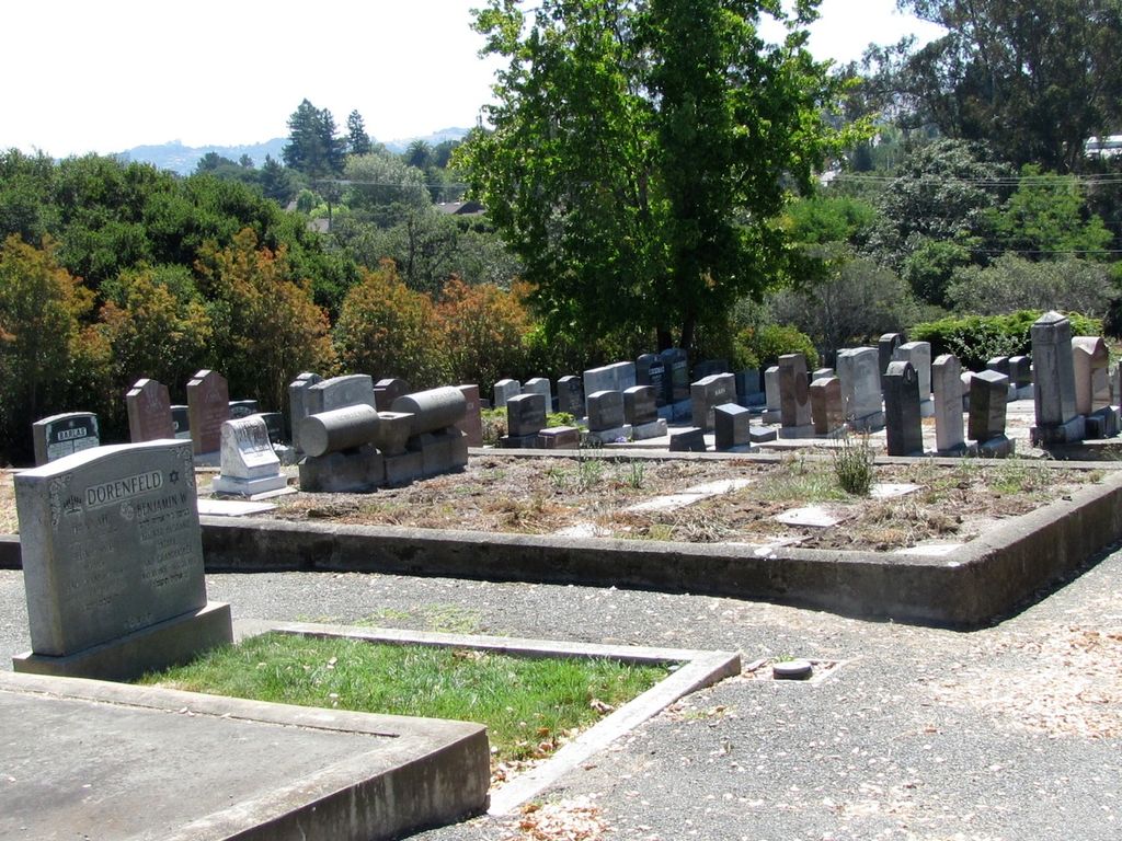
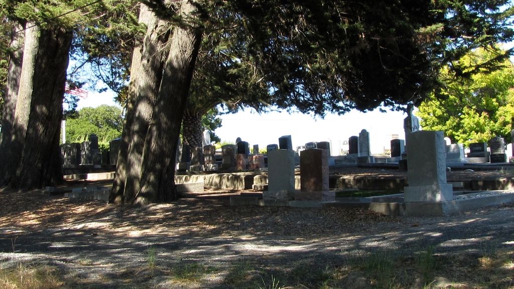
| Description | : | The Salem Cemetery Association was founded in Petaluma in 1857 by the early German Jewish community. The land for the Salem Cemetery on Magnolia Avenue beside Cypress Hill was purchased by the Congregation B'nai Israel from John McNear in 1870. It's unknown where Jewish communities were buried up until that time, but one source noted that given the dates on some of the tombstones, remains were moved from another site after the cemetery was established (much life the transfer of remains from Oak Hill Cemetery to Cypress Hill in the 1870s). It's cited in the newspapers as the "Jewish Cemetery" up... Read More |
frequently asked questions (FAQ):
-
Where is B'nai Israel Cemetery?
B'nai Israel Cemetery is located at Petaluma, Sonoma County ,California ,USA.
-
B'nai Israel Cemetery cemetery's updated grave count on graveviews.com?
12 memorials
-
Where are the coordinates of the B'nai Israel Cemetery?
Latitude: 38.2454700
Longitude: -122.6490000

Nearby Cemetories:
1. Calvary Catholic Cemetery
Petaluma, Sonoma County, USA
Coordinate: 38.2449000, -122.6493400
2. Cypress Hill Memorial Park
Petaluma, Sonoma County, USA
Coordinate: 38.2472000, -122.6505966
3. My Pets Cemetery
Petaluma, Sonoma County, USA
Coordinate: 38.2472000, -122.6506000
4. Oak Hill Cemetery
Petaluma, Sonoma County, USA
Coordinate: 38.2365130, -122.6509010
5. General Vallejo Ranch Cemetery
Sonoma, Sonoma County, USA
Coordinate: 38.2554500, -122.5845200
6. Liberty Cemetery
Petaluma, Sonoma County, USA
Coordinate: 38.2781990, -122.7055500
7. Two Rock Presbyterian Church Cemetery
Two Rock, Sonoma County, USA
Coordinate: 38.2570000, -122.7795029
8. Sonoma State Home Cemetery
Eldridge, Sonoma County, USA
Coordinate: 38.3412190, -122.5427810
9. Faith Lutheran Church Memorial Garden
Sonoma, Sonoma County, USA
Coordinate: 38.2932380, -122.4880690
10. Thompson Family Cemetery
Glen Ellen, Sonoma County, USA
Coordinate: 38.3644240, -122.5621210
11. Jack London State Historic Park Cemetery
Glen Ellen, Sonoma County, USA
Coordinate: 38.3538000, -122.5367000
12. Pioneer Memorial Cemetery
Novato, Marin County, USA
Coordinate: 38.1132532, -122.5902599
13. Macedonia Methodist Episcopal Church Cemetery
Sebastopol, Sonoma County, USA
Coordinate: 38.3594860, -122.7727270
14. Valley Memorial Park
Novato, Marin County, USA
Coordinate: 38.1204300, -122.5436300
15. Mission San Francisco Solano Cemetery
Sonoma, Sonoma County, USA
Coordinate: 38.2937164, -122.4561844
16. Sonoma Veterans Cemetery
Sonoma, Sonoma County, USA
Coordinate: 38.2992790, -122.4566390
17. Valley Cemetery
Sonoma, Sonoma County, USA
Coordinate: 38.2832985, -122.4496994
18. Trinity Episcopal Church Columbarium
Sonoma, Sonoma County, USA
Coordinate: 38.2930390, -122.4521650
19. Mountain Cemetery
Sonoma, Sonoma County, USA
Coordinate: 38.3008003, -122.4535980
20. Saint Francis Solano Cemetery
Sonoma, Sonoma County, USA
Coordinate: 38.2915993, -122.4459991
21. Canfield Cemetery
Sebastopol, Sonoma County, USA
Coordinate: 38.3512430, -122.8147040
22. Bennett Valley Cemetery
Santa Rosa, Sonoma County, USA
Coordinate: 38.4161987, -122.6619034
23. Chapel of the Chimes Cemetery and Mausoleum
Santa Rosa, Sonoma County, USA
Coordinate: 38.4141998, -122.7137985
24. Bloomfield Cemetery
Bloomfield, Sonoma County, USA
Coordinate: 38.3135986, -122.8583984