
| Memorials | : | 74 |
| Location | : | Pettis County, USA |
| Coordinate | : | 38.7132988, -93.4606018 |
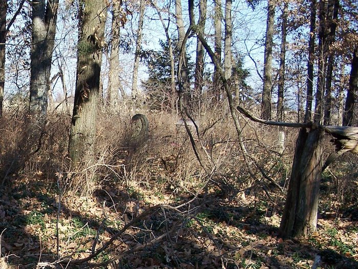
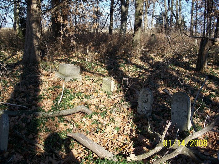
| Description | : | Elk Fork Township, Section 4 : 38.42.48N - 93.27.39W. North side of Y, about 12 miles west of Sedalia. Cemetery is about midway between Mahin Road (entering on the north side of Y) and Renfrow Road (entering on the south side). A rise in the road (Y) allows the drainage ditch to be filled, which gives narrow passage to a tree-line lane in the woods. |
frequently asked questions (FAQ):
-
Where is Bethel Union Church Cemetery?
Bethel Union Church Cemetery is located at Pettis County ,Missouri ,USA.
-
Bethel Union Church Cemetery cemetery's updated grave count on graveviews.com?
74 memorials
-
Where are the coordinates of the Bethel Union Church Cemetery?
Latitude: 38.7132988
Longitude: -93.4606018


Nearby Cemetories:
1. Bethel Cemetery
La Monte, Pettis County, USA
Coordinate: 38.7135200, -93.4611300
2. Rabourn Cemetery
La Monte, Pettis County, USA
Coordinate: 38.7078018, -93.4424973
3. Craighead Cemetery
La Monte, Pettis County, USA
Coordinate: 38.7350006, -93.4124985
4. Botts Cemetery
Pettis County, USA
Coordinate: 38.7118988, -93.4019012
5. Old Hickory Point Cemetery
Pettis County, USA
Coordinate: 38.6652985, -93.4693985
6. Hickory Point Cemetery
Green Ridge, Pettis County, USA
Coordinate: 38.6591670, -93.4683330
7. LaMonte Cemetery
La Monte, Pettis County, USA
Coordinate: 38.7821999, -93.4319000
8. Knob Noster Cemetery
Knob Noster, Johnson County, USA
Coordinate: 38.7655945, -93.5354004
9. Saint Joseph Cemetery
Knob Noster, Johnson County, USA
Coordinate: 38.7599983, -93.5558014
10. Camp Branch Baptist Church Cemetery
Sedalia, Pettis County, USA
Coordinate: 38.6731900, -93.3589900
11. Moore Family Cemetery
La Monte, Pettis County, USA
Coordinate: 38.8034444, -93.4769722
12. Southers Cemetery
Knob Noster, Johnson County, USA
Coordinate: 38.7967410, -93.5218050
13. Green Ridge Cemetery
Green Ridge, Pettis County, USA
Coordinate: 38.6207100, -93.4151500
14. Pleasant Grove Church Cemetery
Warrensburg, Johnson County, USA
Coordinate: 38.6824188, -93.5825195
15. North Dresden Cemetery
Dresden, Pettis County, USA
Coordinate: 38.7469600, -93.3352400
16. Dresden Cemetery
Dresden, Pettis County, USA
Coordinate: 38.7468987, -93.3349991
17. Goodwin Cemetery
Johnson County, USA
Coordinate: 38.6063995, -93.5310974
18. Knaus Cemetery
Johnson County, USA
Coordinate: 38.7957993, -93.5755997
19. Prairie Chapel Presbyterian Cemetery
Dresden, Pettis County, USA
Coordinate: 38.8050003, -93.3553009
20. Nelson Cemetery
Washington Township, Pettis County, USA
Coordinate: 38.6106500, -93.3723300
21. Ellis Cemetery
Johnson County, USA
Coordinate: 38.6996994, -93.6183014
22. County Line Cemetery
Blackwater Township, Pettis County, USA
Coordinate: 38.8394012, -93.4644012
23. Shobe Cemetery
Sedalia, Pettis County, USA
Coordinate: 38.6996994, -93.2968979
24. Lea Cemetery
Johnson County, USA
Coordinate: 38.7641983, -93.6216965