
| Memorials | : | 1936 |
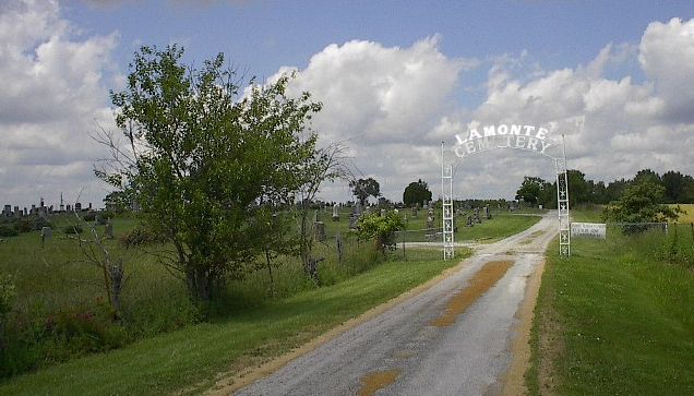
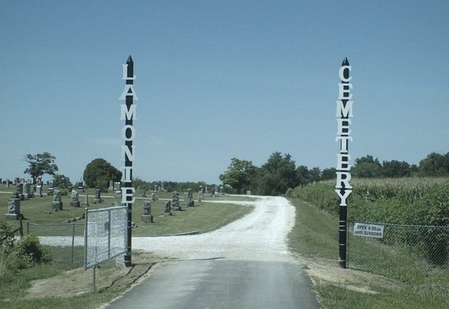
| Location | : | La Monte, Pettis County, USA |
| Coordinate | : | 38.7821999, -93.4319000 |
frequently asked questions (FAQ):
-
Where is LaMonte Cemetery?
LaMonte Cemetery is located at La Monte, Pettis County ,Missouri ,USA.
-
LaMonte Cemetery cemetery's updated grave count on graveviews.com?
1936 memorials
-
Where are the coordinates of the LaMonte Cemetery?
Latitude: 38.7821999
Longitude: -93.4319000
Nearby Cemetories:
1. Moore Family Cemetery
La Monte, Pettis County, USA
Coordinate: 38.8034444, -93.4769722
2. Craighead Cemetery
La Monte, Pettis County, USA
Coordinate: 38.7350006, -93.4124985
3. County Line Cemetery
Blackwater Township, Pettis County, USA
Coordinate: 38.8394012, -93.4644012
4. Prairie Chapel Presbyterian Cemetery
Dresden, Pettis County, USA
Coordinate: 38.8050003, -93.3553009
5. Southers Cemetery
Knob Noster, Johnson County, USA
Coordinate: 38.7967410, -93.5218050
6. Bethel Cemetery
La Monte, Pettis County, USA
Coordinate: 38.7135200, -93.4611300
7. Bethel Union Church Cemetery
Pettis County, USA
Coordinate: 38.7132988, -93.4606018
8. Botts Cemetery
Pettis County, USA
Coordinate: 38.7118988, -93.4019012
9. Rabourn Cemetery
La Monte, Pettis County, USA
Coordinate: 38.7078018, -93.4424973
10. Knob Noster Cemetery
Knob Noster, Johnson County, USA
Coordinate: 38.7655945, -93.5354004
11. North Dresden Cemetery
Dresden, Pettis County, USA
Coordinate: 38.7469600, -93.3352400
12. Dresden Cemetery
Dresden, Pettis County, USA
Coordinate: 38.7468987, -93.3349991
13. Saint Joseph Cemetery
Knob Noster, Johnson County, USA
Coordinate: 38.7599983, -93.5558014
14. Gowin Cemetery
Dunksburg, Johnson County, USA
Coordinate: 38.8747550, -93.4994240
15. Blackwater Chapel Cemetery
Houstonia, Pettis County, USA
Coordinate: 38.8908000, -93.4661600
16. Knaus Cemetery
Johnson County, USA
Coordinate: 38.7957993, -93.5755997
17. Hocker Cemetery
Knob Noster, Johnson County, USA
Coordinate: 38.8567009, -93.5413971
18. Old Hickory Point Cemetery
Pettis County, USA
Coordinate: 38.6652985, -93.4693985
19. Mount Zion Cemetery
Dunksburg, Johnson County, USA
Coordinate: 38.8913900, -93.4975490
20. Camp Branch Baptist Church Cemetery
Sedalia, Pettis County, USA
Coordinate: 38.6731900, -93.3589900
21. Rothwell Cemetery
Johnson County, USA
Coordinate: 38.8711010, -93.5410000
22. David Thomson Cemetery
Georgetown, Pettis County, USA
Coordinate: 38.7799500, -93.2723500
23. Immanuel Lutheran Cemetery
Knob Noster, Johnson County, USA
Coordinate: 38.8275700, -93.5812000
24. Hickory Point Cemetery
Green Ridge, Pettis County, USA
Coordinate: 38.6591670, -93.4683330