
| Memorials | : | 1 |
| Location | : | Chester, Cheshire West and Chester Unitary Authority, England |
| Coordinate | : | 53.2053200, -2.9106300 |
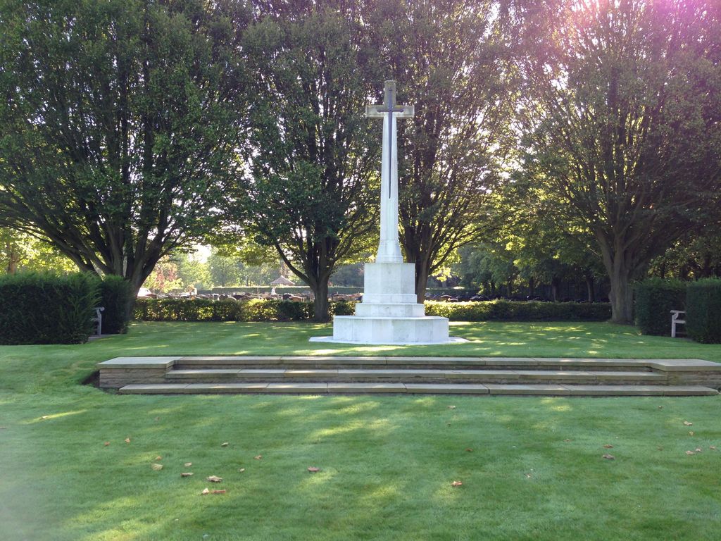
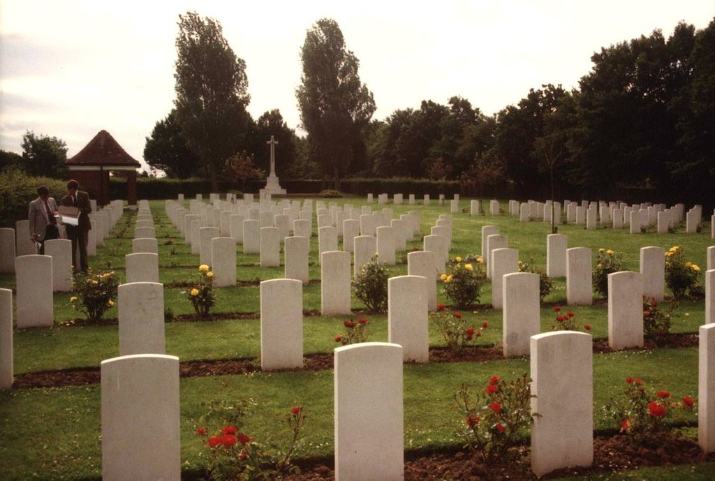
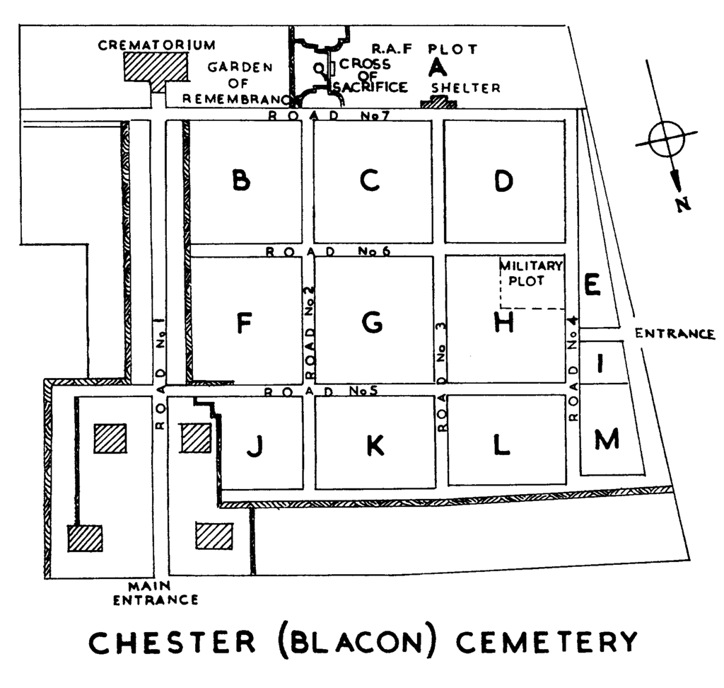
| Description | : | Blacon Cemetery was new in 1940 when the authorities set aside two plots for service burials. The larger plot in section 'A' was used as a Royal Air Force regional cemetery by a number of R.A.F. stations in Cheshire and the adjoining counties. Only airmen are buried in it. The smaller plot in section 'H' was used for Commonwealth burials and for the burial of servicemen from the numerous Polish hospitals and camps in the area. Almost all of the war graves are in one or other of these plots. The cemetery contains 461 Commonwealth burials of the Second World... Read More |
frequently asked questions (FAQ):
-
Where is Blacon Cemetery?
Blacon Cemetery is located at Chester, Cheshire West and Chester Unitary Authority ,Cheshire ,England.
-
Blacon Cemetery cemetery's updated grave count on graveviews.com?
1 memorials
-
Where are the coordinates of the Blacon Cemetery?
Latitude: 53.2053200
Longitude: -2.9106300


Nearby Cemetories:
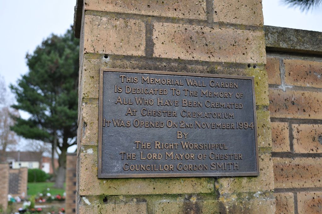
1. Chester Crematorium
Chester, Cheshire West and Chester Unitary Authority, England
Coordinate: 53.2050100, -2.9065700
2. Catholic Apostolic Church
Chester, Cheshire West and Chester Unitary Authority, England
Coordinate: 53.1950660, -2.8949290
3. Chester City Gaol Cemetery
Chester, Cheshire West and Chester Unitary Authority, England
Coordinate: 53.1916040, -2.8962990
4. Holy Ascension Churchyard
Upton-by-Chester, Cheshire West and Chester Unitary Authority, England
Coordinate: 53.2157300, -2.8878700
5. Chester Cathedral
Chester, Cheshire West and Chester Unitary Authority, England
Coordinate: 53.1918900, -2.8904600
6. St Peter's Church
Chester, Cheshire West and Chester Unitary Authority, England
Coordinate: 53.1903000, -2.8917200
7. Wesleyan Chapel
Chester, Cheshire West and Chester Unitary Authority, England
Coordinate: 53.1898540, -2.8883230
8. St Bridget Churchyard
Chester, Cheshire West and Chester Unitary Authority, England
Coordinate: 53.1871000, -2.8931900
9. St. Mary's Centre
Chester, Cheshire West and Chester Unitary Authority, England
Coordinate: 53.1868400, -2.8917900
10. Saint John the Baptist Churchyard
Chester, Cheshire West and Chester Unitary Authority, England
Coordinate: 53.1888299, -2.8855186
11. Chester Castle Cemetery
Chester, Cheshire West and Chester Unitary Authority, England
Coordinate: 53.1853170, -2.8927920
12. St. Mary Without-The-Walls Churchyard
Chester, Cheshire West and Chester Unitary Authority, England
Coordinate: 53.1828358, -2.8888967
13. Overleigh Old Cemetery
Chester, Cheshire West and Chester Unitary Authority, England
Coordinate: 53.1808930, -2.8936610
14. Overleigh New Cemetery
Chester, Cheshire West and Chester Unitary Authority, England
Coordinate: 53.1801900, -2.8941500
15. Saughall Churches of Christ Grove Chapel
Saughall, Cheshire West and Chester Unitary Authority, England
Coordinate: 53.2218900, -2.9583300
16. Ebenezer Primitive Methodist Churchyard
Saughall, Cheshire West and Chester Unitary Authority, England
Coordinate: 53.2232500, -2.9574500
17. St Oswalds Churchyard
Backford, Cheshire West and Chester Unitary Authority, England
Coordinate: 53.2387200, -2.9034100
18. All Saints Churchyard
Saughall, Cheshire West and Chester Unitary Authority, England
Coordinate: 53.2271271, -2.9550779
19. St James Churchyard
Christleton, Cheshire West and Chester Unitary Authority, England
Coordinate: 53.1854400, -2.8382800
20. Mickle Trafford Methodist Church Cemetery
Chester, Cheshire West and Chester Unitary Authority, England
Coordinate: 53.2210040, -2.8327861
21. St. John the Baptist Churchyard
Guilden Sutton, Cheshire West and Chester Unitary Authority, England
Coordinate: 53.2077400, -2.8263600
22. St Mary the Virgin Churchyard
Eccleston, Cheshire West and Chester Unitary Authority, England
Coordinate: 53.1570100, -2.8792600
23. St. Lawrence Churchyard
Stoak, Cheshire West and Chester Unitary Authority, England
Coordinate: 53.2533600, -2.8655200
24. Holy Trinity Churchyard
Capenhurst, Cheshire West and Chester Unitary Authority, England
Coordinate: 53.2574000, -2.9492900