
| Memorials | : | 0 |
| Location | : | Saughall, Cheshire West and Chester Unitary Authority, England |
| Coordinate | : | 53.2218900, -2.9583300 |
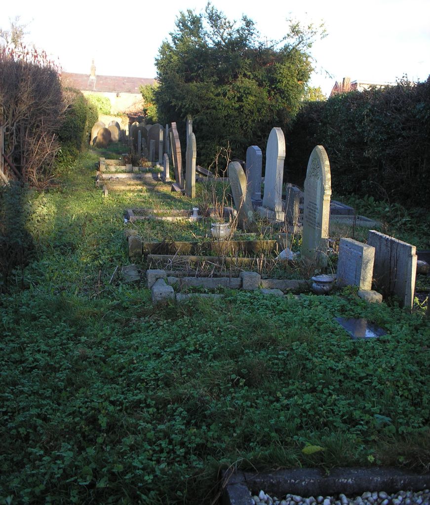
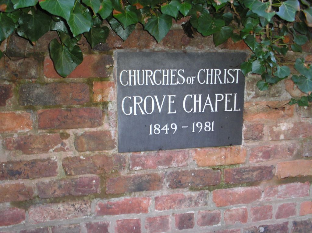
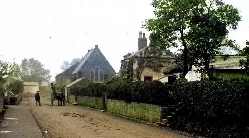
| Description | : | The Chapel closed in 1981 and no longer exists. Only the churchyard remains, surrounded by private houses and gardens. The only access is via a very narrow grassed footpath (With right of way) between two houses, 22 and 26 Hermitage Road. It is better to park in Fox Lea (Off Hermitage Road) and walk the few yards around the corner. There is a stone plaque on the wall to the right of the path with the Chapel name and dates. **** The footpath and the graveyard itself are not well maintained and not suitable for anyone with mobility problems.**** |
frequently asked questions (FAQ):
-
Where is Saughall Churches of Christ Grove Chapel?
Saughall Churches of Christ Grove Chapel is located at Hermitage Road, Saughall, Cheshire Saughall, Cheshire West and Chester Unitary Authority ,Cheshire , CH1 6BEEngland.
-
Saughall Churches of Christ Grove Chapel cemetery's updated grave count on graveviews.com?
0 memorials
-
Where are the coordinates of the Saughall Churches of Christ Grove Chapel?
Latitude: 53.2218900
Longitude: -2.9583300

Nearby Cemetories:
1. Ebenezer Primitive Methodist Churchyard
Saughall, Cheshire West and Chester Unitary Authority, England
Coordinate: 53.2232500, -2.9574500
2. All Saints Churchyard
Saughall, Cheshire West and Chester Unitary Authority, England
Coordinate: 53.2271271, -2.9550779
3. St. Michael's Churchyard
Shotwick Park, Cheshire West and Chester Unitary Authority, England
Coordinate: 53.2388600, -2.9947400
4. Blacon Cemetery
Chester, Cheshire West and Chester Unitary Authority, England
Coordinate: 53.2053200, -2.9106300
5. Chester Crematorium
Chester, Cheshire West and Chester Unitary Authority, England
Coordinate: 53.2050100, -2.9065700
6. Holy Trinity Churchyard
Capenhurst, Cheshire West and Chester Unitary Authority, England
Coordinate: 53.2574000, -2.9492900
7. St Oswalds Churchyard
Backford, Cheshire West and Chester Unitary Authority, England
Coordinate: 53.2387200, -2.9034100
8. Holy Ascension Churchyard
Upton-by-Chester, Cheshire West and Chester Unitary Authority, England
Coordinate: 53.2157300, -2.8878700
9. Catholic Apostolic Church
Chester, Cheshire West and Chester Unitary Authority, England
Coordinate: 53.1950660, -2.8949290
10. Chester City Gaol Cemetery
Chester, Cheshire West and Chester Unitary Authority, England
Coordinate: 53.1916040, -2.8962990
11. Chester Cathedral
Chester, Cheshire West and Chester Unitary Authority, England
Coordinate: 53.1918900, -2.8904600
12. St Peter's Church
Chester, Cheshire West and Chester Unitary Authority, England
Coordinate: 53.1903000, -2.8917200
13. St Bridget Churchyard
Chester, Cheshire West and Chester Unitary Authority, England
Coordinate: 53.1871000, -2.8931900
14. Wesleyan Chapel
Chester, Cheshire West and Chester Unitary Authority, England
Coordinate: 53.1898540, -2.8883230
15. St John The Evangelist
Great Sutton, Cheshire West and Chester Unitary Authority, England
Coordinate: 53.2733100, -2.9364800
16. St. Mary's Centre
Chester, Cheshire West and Chester Unitary Authority, England
Coordinate: 53.1868400, -2.8917900
17. Chester Castle Cemetery
Chester, Cheshire West and Chester Unitary Authority, England
Coordinate: 53.1853170, -2.8927920
18. Saint John the Baptist Churchyard
Chester, Cheshire West and Chester Unitary Authority, England
Coordinate: 53.1888299, -2.8855186
19. St Nicholas Churchyard
Burton, Cheshire West and Chester Unitary Authority, England
Coordinate: 53.2616430, -3.0251070
20. Overleigh Old Cemetery
Chester, Cheshire West and Chester Unitary Authority, England
Coordinate: 53.1808930, -2.8936610
21. Overleigh New Cemetery
Chester, Cheshire West and Chester Unitary Authority, England
Coordinate: 53.1801900, -2.8941500
22. St. Mary Without-The-Walls Churchyard
Chester, Cheshire West and Chester Unitary Authority, England
Coordinate: 53.1828358, -2.8888967
23. St. Lawrence Churchyard
Stoak, Cheshire West and Chester Unitary Authority, England
Coordinate: 53.2533600, -2.8655200
24. St. Paul's Churchyard
Hooton, Cheshire West and Chester Unitary Authority, England
Coordinate: 53.2902200, -2.9511400