
| Memorials | : | 0 |
| Location | : | Chester, Cheshire West and Chester Unitary Authority, England |
| Coordinate | : | 53.1950660, -2.8949290 |
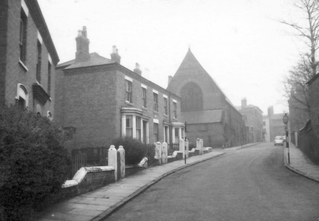
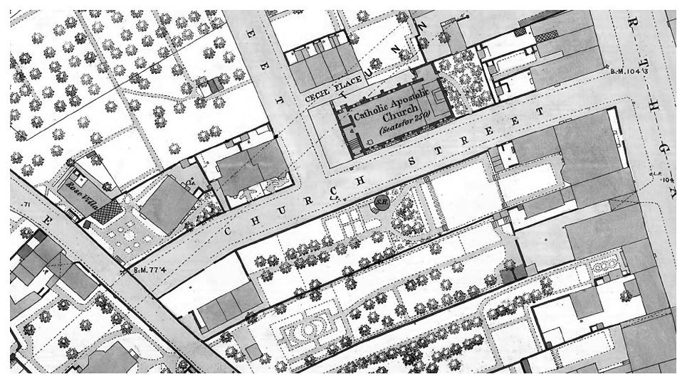
| Description | : | This church was located on the corner of Church Street & Lorne Street - just off Garden Lane Chester. Sadly the church and surrounding area were demolished in the 1960's to make way for the Chester Ring Road. Church Street, as was, now forms part of the Garden Lane Car Park. |
frequently asked questions (FAQ):
-
Where is Catholic Apostolic Church?
Catholic Apostolic Church is located at Church Street Chester, Cheshire West and Chester Unitary Authority ,Cheshire , CH1 4EUEngland.
-
Catholic Apostolic Church cemetery's updated grave count on graveviews.com?
0 memorials
-
Where are the coordinates of the Catholic Apostolic Church?
Latitude: 53.1950660
Longitude: -2.8949290
Nearby Cemetories:
1. Chester City Gaol Cemetery
Chester, Cheshire West and Chester Unitary Authority, England
Coordinate: 53.1916040, -2.8962990
2. Chester Cathedral
Chester, Cheshire West and Chester Unitary Authority, England
Coordinate: 53.1918900, -2.8904600
3. St Peter's Church
Chester, Cheshire West and Chester Unitary Authority, England
Coordinate: 53.1903000, -2.8917200
4. Wesleyan Chapel
Chester, Cheshire West and Chester Unitary Authority, England
Coordinate: 53.1898540, -2.8883230
5. St Bridget Churchyard
Chester, Cheshire West and Chester Unitary Authority, England
Coordinate: 53.1871000, -2.8931900
6. Saint John the Baptist Churchyard
Chester, Cheshire West and Chester Unitary Authority, England
Coordinate: 53.1888299, -2.8855186
7. St. Mary's Centre
Chester, Cheshire West and Chester Unitary Authority, England
Coordinate: 53.1868400, -2.8917900
8. Chester Castle Cemetery
Chester, Cheshire West and Chester Unitary Authority, England
Coordinate: 53.1853170, -2.8927920
9. Chester Crematorium
Chester, Cheshire West and Chester Unitary Authority, England
Coordinate: 53.2050100, -2.9065700
10. St. Mary Without-The-Walls Churchyard
Chester, Cheshire West and Chester Unitary Authority, England
Coordinate: 53.1828358, -2.8888967
11. Blacon Cemetery
Chester, Cheshire West and Chester Unitary Authority, England
Coordinate: 53.2053200, -2.9106300
12. Overleigh Old Cemetery
Chester, Cheshire West and Chester Unitary Authority, England
Coordinate: 53.1808930, -2.8936610
13. Overleigh New Cemetery
Chester, Cheshire West and Chester Unitary Authority, England
Coordinate: 53.1801900, -2.8941500
14. Holy Ascension Churchyard
Upton-by-Chester, Cheshire West and Chester Unitary Authority, England
Coordinate: 53.2157300, -2.8878700
15. St James Churchyard
Christleton, Cheshire West and Chester Unitary Authority, England
Coordinate: 53.1854400, -2.8382800
16. St Mary the Virgin Churchyard
Eccleston, Cheshire West and Chester Unitary Authority, England
Coordinate: 53.1570100, -2.8792600
17. St. John the Baptist Churchyard
Guilden Sutton, Cheshire West and Chester Unitary Authority, England
Coordinate: 53.2077400, -2.8263600
18. St Oswalds Churchyard
Backford, Cheshire West and Chester Unitary Authority, England
Coordinate: 53.2387200, -2.9034100
19. Mickle Trafford Methodist Church Cemetery
Chester, Cheshire West and Chester Unitary Authority, England
Coordinate: 53.2210040, -2.8327861
20. Saughall Churches of Christ Grove Chapel
Saughall, Cheshire West and Chester Unitary Authority, England
Coordinate: 53.2218900, -2.9583300
21. Ebenezer Primitive Methodist Churchyard
Saughall, Cheshire West and Chester Unitary Authority, England
Coordinate: 53.2232500, -2.9574500
22. All Saints Churchyard
Saughall, Cheshire West and Chester Unitary Authority, England
Coordinate: 53.2271271, -2.9550779
23. St. Peter's Churchyard
Plemstall, Cheshire West and Chester Unitary Authority, England
Coordinate: 53.2249000, -2.8144700
24. St Peter's Parish Church Plemstall
Mickle Trafford, Cheshire West and Chester Unitary Authority, England
Coordinate: 53.2249565, -2.8143278