
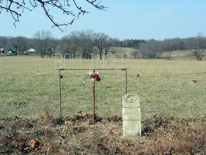
| Memorials | : | 0 |
| Location | : | South Fork, Howell County, USA |
| Coordinate | : | 36.6208038, -91.9175491 |
| Description | : | DIRECTIONS: Take Hwy 160 West from West Plains turn left on Rt. JJ, turn right on C.R. 7200, turn right on C.R. 7140 and cemetery will be on the left side of road. |
frequently asked questions (FAQ):
-
Where is Bollinger Cemetery?
Bollinger Cemetery is located at South Fork, Howell County ,Missouri ,USA.
-
Bollinger Cemetery cemetery's updated grave count on graveviews.com?
0 memorials
-
Where are the coordinates of the Bollinger Cemetery?
Latitude: 36.6208038
Longitude: -91.9175491
Nearby Cemetories:
1. Old Homeland Cemetery
Homeland, Howell County, USA
Coordinate: 36.6631012, -91.9186020
2. Homeland Cemetery
Homeland, Howell County, USA
Coordinate: 36.6706009, -91.9167023
3. Mount Zion Cemetery
Benton Township, Howell County, USA
Coordinate: 36.5868600, -91.9785500
4. Amy Union Chapel Cemetery
Amy, Howell County, USA
Coordinate: 36.6046753, -92.0032043
5. McElmurry Cemetery
Moody, Howell County, USA
Coordinate: 36.5503006, -91.9516983
6. Evergreen Cemetery
West Plains, Howell County, USA
Coordinate: 36.6515503, -91.8312988
7. Stuart Union Cemetery
Howell County, USA
Coordinate: 36.5482000, -91.8895000
8. Parker Cemetery
Howell County, USA
Coordinate: 36.6730995, -91.8469009
9. Blue Mound Cemetery
Pottersville, Howell County, USA
Coordinate: 36.7026100, -91.9695200
10. Davis Cemetery
Moody, Howell County, USA
Coordinate: 36.5237560, -91.9268560
11. Nicks Cemetery
Hocomo, Howell County, USA
Coordinate: 36.5588989, -92.0141983
12. Moody Cemetery
Moody, Howell County, USA
Coordinate: 36.5320206, -91.9889297
13. Howell County Rural Cemetery
Mountain View, Howell County, USA
Coordinate: 36.6831100, -91.8098600
14. County Farm Cemetery
Chapin, Howell County, USA
Coordinate: 36.6831017, -91.8097000
15. Pottersville Cemetery
Pottersville, Howell County, USA
Coordinate: 36.6972008, -92.0152969
16. Pleasant Hill Cemetery
Pottersville, Howell County, USA
Coordinate: 36.7310982, -91.9606018
17. Oak Lawn Cemetery
West Plains, Howell County, USA
Coordinate: 36.7235985, -91.8419037
18. Meltabarger Cemetery
West Plains, Howell County, USA
Coordinate: 36.6136017, -91.7658005
19. Joice Cemetery
Howell County, USA
Coordinate: 36.5494003, -92.0417023
20. Big Springs Cemetery
Caulfield, Howell County, USA
Coordinate: 36.5783005, -92.0610962
21. Gospel Hill Church of Christ Cemetery
Pottersville, Howell County, USA
Coordinate: 36.6812100, -92.0570100
22. Cannon Graveyard
Lanton, Howell County, USA
Coordinate: 36.5046997, -91.8522034
23. Hopes Rest Cemetery
West Plains, Howell County, USA
Coordinate: 36.7452500, -91.9557700
24. Cureall Cemetery
Cureall, Howell County, USA
Coordinate: 36.6713982, -92.0653000