
| Memorials | : | 0 |
| Location | : | West Plains, Howell County, USA |
| Coordinate | : | 36.7452500, -91.9557700 |
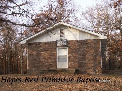
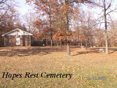
| Description | : | DIRECTIONS: Take Rt. CC (off Hwy. 63) from West Plains and go apx. 5-10 miles. The "primitive Baptist" church and cemetery are on the right (there is no sign; be on the lookout for a small stone church on a hill). |
frequently asked questions (FAQ):
-
Where is Hopes Rest Cemetery?
Hopes Rest Cemetery is located at West Plains, Howell County ,Missouri ,USA.
-
Hopes Rest Cemetery cemetery's updated grave count on graveviews.com?
0 memorials
-
Where are the coordinates of the Hopes Rest Cemetery?
Latitude: 36.7452500
Longitude: -91.9557700
Nearby Cemetories:
1. Pleasant Hill Cemetery
Pottersville, Howell County, USA
Coordinate: 36.7310982, -91.9606018
2. New Liberty Baptist Cemetery
Grimmet, Howell County, USA
Coordinate: 36.7775002, -91.9869003
3. Blue Mound Cemetery
Pottersville, Howell County, USA
Coordinate: 36.7026100, -91.9695200
4. Lone Pine Cemetery
West Plains, Howell County, USA
Coordinate: 36.7813988, -91.9057999
5. Collins Cemetery
Siloam Springs, Howell County, USA
Coordinate: 36.7858009, -92.0139008
6. Pottersville Cemetery
Pottersville, Howell County, USA
Coordinate: 36.6972008, -92.0152969
7. Campbell Cemetery
West Plains, Howell County, USA
Coordinate: 36.7563600, -91.8721200
8. Sadie Brown Cemetery
West Plains, Howell County, USA
Coordinate: 36.7967186, -91.8965530
9. Galloway Cemetery
West Plains, Howell County, USA
Coordinate: 36.7529106, -91.8682175
10. Homeland Cemetery
Homeland, Howell County, USA
Coordinate: 36.6706009, -91.9167023
11. Union Grove General Baptist Cemetery
West Plains, Howell County, USA
Coordinate: 36.7403380, -92.0601540
12. Mount Zion Cemetery
Dry Creek Township, Howell County, USA
Coordinate: 36.8299200, -91.9486000
13. Old Homeland Cemetery
Homeland, Howell County, USA
Coordinate: 36.6631012, -91.9186020
14. Oak Lawn Cemetery
West Plains, Howell County, USA
Coordinate: 36.7235985, -91.8419037
15. Ledbetter Cemetery
Pottersville, Howell County, USA
Coordinate: 36.7256012, -92.0753021
16. Gospel Hill Church of Christ Cemetery
Pottersville, Howell County, USA
Coordinate: 36.6812100, -92.0570100
17. Howell Memorial Park Cemetery
Pomona, Howell County, USA
Coordinate: 36.8460007, -91.9181976
18. Dripping Springs Cemetery
West Plains, Howell County, USA
Coordinate: 36.8175583, -91.8487625
19. Parker Cemetery
Howell County, USA
Coordinate: 36.6730995, -91.8469009
20. Pleasant View Cemetery
West Plains, Howell County, USA
Coordinate: 36.7900009, -91.8257980
21. Siloam Springs Cemetery
Gentryville, Douglas County, USA
Coordinate: 36.7867012, -92.0875015
22. Siloam Springs Cemetery
Siloam Springs, Howell County, USA
Coordinate: 36.7867100, -92.0876400
23. Cureall Cemetery
Cureall, Howell County, USA
Coordinate: 36.6713982, -92.0653000
24. Mitts Cemetery
Howell County, USA
Coordinate: 36.7633018, -92.1066971