
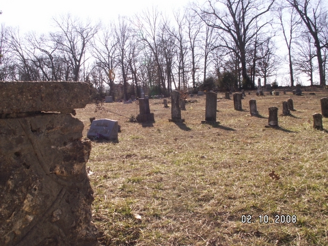
| Memorials | : | 7 |
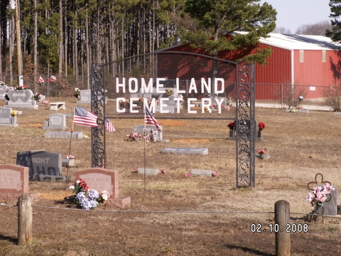
| Location | : | Homeland, Howell County, USA |
| Coordinate | : | 36.6706009, -91.9167023 |
frequently asked questions (FAQ):
-
Where is Homeland Cemetery?
Homeland Cemetery is located at Homeland, Howell County ,Missouri ,USA.
-
Homeland Cemetery cemetery's updated grave count on graveviews.com?
7 memorials
-
Where are the coordinates of the Homeland Cemetery?
Latitude: 36.6706009
Longitude: -91.9167023

Nearby Cemetories:
1. Old Homeland Cemetery
Homeland, Howell County, USA
Coordinate: 36.6631012, -91.9186020
2. Bollinger Cemetery
South Fork, Howell County, USA
Coordinate: 36.6208038, -91.9175491
3. Blue Mound Cemetery
Pottersville, Howell County, USA
Coordinate: 36.7026100, -91.9695200
4. Parker Cemetery
Howell County, USA
Coordinate: 36.6730995, -91.8469009
5. Pleasant Hill Cemetery
Pottersville, Howell County, USA
Coordinate: 36.7310982, -91.9606018
6. Evergreen Cemetery
West Plains, Howell County, USA
Coordinate: 36.6515503, -91.8312988
7. Oak Lawn Cemetery
West Plains, Howell County, USA
Coordinate: 36.7235985, -91.8419037
8. Hopes Rest Cemetery
West Plains, Howell County, USA
Coordinate: 36.7452500, -91.9557700
9. Pottersville Cemetery
Pottersville, Howell County, USA
Coordinate: 36.6972008, -92.0152969
10. Howell County Rural Cemetery
Mountain View, Howell County, USA
Coordinate: 36.6831100, -91.8098600
11. County Farm Cemetery
Chapin, Howell County, USA
Coordinate: 36.6831017, -91.8097000
12. Galloway Cemetery
West Plains, Howell County, USA
Coordinate: 36.7529106, -91.8682175
13. Campbell Cemetery
West Plains, Howell County, USA
Coordinate: 36.7563600, -91.8721200
14. Amy Union Chapel Cemetery
Amy, Howell County, USA
Coordinate: 36.6046753, -92.0032043
15. Mount Zion Cemetery
Benton Township, Howell County, USA
Coordinate: 36.5868600, -91.9785500
16. Howell Valley Cemetery
West Plains, Howell County, USA
Coordinate: 36.7144012, -91.7953033
17. Lone Pine Cemetery
West Plains, Howell County, USA
Coordinate: 36.7813988, -91.9057999
18. Gospel Hill Church of Christ Cemetery
Pottersville, Howell County, USA
Coordinate: 36.6812100, -92.0570100
19. Cureall Cemetery
Cureall, Howell County, USA
Coordinate: 36.6713982, -92.0653000
20. Chapin Cemetery
West Plains, Howell County, USA
Coordinate: 36.6781006, -91.7683029
21. New Liberty Baptist Cemetery
Grimmet, Howell County, USA
Coordinate: 36.7775002, -91.9869003
22. McElmurry Cemetery
Moody, Howell County, USA
Coordinate: 36.5503006, -91.9516983
23. Stuart Union Cemetery
Howell County, USA
Coordinate: 36.5482000, -91.8895000
24. Sadie Brown Cemetery
West Plains, Howell County, USA
Coordinate: 36.7967186, -91.8965530