
| Memorials | : | 3 |
| Location | : | Pottersville, Howell County, USA |
| Coordinate | : | 36.7026100, -91.9695200 |
frequently asked questions (FAQ):
-
Where is Blue Mound Cemetery?
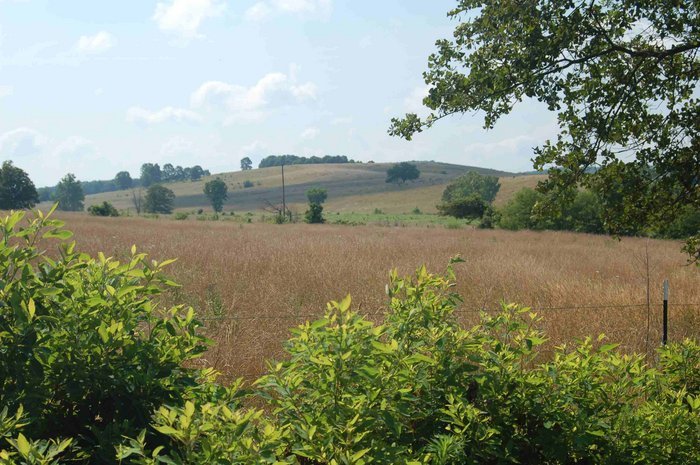
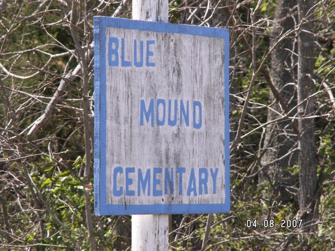
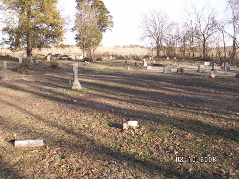
Blue Mound Cemetery is located at Pottersville, Howell County ,Missouri ,USA.
-
Blue Mound Cemetery cemetery's updated grave count on graveviews.com?
3 memorials
-
Where are the coordinates of the Blue Mound Cemetery?
Latitude: 36.7026100
Longitude: -91.9695200
Nearby Cemetories:
1. Pleasant Hill Cemetery
Pottersville, Howell County, USA
Coordinate: 36.7310982, -91.9606018
2. Pottersville Cemetery
Pottersville, Howell County, USA
Coordinate: 36.6972008, -92.0152969
3. Hopes Rest Cemetery
West Plains, Howell County, USA
Coordinate: 36.7452500, -91.9557700
4. Homeland Cemetery
Homeland, Howell County, USA
Coordinate: 36.6706009, -91.9167023
5. Old Homeland Cemetery
Homeland, Howell County, USA
Coordinate: 36.6631012, -91.9186020
6. Gospel Hill Church of Christ Cemetery
Pottersville, Howell County, USA
Coordinate: 36.6812100, -92.0570100
7. New Liberty Baptist Cemetery
Grimmet, Howell County, USA
Coordinate: 36.7775002, -91.9869003
8. Union Grove General Baptist Cemetery
West Plains, Howell County, USA
Coordinate: 36.7403380, -92.0601540
9. Cureall Cemetery
Cureall, Howell County, USA
Coordinate: 36.6713982, -92.0653000
10. Ledbetter Cemetery
Pottersville, Howell County, USA
Coordinate: 36.7256012, -92.0753021
11. Collins Cemetery
Siloam Springs, Howell County, USA
Coordinate: 36.7858009, -92.0139008
12. Bollinger Cemetery
South Fork, Howell County, USA
Coordinate: 36.6208038, -91.9175491
13. Lone Pine Cemetery
West Plains, Howell County, USA
Coordinate: 36.7813988, -91.9057999
14. Campbell Cemetery
West Plains, Howell County, USA
Coordinate: 36.7563600, -91.8721200
15. Galloway Cemetery
West Plains, Howell County, USA
Coordinate: 36.7529106, -91.8682175
16. Amy Union Chapel Cemetery
Amy, Howell County, USA
Coordinate: 36.6046753, -92.0032043
17. Parker Cemetery
Howell County, USA
Coordinate: 36.6730995, -91.8469009
18. Oak Lawn Cemetery
West Plains, Howell County, USA
Coordinate: 36.7235985, -91.8419037
19. Setzer Cemetery
Howell County, USA
Coordinate: 36.6405983, -92.0802994
20. Sadie Brown Cemetery
West Plains, Howell County, USA
Coordinate: 36.7967186, -91.8965530
21. Mount Zion Cemetery
Benton Township, Howell County, USA
Coordinate: 36.5868600, -91.9785500
22. Evergreen Cemetery
West Plains, Howell County, USA
Coordinate: 36.6515503, -91.8312988
23. Mitts Cemetery
Howell County, USA
Coordinate: 36.7633018, -92.1066971
24. Siloam Springs Cemetery
Gentryville, Douglas County, USA
Coordinate: 36.7867012, -92.0875015