
| Memorials | : | 0 |
| Location | : | Boxmeer, Boxmeer Municipality, Netherlands |
| Coordinate | : | 51.6427910, 5.9497830 |
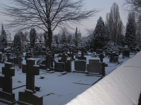
| Description | : | Oude RK. Begraafplaats aan de Hoogeweg te Boxmeer. |
frequently asked questions (FAQ):
-
Where is Boxmeer Roman Catholic Churchyard?
Boxmeer Roman Catholic Churchyard is located at Hoogeweg Boxmeer, Boxmeer Municipality ,Noord-Brabant ,Netherlands.
-
Boxmeer Roman Catholic Churchyard cemetery's updated grave count on graveviews.com?
0 memorials
-
Where are the coordinates of the Boxmeer Roman Catholic Churchyard?
Latitude: 51.6427910
Longitude: 5.9497830

Nearby Cemetories:
1. Afferden Begraafplaats
Afferden, Bergen Municipality, Netherlands
Coordinate: 51.6349100, 6.0131700
2. Sint Anthonis Roman Catholic Churchyard
Sint Anthonis, Sint Anthonis Municipality, Netherlands
Coordinate: 51.6269800, 5.8830600
3. Joodse Begraafplaats
Vierlingsbeek, Boxmeer Municipality, Netherlands
Coordinate: 51.5961600, 6.0010200
4. Ottersum Roman Catholic Cemetery
Ottersum, Gennep Municipality, Netherlands
Coordinate: 51.7020800, 5.9824600
5. Overloon War Cemetery
Overloon, Boxmeer Municipality, Netherlands
Coordinate: 51.5741500, 5.9576600
6. Westerbeek Roman Catholic Cemetery
Westerbeek, Sint Anthonis Municipality, Netherlands
Coordinate: 51.5825900, 5.8631600
7. Milsbeek War Cemetery
Milsbeek, Gennep Municipality, Netherlands
Coordinate: 51.7254400, 5.9511900
8. Kerkhof Sint-Anthonius Abtkerk
Maashees, Boxmeer Municipality, Netherlands
Coordinate: 51.5713400, 6.0333100
9. Boschhuizen Cemetery
Oostrum, Venray Municipality, Netherlands
Coordinate: 51.5454100, 5.9999200
10. Beers Rooms Katholieke Begraafplaats
Beers, Cuijk Municipality, Netherlands
Coordinate: 51.7261800, 5.8265400
11. Saint Vincentius Kath. Asperden
Asperden, Kreis Kleve, Germany
Coordinate: 51.6929200, 6.1134800
12. Venray War Cemetery
Venray, Venray Municipality, Netherlands
Coordinate: 51.5291100, 5.9558900
13. Mook-en-Middelaar Roman Catholic Churchyard
Mook, Mook en Middelaar Municipality, Netherlands
Coordinate: 51.7531600, 5.8854200
14. Mook War Cemetery
Mook, Mook en Middelaar Municipality, Netherlands
Coordinate: 51.7541200, 5.8854300
15. Trans Cedron
Oostrum, Venray Municipality, Netherlands
Coordinate: 51.5269351, 6.0206018
16. Reichswald Forest War Cemetery
Kleve, Kreis Kleve, Germany
Coordinate: 51.7406464, 6.0824242
17. Sint-Gertrudiskerk
Oirlo, Venray Municipality, Netherlands
Coordinate: 51.5106399, 6.0367345
18. Odiliapeel Roman Catholic Cemetery
Odiliapeel, Uden Municipality, Netherlands
Coordinate: 51.6435700, 5.7031100
19. Groesbeek Canadian War Cemetery and Memorial
Groesbeek, Berg en Dal Municipality, Netherlands
Coordinate: 51.7982900, 5.9321900
20. Begraafplaats Wellerlooi
Wellerlooi, Bergen Municipality, Netherlands
Coordinate: 51.5343955, 6.1371499
21. Friedhof Nütterden
Kranenburg, Kreis Kleve, Germany
Coordinate: 51.7904340, 6.0629380
22. Grave Roman Catholic Cemetery
Grave, Grave Municipality, Netherlands
Coordinate: 51.7545100, 5.7454800
23. Algemene begraafplaats
Grave Municipality, Netherlands
Coordinate: 51.7547000, 5.7454600
24. Joodse Begraafplaats
Grave Municipality, Netherlands
Coordinate: 51.7548700, 5.7454100